Moon

The Moon / La Luna / Der Mond / La Lune

The Moon / La Luna / Der Mond / La Lune

Publisher: Hallwag Verlag, Bern, Switzerland First Publication Date: 1978 With index, moon data and explanation witten by Peter Eberhardt (Bern) 2000 Edition ISBN 3-8283-0110-X

KSIĘŻYC – Polish Moon Map (2011)

KSIĘŻYC – Polish Moon Map (2011)

2-sided wall map MAPA KSIEZYCA Series: Kosmos Tajemnice wszechswiata – Kosmos Mysteries of the Universe – Encyklopedia Astronomi i astzronautiki map series Publisher/Cartographer: not indicated Map background taken from  NASA Lunar Earthside, Farside, and Polar Charts (LMP) Series by Aeronautical Chart Information Center, United States Air Force in 1:5,000,000 published in 1976 Polar and equatorial […]

Complete Moon Map / Polnaya Karta Luny (1979/85)

Complete Moon Map / Polnaya Karta Luny (1979/85)

Publisher: Sternberg Institute of Moscow State Lomonosov University 1979 Edition In 9 sheets and in 1 sheet Sample sheets from the 9 sheet version Alternative scans (courtesy Ton Lindeman)   Polnaya Karta Luny 1:10 000 000 Nauka, Moskva, 1979. Luna-3, Zond-3, Lunar Orbiter Reprinted in 1985 Using the originals of relief shading of this map, a […]

Moon Globe / Globus Luny

Moon Globe / Globus Luny

1:10 000 000 Globus Luny sostavlen po fotografiyam AMS Luna-3, Zond-3, s tsastitsnym ispolzovaniem snimkov Lunar Orbiter …. Sternberg Institute In 12 segments Polar: azimuthal projection The far side segments used an original method of transformation using spherical screen. Negatives of the full maps of the moon 1979 1:5M used in cartographic projector on spherical screen. […]

Map of the visible equatorial region of the Moon (1968)

Map of the visible equatorial region of the Moon (1968)

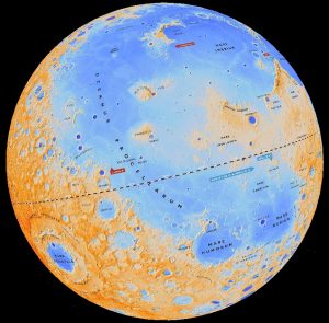
Карта Луны. Экваториальная зона видимого полушария. ГАИШ, ЦНИИГАиК, научн. рук. Ю. Н. Липокий, М., «Наука», 1968. Karta Luny Yekvatorialnaya Zona Vidimogo Polushariya 1:1 000 000 Nauka, Moskva 1968 Supervized by Yu N Lipskiy Sternberg Astronomical Institute Mercator Projection In 7 sheets Made by military cartographers; 8 sheets, for the central part of the nearside Moon. Compiled […]

Millner’s Atlas (1850)

Millner’s Atlas (1850)

A Descriptive Atlas of Astronomy and of Physical and Political Geography with descriptive letter-press by the Rev. Thomas Milner, M.A., F.R.G.S published in London in 1850 by Wm. S. Orr and Co.    

MIIGAiK’s Map of the Moon (1992)

MIIGAiK’s Map of the Moon (1992)

Source: Bugaevsky L.M., Shingareva K.B., Krasnopevtseva B.V et al. Atlas Planet Zemnoi Gruppy i ih Sputnikov («Атлас планет земной группы и их спутников».). MIIGAiK, 1992. Moscow Scale: 1:25 000 000 Note: This is a geologo-morphologic map. The Atlas contains several additional thematic maps of the Moon. The online version of the Atlas is available at […]

Engravings of the Moon (Mellan and Gassendi 1637)

Engravings of the Moon (Mellan and Gassendi 1637)

Photorealistic engravings of the Moon (1635-37) 23.7 x 17.9 cm engraving by Claude Mellan. This work was commissioned by Pierre Gassendi. The original series consisted of three parts: 1st quarter, 2nd quarter (full Moon), 3rd quarter. (c) The Elisha Whittelsey Collection, The Elisha Whittelsey Fund, 1960 Courtesy EA Whitaker. Recommended: Galileo Project    

Tobias Mayer’s maps of the Moon (1748, 1775)

Tobias Mayer’s maps of the Moon (1748, 1775)

Date : 1748 Title: Lunar eclipse map /  Représentation de l’eclipse partiale de la Lune qui arrivera la nuit du 8 au 9 d’août, 1748 dressée suivant les lois de la vraie projection et accompagné d’un imprimé qui lui servira d’éclaircissement / par T. Maier. Publisher: Homann. Cartographer: Mayer JT Source: ark:/12148/btv1b7710369w Nomenclature: Riccioli Language: […]

Mayer/Schröter Map of the Moon (1791)

Mayer/Schröter Map of the Moon (1791)

Publication Date: 1791 Published in Selenotopographische Fragmente zur genauern Kenntniss der Mondfläche, ihrer erlittenen Veränderungen und Atmosphäre, sammt den dazu gehörigen Specialcharten und Zeichnungen / Johann Hieronymus Schroeter Cartographer: Tobias Mayer Nomenclature: JH Schröter Additional figures Heights and depths   Source http://www.e-rara.ch/zut/content/titleinfo/544831

LRO Topographic Globe of the Moon

Virtual globe for Google EarthSource: Lunar Reconnaissance Orbiter Wide Angle Camera Digital Terrain ModelLamguage: Latin/EnglishMap editor: Henrik Hargitai / ICA Commission on Planetary CartographyComment: It displays the  names  of the largest features plus landing site locations plus some of the most interesting features, including basins not named formallyDate: December 2011.LROC data provided courtesy of NASA/GSFC/Arizona […]

Map of the Moon (Littrow, 1825)

Map of the Moon (Littrow, 1825)

Littrow, J.J. 1825; Populäre Astronomie, vol II; Wien Image  courtesy of Ton Lindemann.

Explanation
Column name Column description
Catalog ID (M) N/A
Title Title of map
Author Name of mapper(s), or author, PI, map editor, illustrator, etc. with roles
Nationality Nationality of author
Start date Year when mapping began / or year or observation
Date of publication Year of publication or completion of manusctipt (empty if not published yet)
Body Target name (planetary body)
Online Online references about the map
Projection Projection of map. 2-hemisphere is shown here.
Scale N/A
Orientation Orientation of map [north up, south up] – only for historic maps (north: cartographic tradition, south: astronomical tradition)
Publication type The type of work that contains the map. [standalone, journal, conference, atlas, book figure, book supplement, book plate, encyclopedia, multisheet, digital]
Type, purpose Type of map purpose [generic, outreach, science, citizen, surface operation (pre mission), landing site (post mission), observer, opposition, index, reference, eclipse/transit/occultation] generic: not defined, outreach: maps for the general public made b
Primary Nomenclature Laguage(s) of nomenclature displayed on the map [Latin, English etc., IAU, informal]. Latin for Latin nomenclature prior to IAU.
Ref (map) Full reference of map publication or publication that contains the map
DOI DOI number of map
ID (publication) ID of map publication or figure number
Origin type If this map is not original, the following codes are used: [L: language variant, N: new print, U: updated edition, C: copied / modified from another map, R: renovation map (digital version of paper map with slight changes), F facsimile. RP: republished in
Origin ID Any maps that this map is based on or copied from. Database ID of original map.
Based on map Name of mapper
Base (spacecraft, telescope) Name of spacecraft / instrument
Original title Title of map in original langage (if not English)
Publisher Name of Publisher; manuscript or self-published. For journals and conferences, the name of the journal or conference.
Coverage Coverage of map [global, hemispheric, regional, local, landing site, landing ellipse, traverse]
Target location IAU name of target feature (if named) or near side, far side etc. (If nothing noted, it is global)
Country Country of Publisher (original/translation)
Type, content Type of map [photo, map, sketch map, drawing, globe, tactile, data]. Data for raster datasets. For vector data, see Feature DB. Drawing: no grid, scale, projection etc.
Image base Base theme of the map [shaded relief, photomosaic, photo, none]
Theme Theme of map [visual, albedo, radar, low sun, topography, elevation, geology, geomorphology, art, nomenclature reference, feature, landing site reference, opposition map, event (eclipse etc) etc.]. Low sun is optical photo with shadows and no albedo. Vis
Technique Cartographic technique [imagemap, datamap, cartographic map, unit map, airbrush, pencil, line drawing/outline, contour lines, DEM, DIM, shaded relief / hillshading, raster data etc.]
Style Details on style
Method Method how the data was obtained
Mapping scale Scale of mapping
Resolution Raster dataset resoltion [m/pixel]
Short Reference Short form of reference to the map publication
GIS / data URL where GIS or original spatial data is
Data provider N/A
Profession Profession of author (for historic maps)
Designator Sheet designator terms following Greeley and Batson (1990) Planetary Mapping. Cambridge University Press. – only if displayed on the map. First letter: target body, 5M: scale, 90/0 etc: center coordinates, OM – orthophotomosaic , T – Topographic data (nom
Control Controlled, semi-controlled, uncontrolled
Note on control Base of control
Series title Title of map series
Number of maps (in work) N/A
Number of quads N/A
Quad ID Quad ID (or quads IDs) contained on the map
Map Diameter N/A
Map width cm N/A
Map height cm N/A
Map width px N/A
Map height px N/A
Base type Type of instrument of observation of base data [naked eye, telescope, spacecraft, space telescope, lander]
Location of copy Library or archive where manuscript or rare copy is kept
Ref (literature) Reference – literature about the map, may be the source of data if the map is not available. Separated with # symbols.
Status (2017) Status of mapping [complete, in progress, in review] (mostly for USGS maps)
Aim Original aim of mapping, if available
Notes Any comments, remarks [Long text, may be multiple paragraphs]
Secondary nomenclature Other languages of the nomenclature
Nomenclature Notes Remarks on nomenclature
Photo note N/A
Reference frame ID from RefFrames
web2 Online references about the map
web3 Online references about the map
web4 Online references about the map
ocentric/ographic Map coordinate [planetographic, planetocentric]
N N/A
S N/A
W 360E N/A
E 360E N/A
W 180 N/A
E 180 N/A
W 360W N/A
R 360W N/A
fig1 N/A
fig1 caption N/A
fig2 N/A
fig2 caption N/A
fig3 N/A
fig3 caption N/A
fig4 N/A
fig4 caption N/A
fig5 N/A
fig5 caption N/A
STATUS N/A
Sum $180