Planetary Map Quadrangle Layouts and Designations
Primary source: Batson RM: Map formats and projections used in planetary cartography.
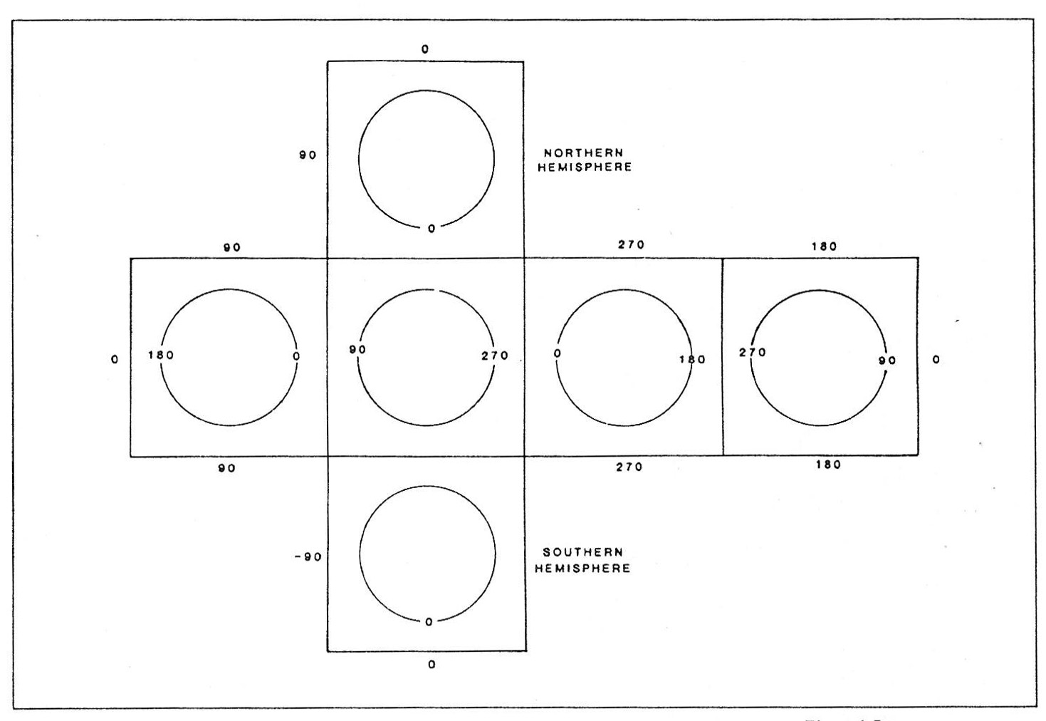
Single-sheet planetary map layout
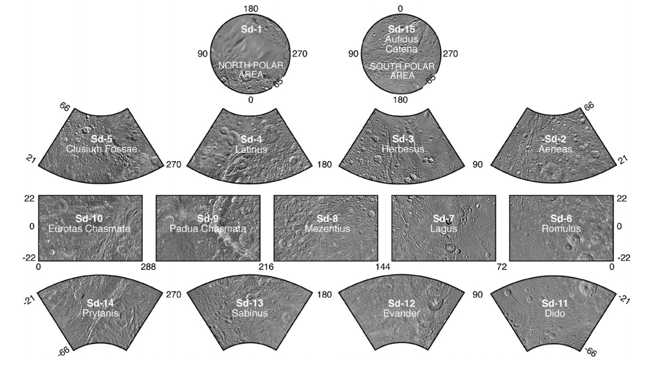
Mimas quads in the Semi-controlled Mosaic of Mimas. 1:1.5M, DLR (Roatsch et al. 2009)
Ceres global mosaic for Dawn FC images, at 1:2M scale
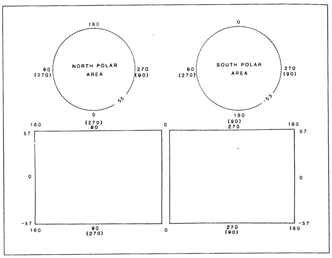
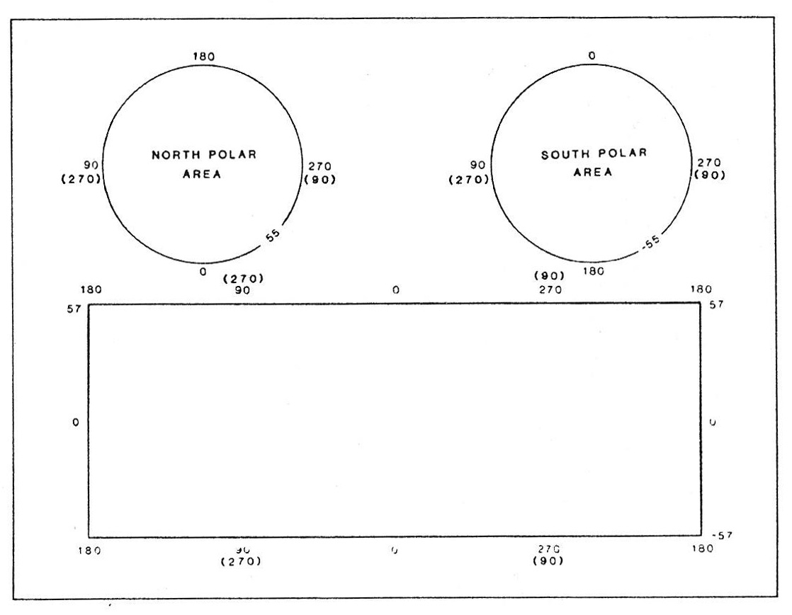
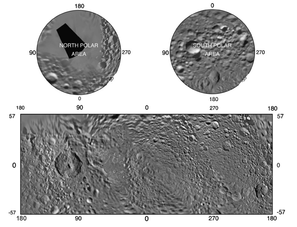
Single-sheet planetary map layout
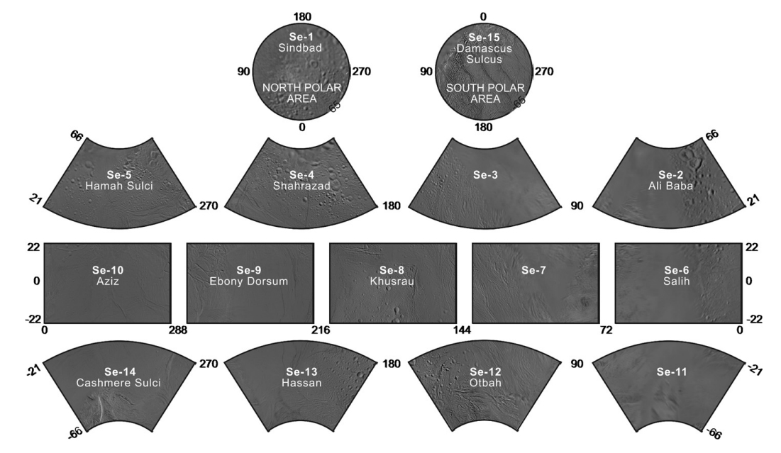
Iapetus Quads. Semi-controlled Mosaic of Iapetus, 1:3M, DLR, Roatsch et al. 2009
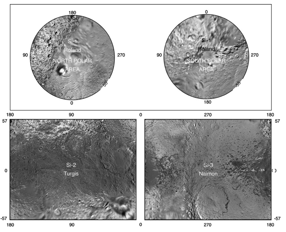
Phobos quads in the Controlled Mosaic of Phobos (Oberst, J, DLR. Photogrammetry: Oberst J, Willner K., Cartography: Semm S, Wahlisch M)
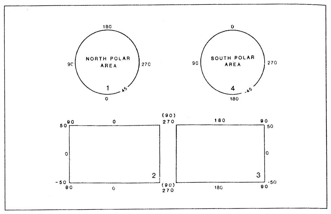
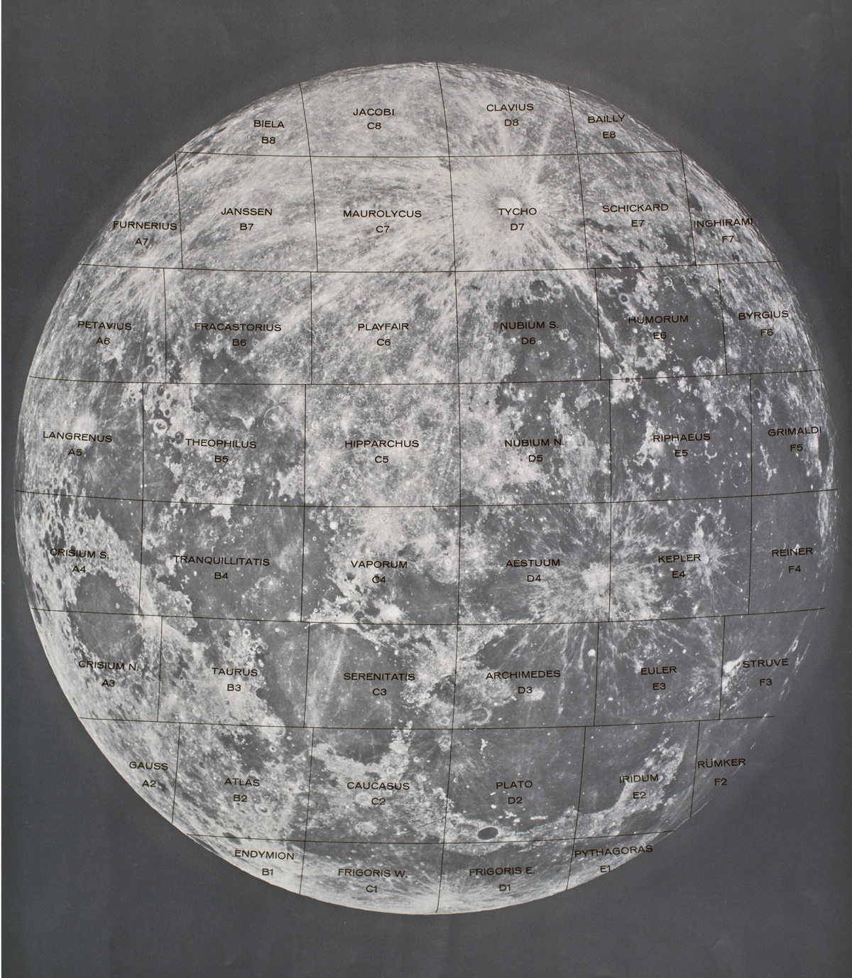
Four-sheet layout. Good for Moon-sized bodies at 1:5M scale.
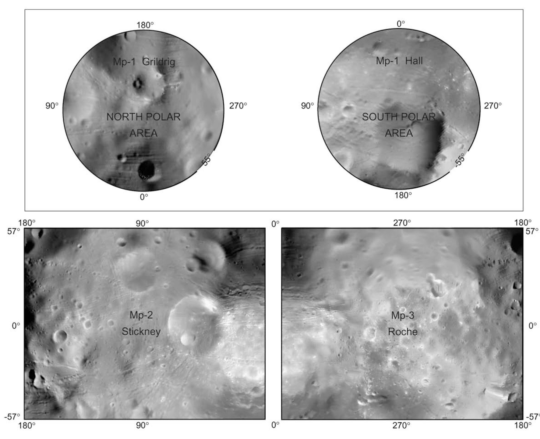
Io quadrangles, 1:5M, USGS geologic mapping
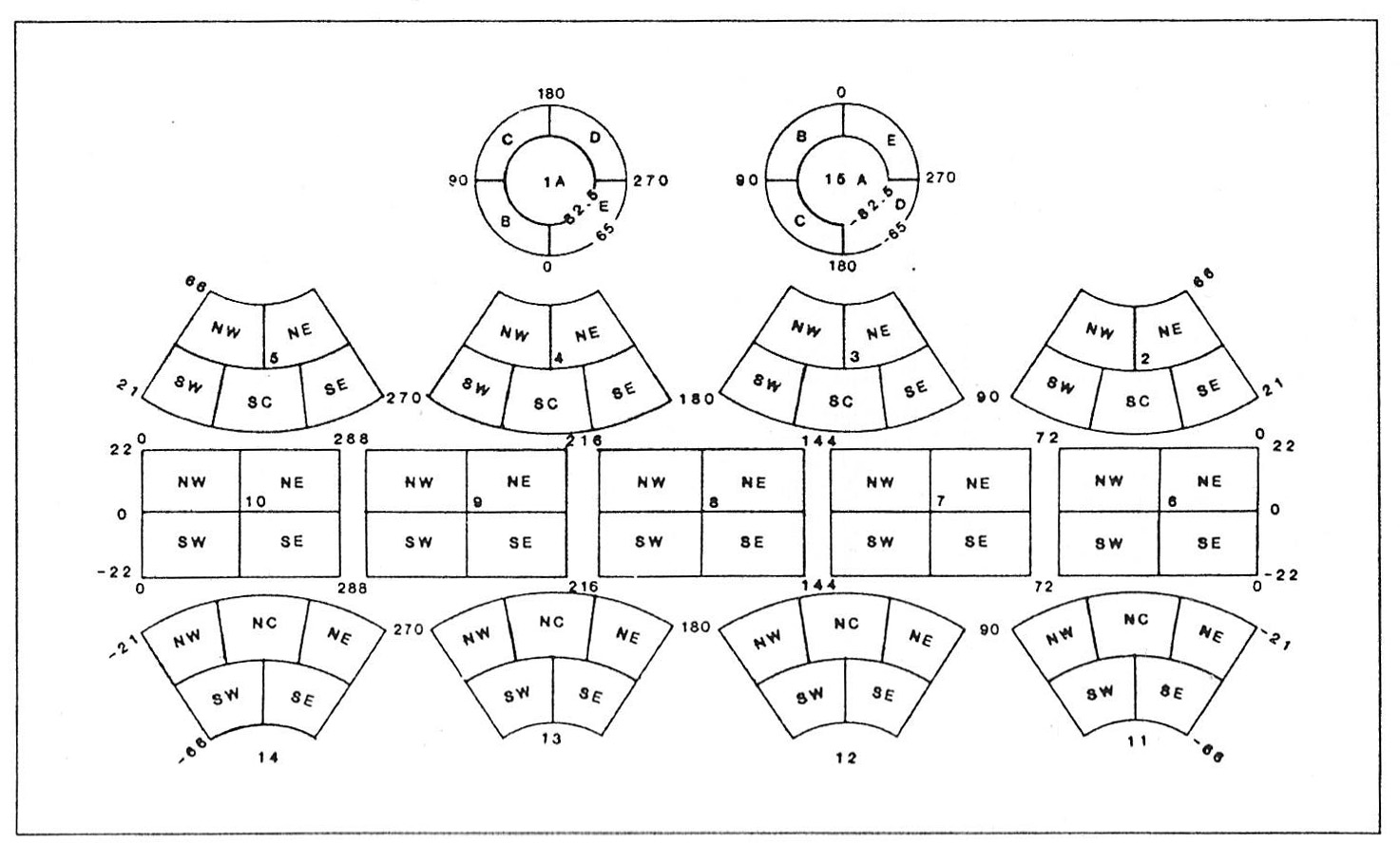
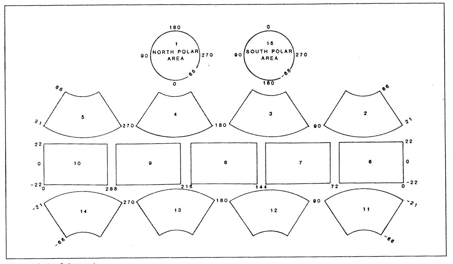
8-sheet layout.
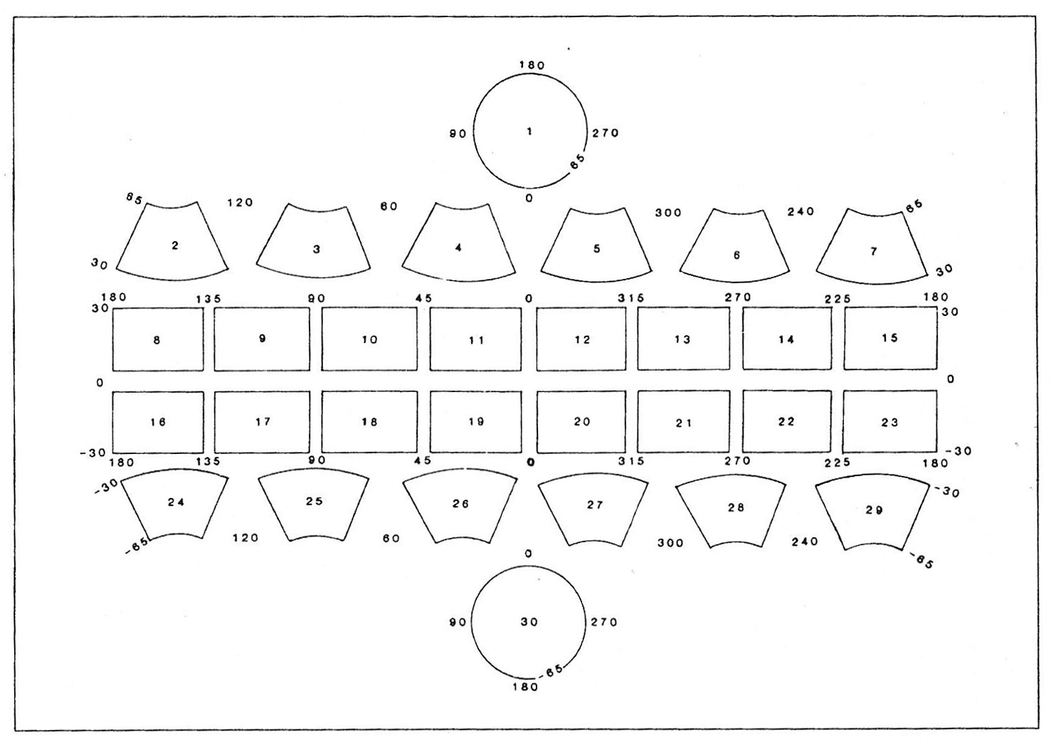
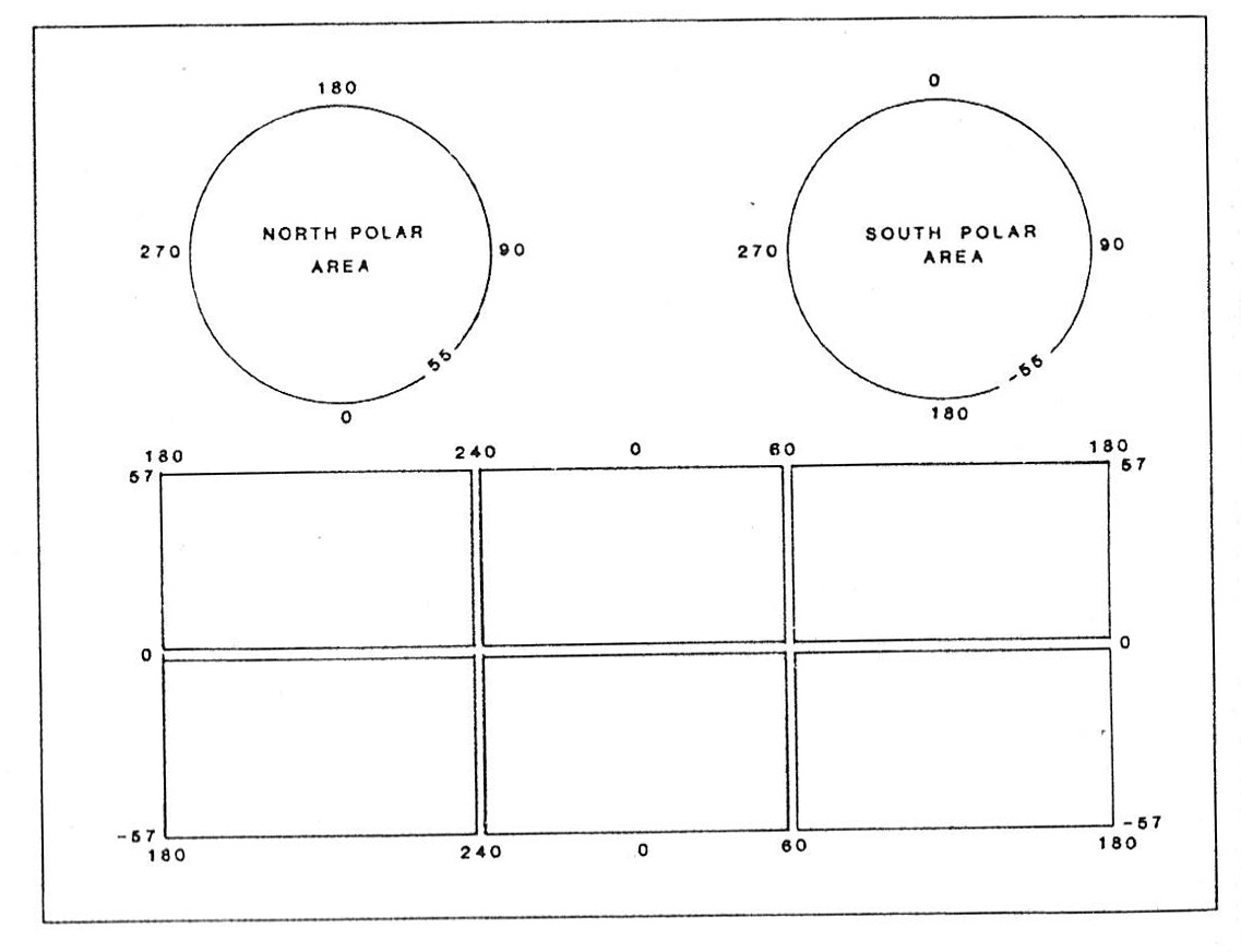
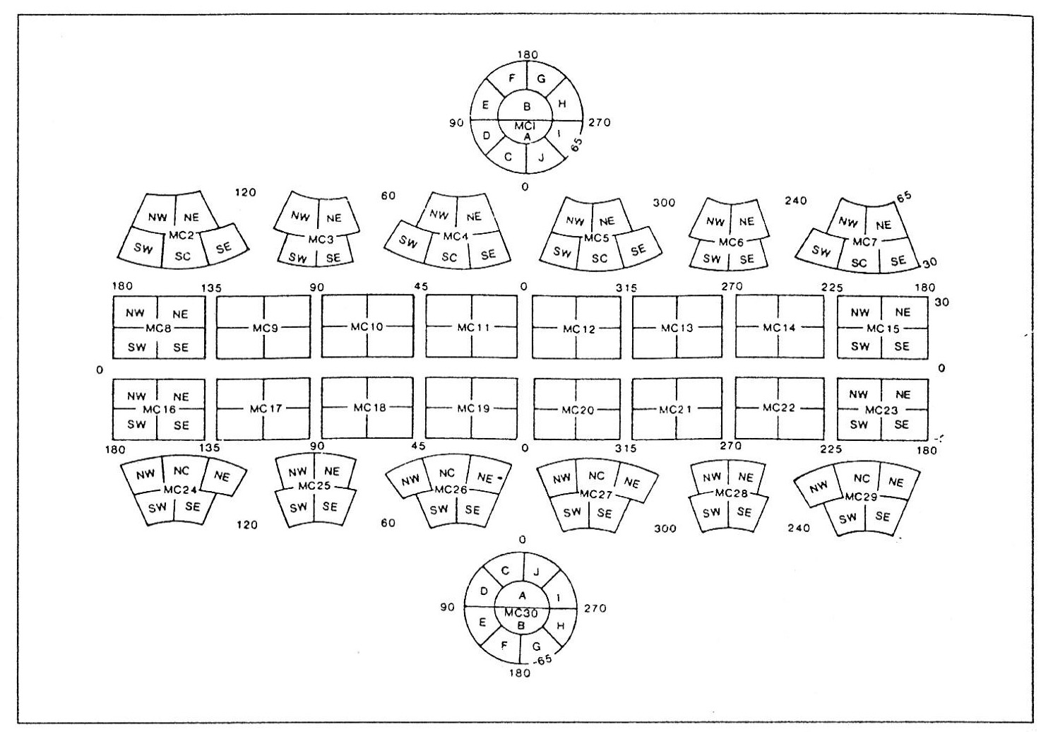
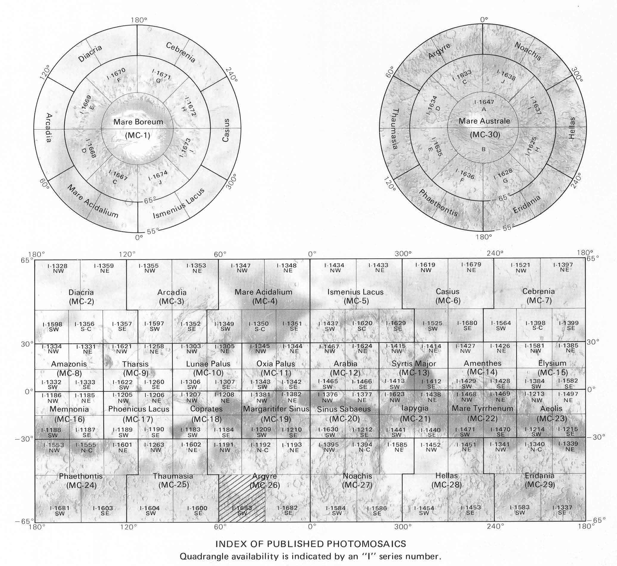
30-sheet layout (Mars, 1:5M)
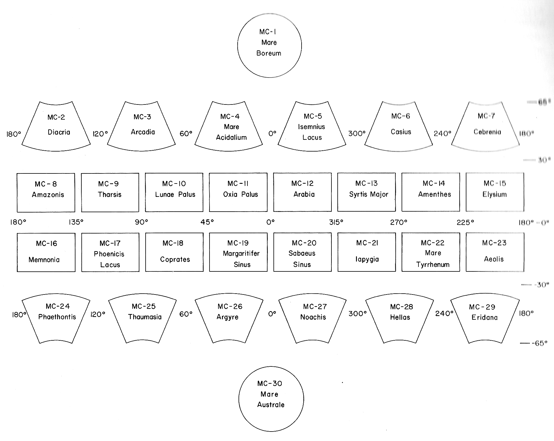
Mars quadrangles with names (Mutch et al. 1976)
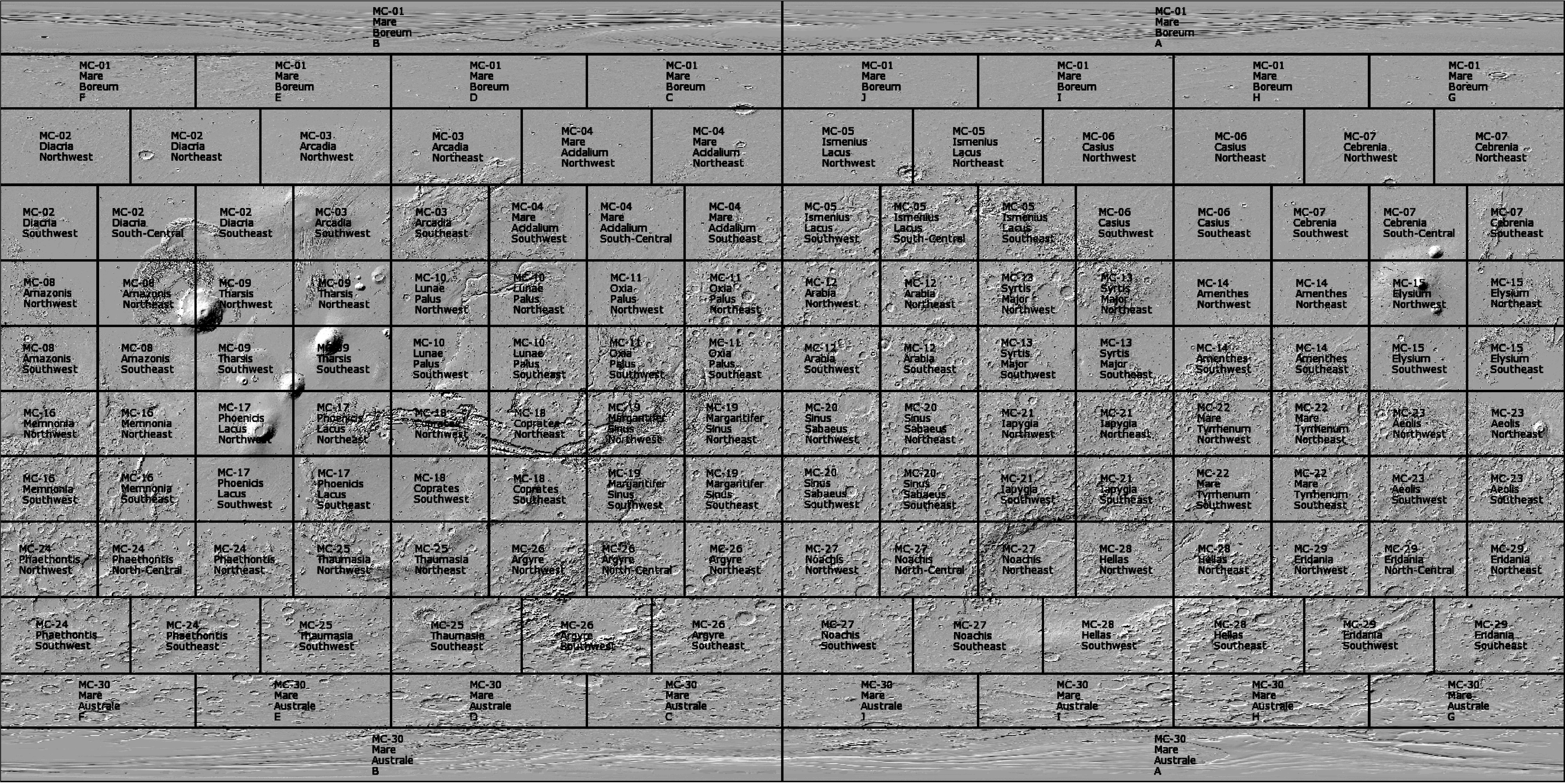
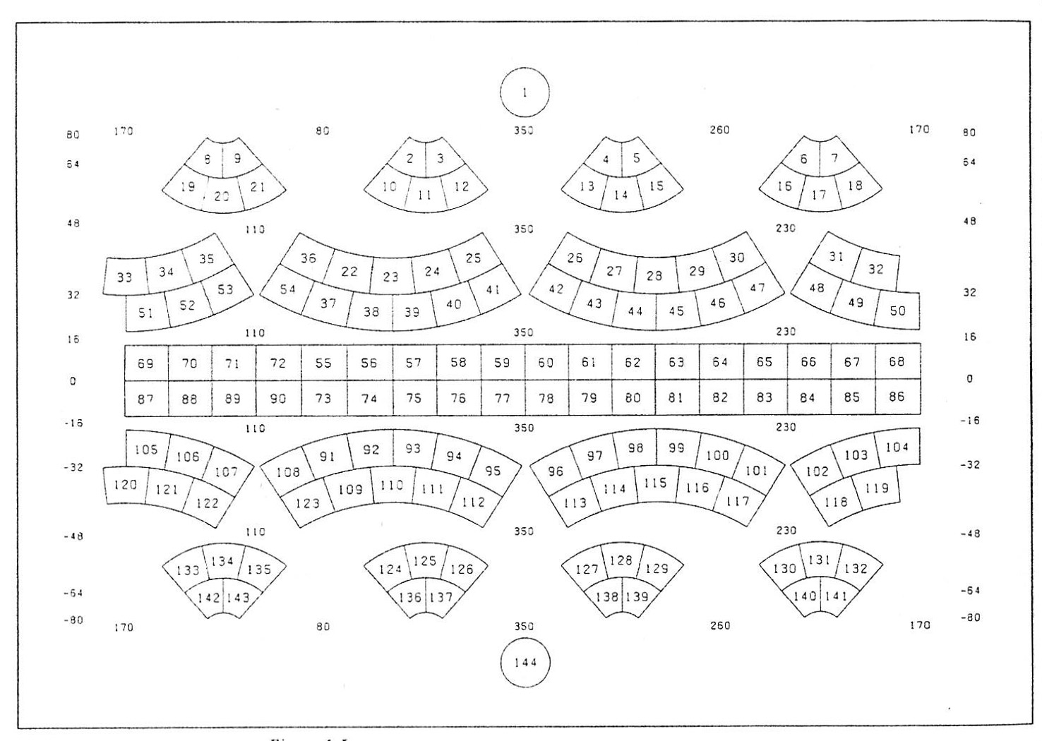
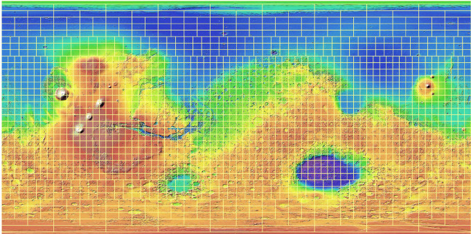
140-sheet layout. Mars, 1:2M.
1:2M Mars layout from the controlled photomosaic series of USGS
1:2M Mars quads with quad names from Mars WMS Server.
80-sheet layout, Mercury, 1:2M
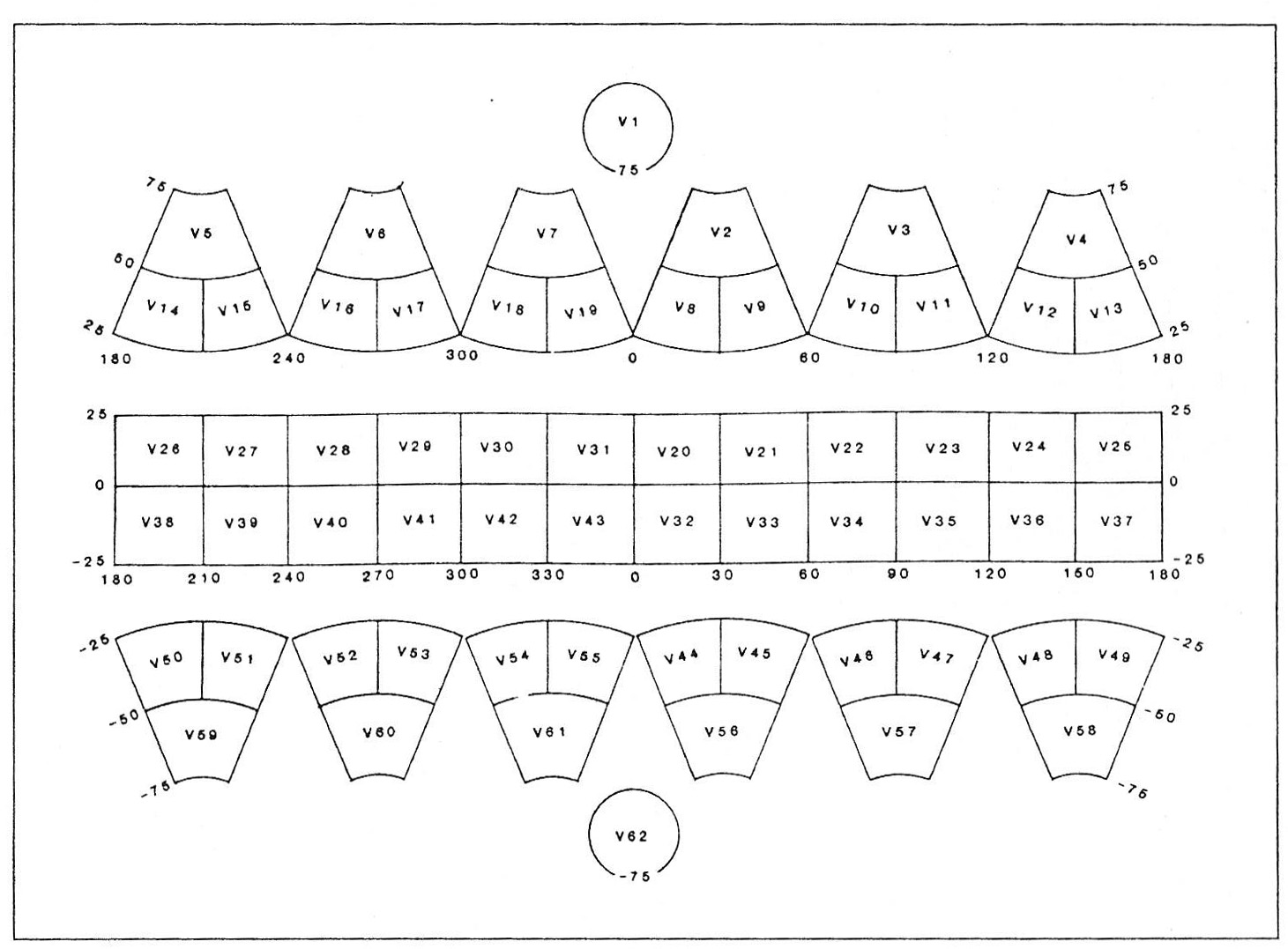
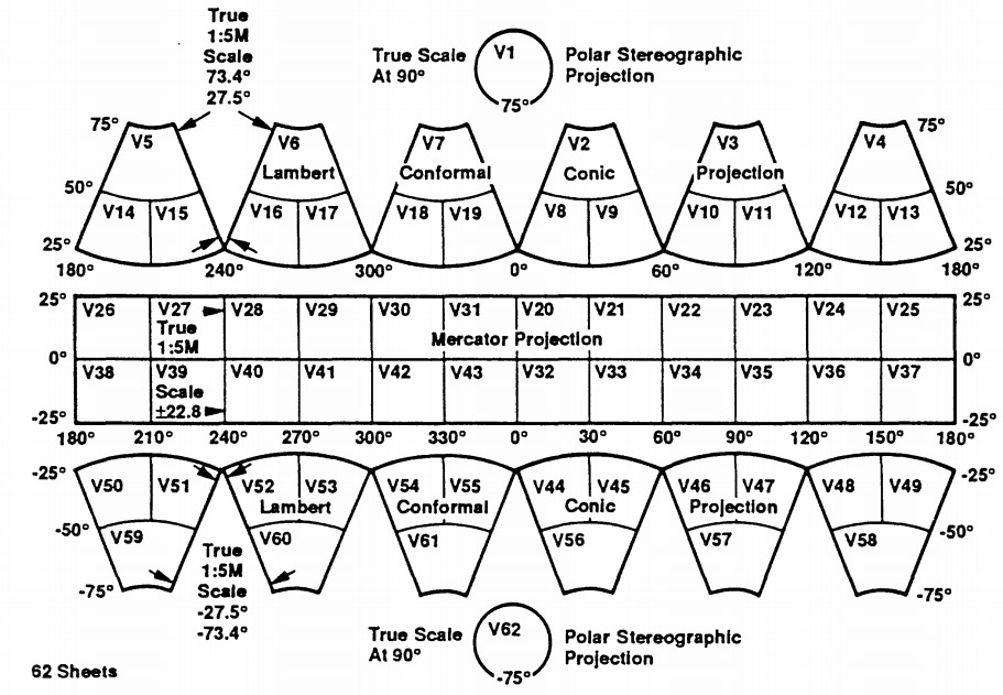
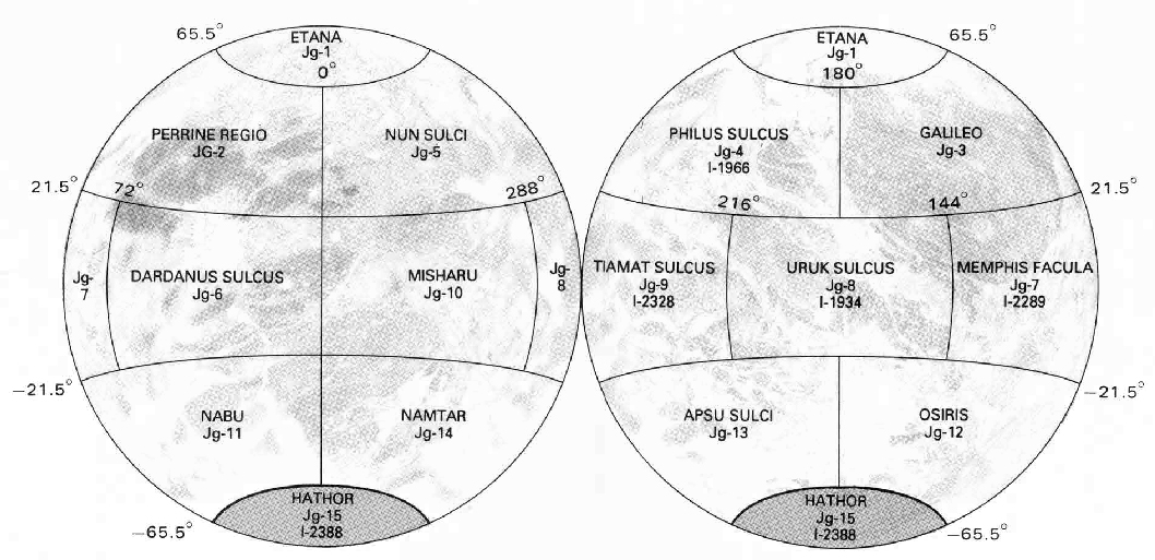
62-sheet, Venus, 1:5M
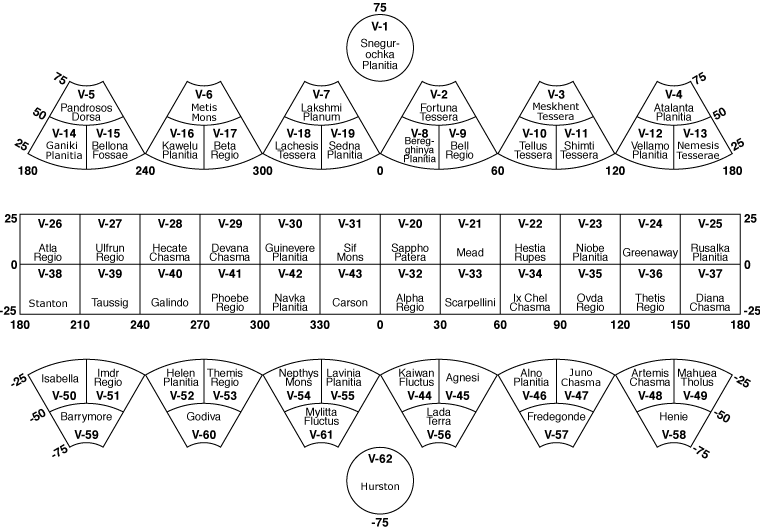
Venus quadrangles with names from the IAU WGPSN
Venus 1:5M quads in the Venus’ Geologic Mappers Handbook. 1993 Reprinted from Ford and others (1989, figure 11). Ford, J.P., and 8 others, 1989, Spaceborne Radar Observations, A Guide for Magellan Radar-Image Analysis: JPL Publication 89-41,126 p.
Northern hemisphere Quadrangles as shown in Soviet Venera radar mosaic atlas

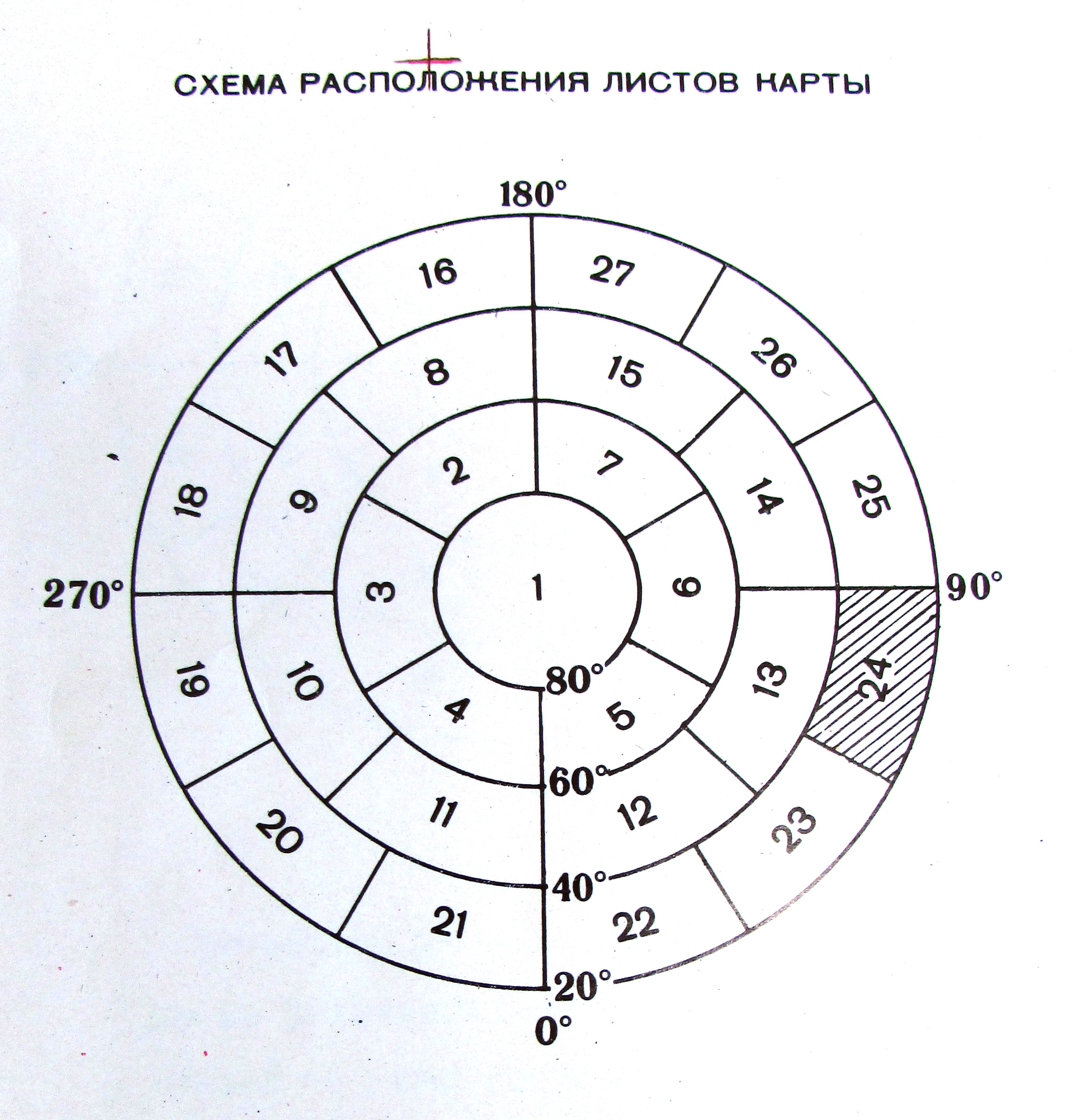
90-sheet 1:5M Venus quads in Fotokarta Venery Soviet series 1985-88. Source: Atlas of Terretstrial planets and their Moons, MIIGAIK 1992.
15 sheet layout. Mercury, 1:5M
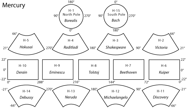
Mercury quads from the IAU Gazetteer of Planetary Nomenlcature
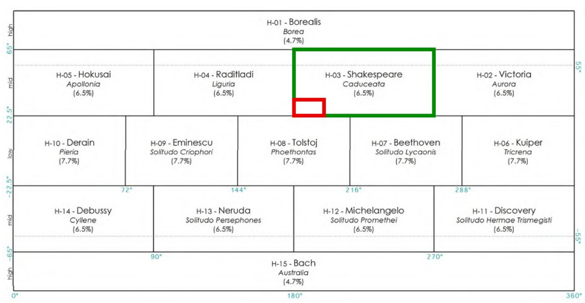
New topographic and old albedo names of Mercury quads.
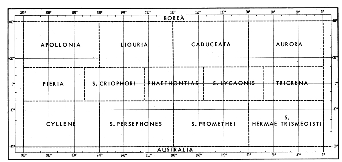
Mercury 1:5M quadrangles used previously, with albedo names.”For the initial 1:5,000,000 topographic maps of the parts of Mercury photographed by Mariner 10, we suggest that map sheets be assigned dual names. The first sheet name will be that of a prominent topographic feature, and the second name, to be placed in parentheses, will be that of an albedo feature as indicated” (Resolutions from the Second Meeting of the I.A.U. Working Group for Planetary System Nomenclature, Moscow, USSR, July 14 and 18, 1975.)
Tethys quads, Semi-controlled Mosaic of Tethys 1:1M, DLR, Roatsch et al. 2009
Enceladus quads (tiles) 1:500k, Roatsch et al. 2008
Dione quads, (tiles) 1:1M, Roatsch et al. 2008
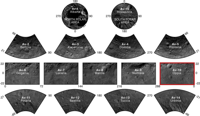
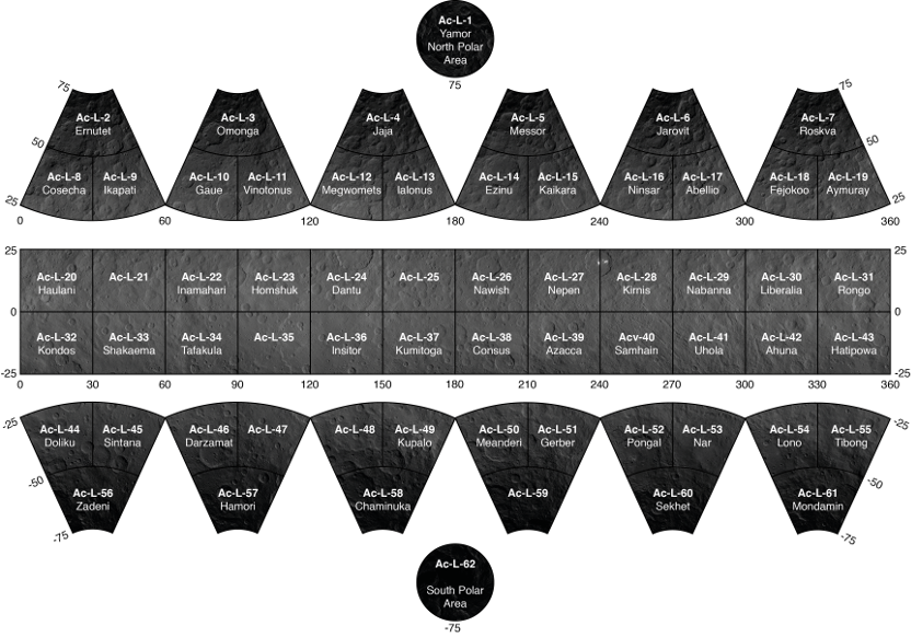
Vesta quadrangles for 1:500k mapping
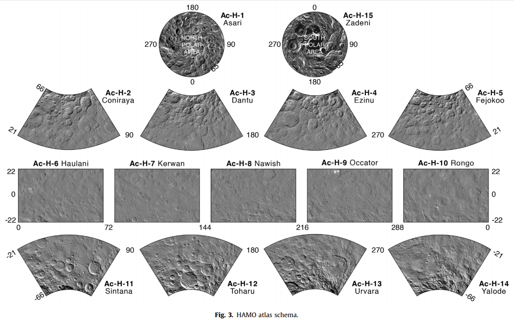
Ceres HAMO mapping at 1:750k scale
Ganymede qudrangles 1:5M
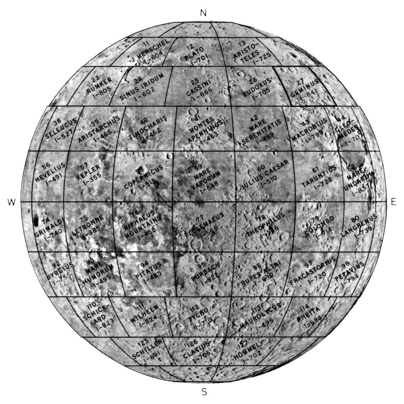
144 sheet layout, Moon, 1:1M. This is used by the The Lunar Astronautical Chart (LAC) series and nomenclature maps.
Sheet designations in the “Geologic Atlas of the Moon” map series. Near side only. 1:1M sheets.
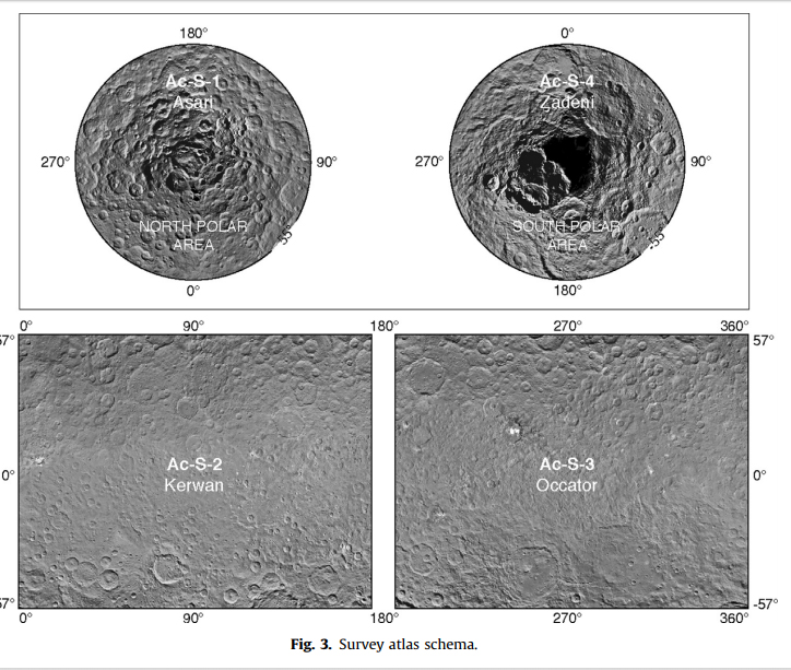
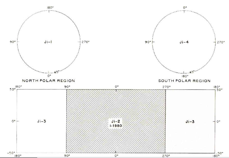
Layout for mapping an irregular body
1:500k Mars MTM quads. (Mars Transverse Mercator). Quads are 5×5°. It has 1964 quads. Names are generated from center latitude (xx) and longitude (yyy), e.g., 40292.
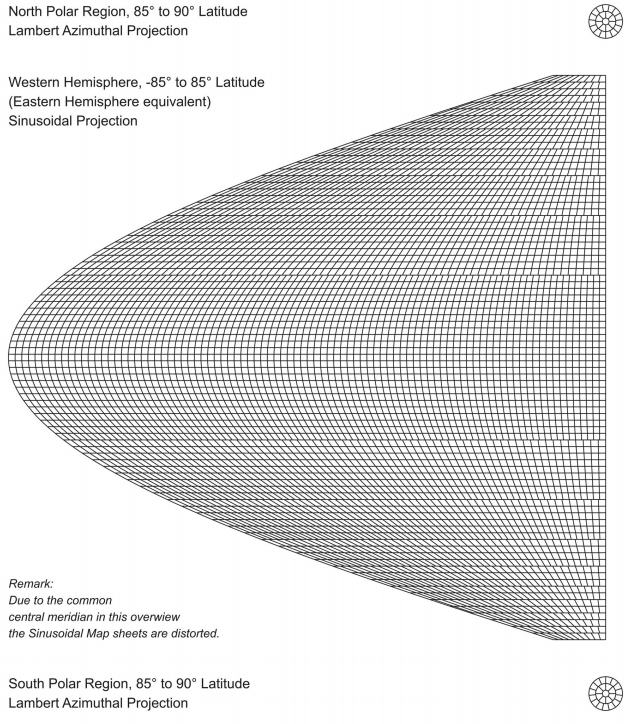
“Sheet Lines System of the Topographic Image Map Mars 1:200,000”, DLR, Mars HRSC mapping. Gehrke et al. Cartography with HRSC on Mars Express – The New Series “Topographic Image Map Mars 1:200,000” Sheets are 2×2°, resulting in 59-70 cm large sheets. Mars is covered by 10,372 map sheets, 10,324 in Sinusoidal Projection and 48 in
Lambert Azimuthal Projection.
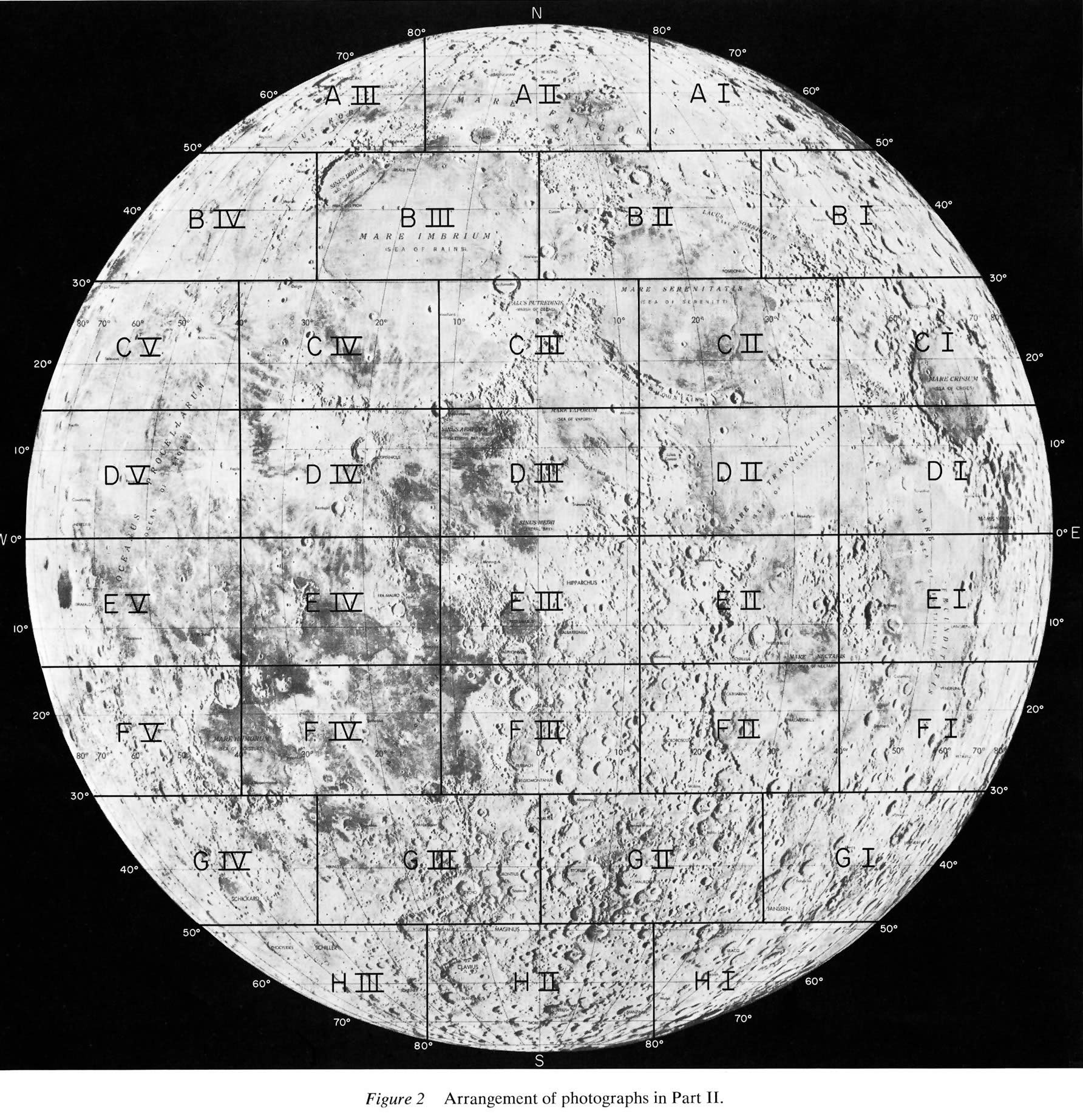
44-sheet orthographic projection, Photographic Lunar Atlas, 1960. 1:1,37M at the limbs. Near side only.
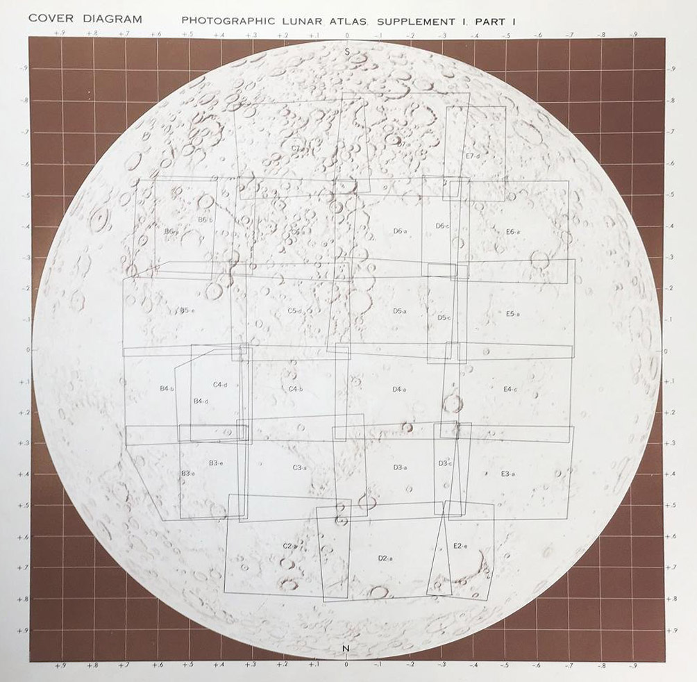
Sheets of the Orthographic Atlas of the Moon 1960
Consolidated Lunar Altas 1967 (full moon plates) 1:2.4M
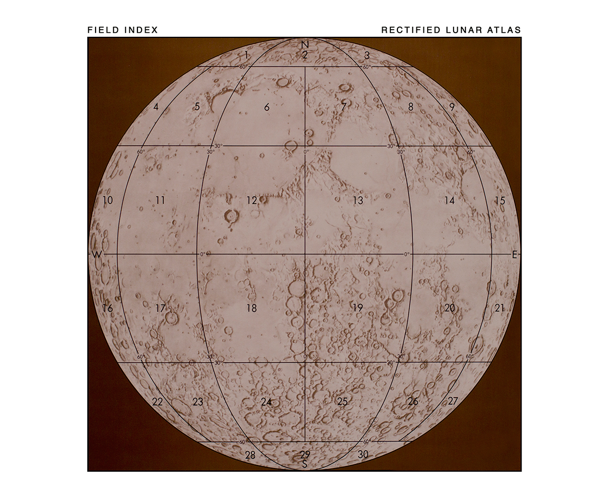
Rectified Lunar Atlas 1963 1:3.5M, UoA Press. Near side only.
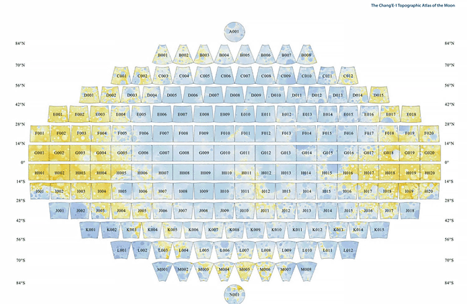
Chang’E Lunar Map – 188 subdivisions. 84-90: Polar azimuthal projection, 18-45: Lambert conformal conic projection, 0-18: Mercator projection. 2010.
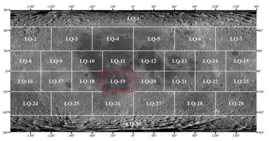
30-quad scheme of new lunar geologic mapping. This scheme was proposed by Gaddis et al. 2004 and was also implemented for the chinese lunar geologic mapping at 1:2.5M scale.
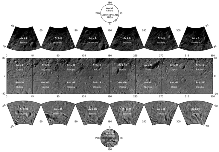
Vesta LAMO quads 1:200k
Ceres LAMO quads 1:250k