Moon

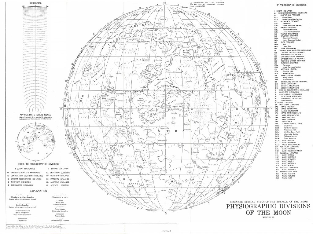
Physiographic Map of the Moon (1961)

Physiographic Map of the Moon (1961)

Physiographic Divisions of the Moon 1:3 800 000 Engeneering Special Study of the Surface of the Moon I-351 1961 USGS Robert Hackman, Arnold Mason   It contains a detailed, new, English, geographic nomenclature for the near side of the Moon. These names and division was never used afterwards even though it is more coherent than the […]

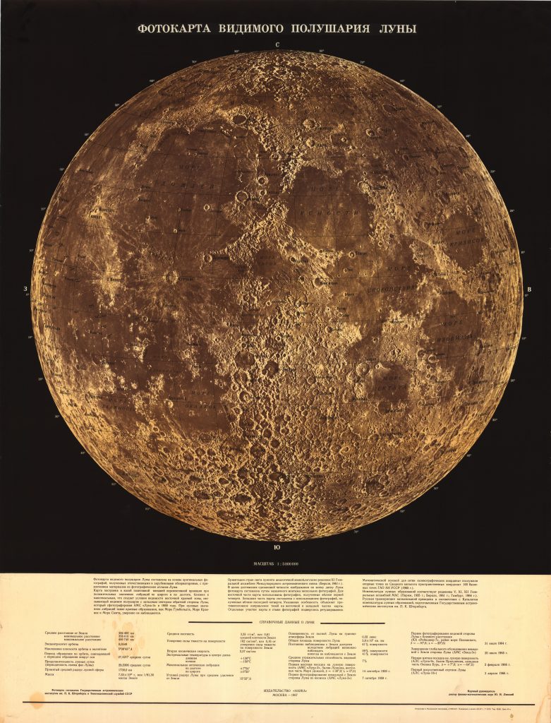
Photomap of the visible side of the Moon (1967)

Photomap of the visible side of the Moon (1967)

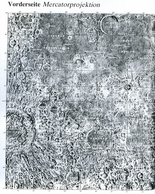
Фотокарта видимого полушария.СССР, Ю. Н. Липский, М., «Наука», 1967. Fotokarta Vidimogo Polusariya Luny Nauka, Moskva, 1967. 1:5 000 000 Yu. N. Lipskiy Sternberg State Astronomical Institute „Gerard Kuiper took two Lick Observatory photographs to Moscow, where a group of military cartographers workig under Lev Bugaevsky combined them with other images to create this photomap. Professor Yurii […]

Persian Lunar Photomaps (2005)

Persian Lunar Photomaps (2005)

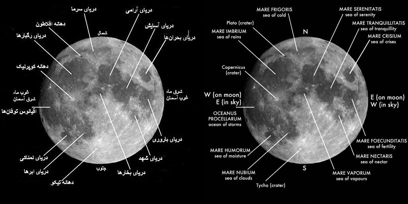
  This map (photo) is by Ardakani (Ardekani), Hossein Haeri (2005) This  map are available on the Persian Wikipedia and is a translation of the English version (to the right)  

Penny Cylopaedia’s Map of the Moon (1863)

Penny Cylopaedia’s Map of the Moon (1863)

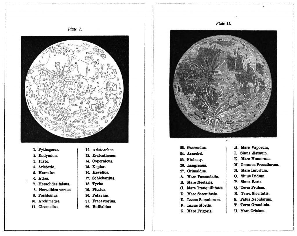
This map was republished in Josiah Crampton’s The Lunar World – its scenery, motions, etc. Edinburgh, 1863. Comment: The maps by Messrs. Beer Maedler are the most minutely accurate, but [this map] is better adapted for popular use” The nomenclature includes names of Terrae. The other illustrations are from Josiah Crampton’s The Lunar World.   […]

Pallas Nagylexikon Moon Map (1893-1897)

Pallas Nagylexikon Moon Map (1893-1897)

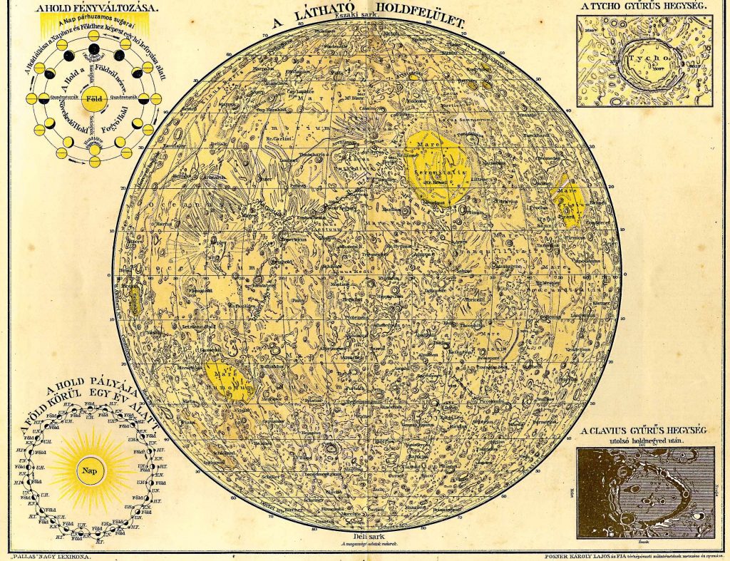
Engraved by Posner Károly Lajos and Son Nomenclature: Hungarian, Latin Published in Pallas Nagylexikon, 1893-1897 The lexikon’s entry on the Moon (detail) Holdtopográfia. Már Galilei felismerte 1610. ujonnan feltalált távcsövével a H. hegyeit és azok árnyékait, s iparkodott megbecsülni a hegyek magasságait. A XVII. sz. közepe felé már találkozunk holdtérképekkel, de a tulajdonképeni Selenographiát csak […]

Nicholson’s Map of the Moon (1807)

Nicholson’s Map of the Moon (1807)

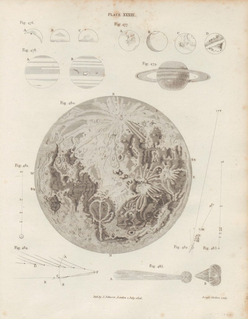
Probably first published in “Nicholson’s Journal”, also know as “Journal of Natural Philosophy, Chemistry and the Arts”. Source: Young, T. 1807; A course of lectures on natural philosophy and the mechanical arts, vol I; London. Image  courtesy of Ton Lindemann.

The Earth’s Moon (National Geographic)

The Earth’s Moon (National Geographic)

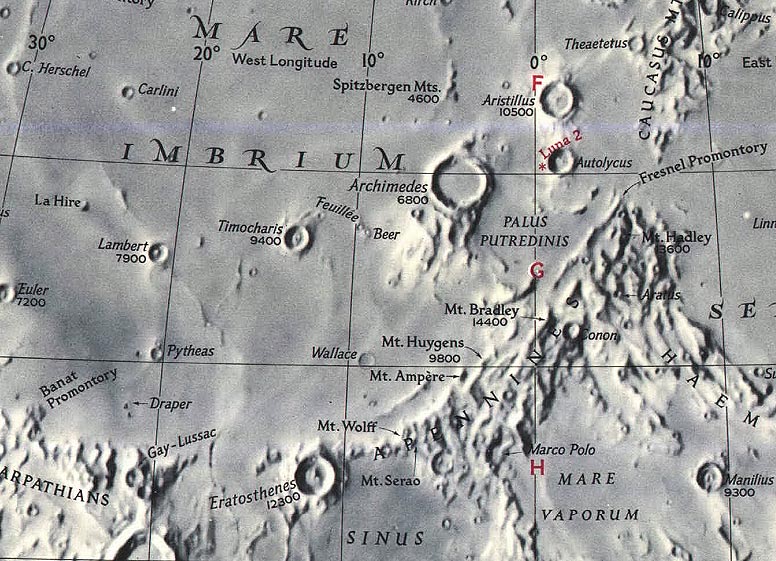
Publisher: (c) The National Geography Society Feb 1969 / 1976 / 2003 editions Nomenclature: 1969: English/Latin, 2004: Latin Background map:  Tibor Toth (1969) Font design: Charles Riddiford (same font as in other National Geographic maps) Design: Dave Cook, Richard Furno (Source: part 1 part 2) With complete index on the back side of the map. […]

Map of the Moon (Müller 1856)

Map of the Moon (Müller 1856)

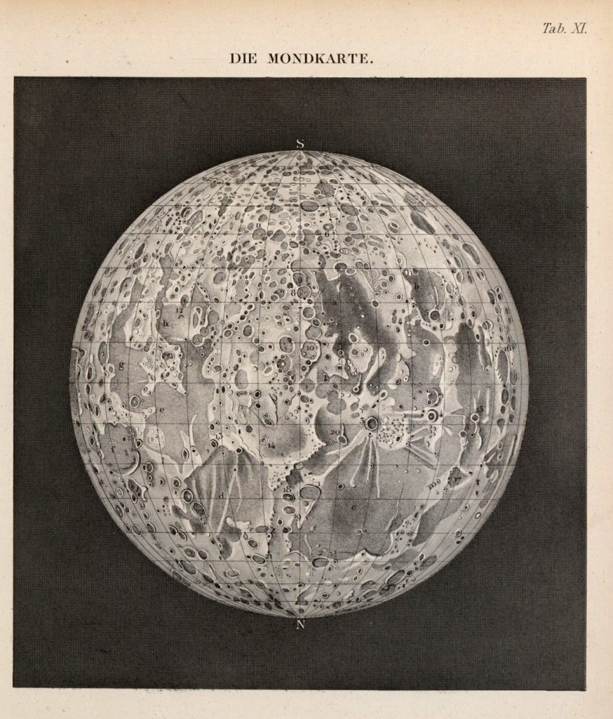
Müller, J. 1856; Lehrbuch der kosmischen Physik – Atlas; Braunschweig Image  courtesy of Ton Lindemann.

Morphologic provinces of the Moon (1981)

Morphologic provinces of the Moon (1981)

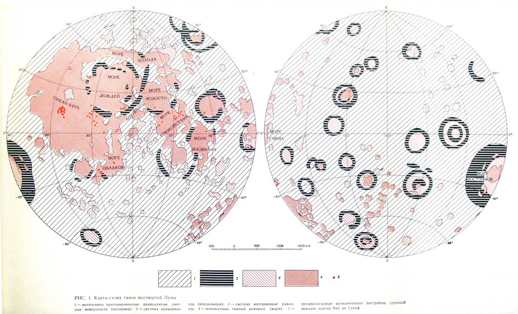
Karta-skhema tipov mestnostey Luny KP Florenskiy, AT Bazilevskiy, GA Burba, VP Volkovc AV Ivanov, RO Kuzmin, MA Nazarov, OV Nikolaeva, AA Pronim, OD Rodye, OI Yakovlev, AA Yarosevskiy; Ed. VL Barsukov Otserki Sravnitel’noj Planetologii Nauka, Moskva, 1981. Vernadski Institute.
Atlas of the Moon (1953)

Atlas of the Moon (1953)

Reference: Patrick Moore: Der Mond. Herder. Language of nomenclature: Latin Language of explanations: German Publication Date: 1953 Publication Place: Freiburg – Basel – Wien  

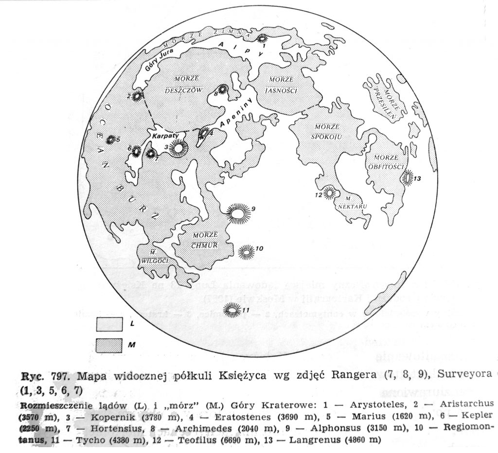
Map of the Moon from Klimaszewski’s Geomorfologia (1978)

Map of the Moon from Klimaszewski’s Geomorfologia (1978)

From the book: Mieczysław Klimaszewski: Geomorfologia Warszawa, 1978 edition Nomenclature: Polish  

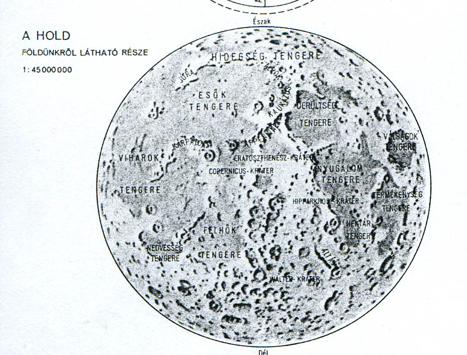
Map of the Moon, Novi Sad (1978)

Map of the Moon, Novi Sad (1978)

Reference: Földrajzi Atlasz,  Tartományi Tankönyvkiadó Intézet, Novi Sad – Cartographica, Budapest a school atlas made for Hungarian students in Vojvodina, Jugoslavia. Page: “A Naprenszer és a Csillagos égbolt” Language of nomenclature: Hungarian Language of explanations: Hungarian Map type: Shaded Relief Scale: 1:45  000 000 Publication Date: 1978 Publication Place: Novi Sad  Jugoslavia – Budapest, Hungary Publisher: […]