Chart of Mars (1892)
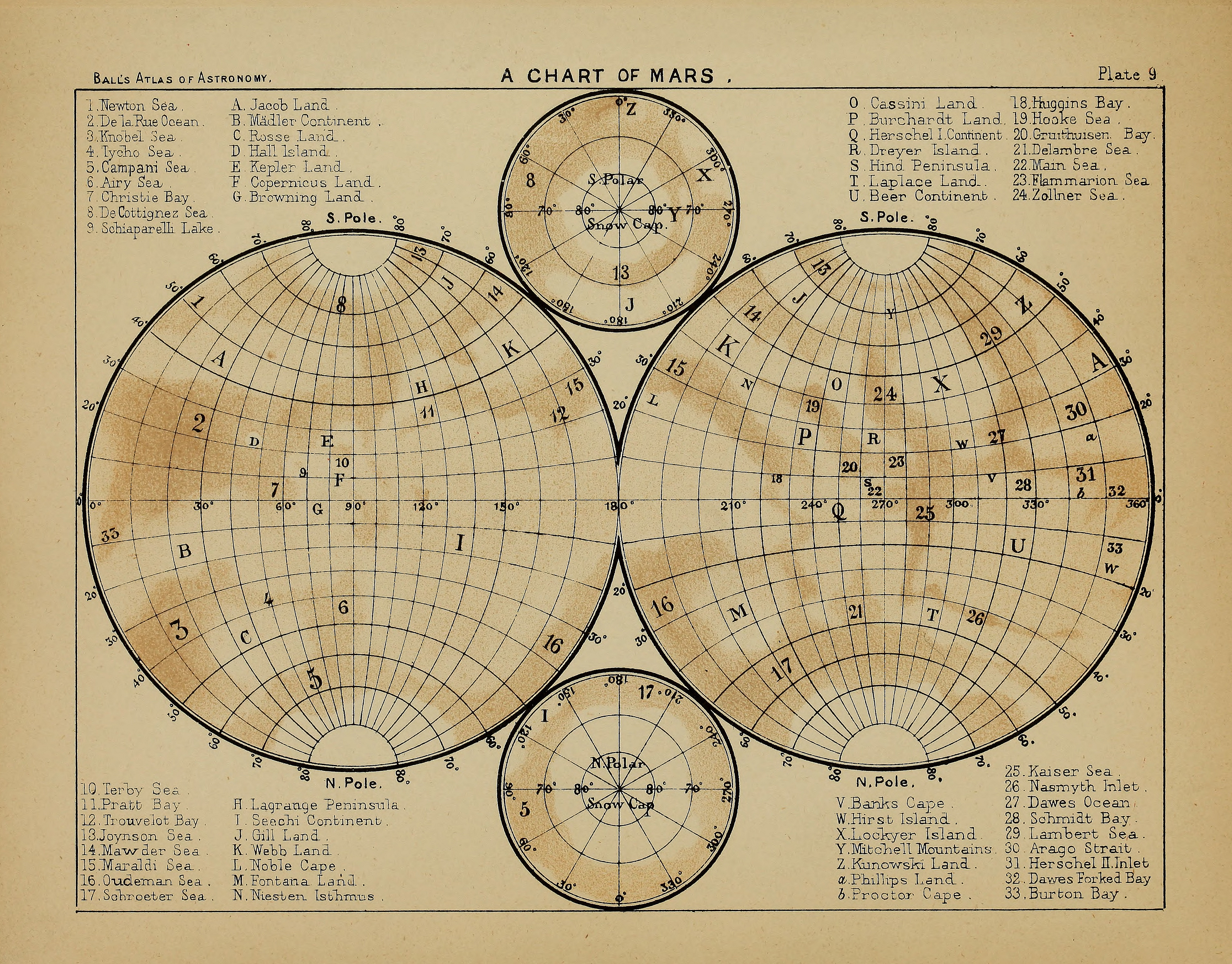
“This map represents the surface of Mars on the stereographic projection. It has been compiled (with only two exceptions, where, as shown by Mr. Knobel in 1884, the balance of evidence appears to incline otherwise) from Mr. N. E. Green’s Chart of Mars, published in theTransactions of the Royal Astronomical Society, Vol. XLIV. The details of this chart have been compared with views of the planet by Schiaparelli, Trouvelot, Terby, De la Rue, Lockyer, Knobel, Christie, Maunder, Brett, Dreyer, and others, and no form is introduced that has not been confirmed by the drawings of at least three observers, so that any markings to be found there may be taken to represent a real feature of the planet. The exceptions to which I have referred are called by Mr. Green — Phillips Island and Leverrier Land. The first of these appears to be connected by a tongue of land between Burton Bay and Dawes Forked Bay with Beer Continent. I have consequently changed the name to Phillips Land ; and Herschel II. Strait, which by the same alteration ceases to be a strait, I have called Herschel II. Inlet. Leverrier Land I have omitted altogether, as Mr. Knobel was unable to find any trace of it under very favourable circumstances in 1884. The Lassell Sea, too, of Mr. Green appears to be only a prolongation of Nasmyth Inlet, and the name has been accordingly omitted. The smaller maps at the top and bottom of the plate are also on the stereographic projec- tion, and represent the polar regions of the planet, showing the form and extent of the northern and southern snow-caps as seen by Mr. Green in 1877. In comparing this plate with the appearance of the planet in the telescope, it should be remembered that parts near the centre of the maps are by this method of projection represented on a smaller scale than those near the edge.”
Published in: Ball, R.S. 1892; An atlas of astronomy – a series of seventy-two plates, with introduction and index; New York. Plate IX.
Language: English
Courtesy Ton Lindemann.


