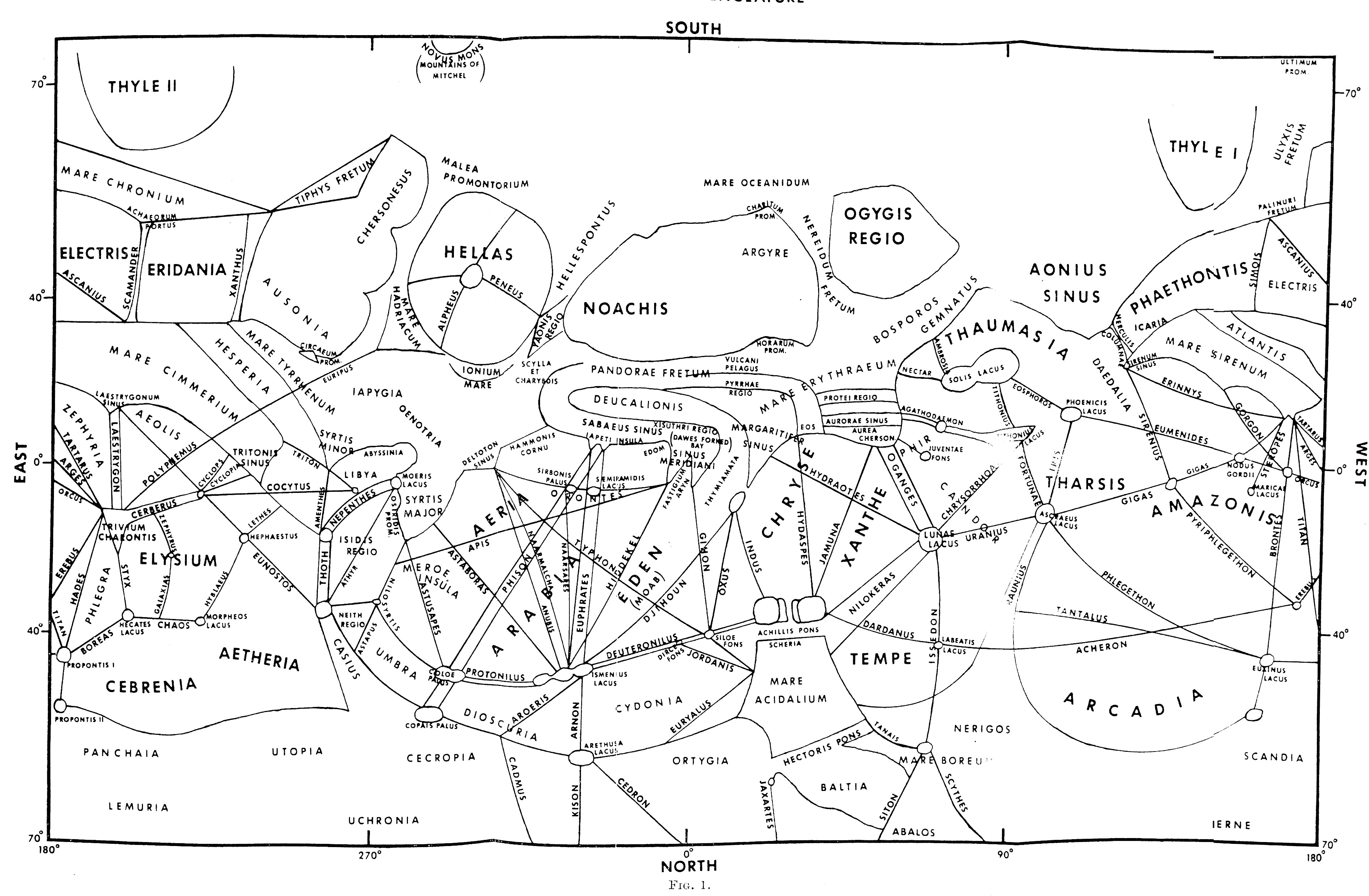
R.A.Wells’ Map of Mars (1971)
Publication Date: 1971
Based on: the text about Martian nomenclature by T.L. MacDonald
Published in: T.L. MacDonald: The origins of Martian nomenclature. Icarus Volume 15, Issue 2, October 1971, Pages 233-240 Web access
Language of nomenclature: Latin

Original map caption:
“Martian nomenclature sketch map prepared by H. A.Wells for identifying regions on Mars as discussed in the text. The authority for the locations of named areas are as follows: G. V. Schiaparelli, Il Pianeta Marte, Milano (1893): P. Lowell, Annals of the Lowell Observatory, Vol I (1898), Vol. II (1900), Vol. III (1905); E. M. Antoniadi, La Planete Mars, Hermann, Paris (1930): and T. L. MacDonald in that order. Wherever an area was in question or lacking in the maps from these observers, MacDonald’s accounting of the location is used. Some area names disagree with: those in later maps by other observers and current compilations by the A.C.I.C.; however, since the above-mentioned observers are the primary sources and since, as a contemporary, MacDonald represents one of the final links directly to these observers’ modes of thought, this version of nomenclature location is considered by R. A. Wells to be the most accurate. The location of surface features by cartographic coordinates is, of course, only approximate since a definitive system has yet to be devised (the Mariner 6 and 7 photos are now being processed to obtain a highly accurate coordinate system). South is placed at the top and longitude increases to the West in accordance with “astronomical” convention and for ease in reading the text.”

