Földgömb’s Map of Mars

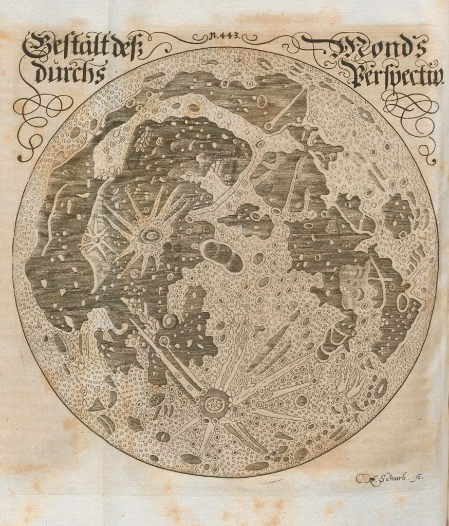
Francisci’s drawing of the Moon (1676)

Francisci’s drawing of the Moon (1676)

Source: Francisci, E. 1676; Das eröffnete Lust-Haus der Ober- und Nieder-Welt; bey mehrmaliger Unterredung vor dißmal so wol von der Natur, Welt, Himmel und dem Gestirn insgemein, als auch insonderheit von dem Mond, der Sonnen und allen übrigen wandelbaren Sternen; imgleichen von den Haar-Sternen oder Kometen, wie auch gestirnten Einflüssen, Stuffen-Jahren, Talismannen / allen Natur-, […]
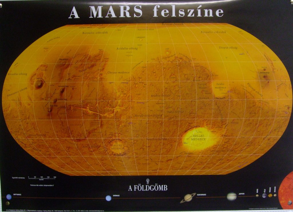
Földgömb’s Map of Mars

Földgömb’s Map of Mars

Source: A Földgömb  9.(25.) 2007. jan-febr. 1.(221.) Copyright: Heiling Media Kft http://www.foldgomb.hu Projection: Robinson Type: MOLA based topographic Nomenclature: Hungarian Cartographers: Henrik Hargitai, Zsombor Nemerkényi  

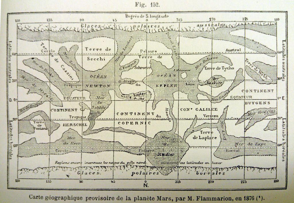
Flammarion’s Maps of Mars (1876-90)

Flammarion’s Maps of Mars (1876-90)

1876 Publication Date: 1876 Source: map 4 in: Percival Lowell:  Areography. The Popular Science Monthly, September, 1902. vol. LXI.—25. p 385-406 Note by Lowell: “Resume by Flammarion of all to date”, i.e. of the maps by Beer and Madler (1840), Kaiser (1864), and Dawes by Proctor (1867). Original version Published in: Flammarion, C (1892) La planete […]

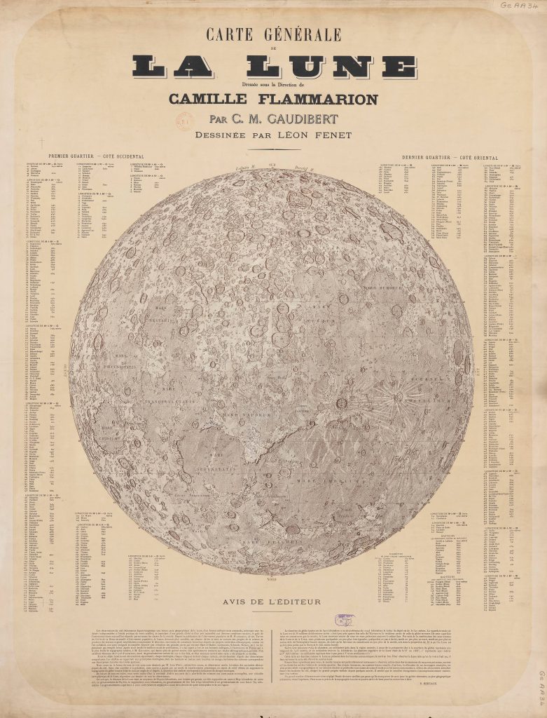
Map of the Moon (Flammarion/Gaudibert/Fenet 1887-1900)

Map of the Moon (Flammarion/Gaudibert/Fenet 1887-1900)

Carte générale de la Lune. Editor: Camille Flammarion Based on: the map of C.M. Gaudibert Graphic artist: Léon Fenet Date: 1887 Publication: standalone  sheet Contribution by Ton Lindemann. Advertisement about the map, The Physical Review 2/5, 1895 “A Hold általános térképe” (Moon’s general map), Hungarian edition Camille Flammarion’s Népszerű csillagászat (Popular Astronomy), Az égbolt egyetemes […]

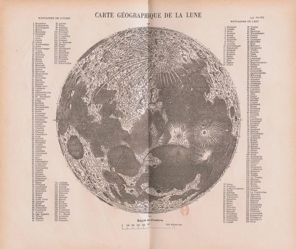
Map of the Moon (Flammarion 1881-1898)

Map of the Moon (Flammarion 1881-1898)

Carte Géographique de la Lune Date: 1881 Publication: Astronomie Populaire Contribution by Ton Lindemann 1898; Wonderen des Hemels; Zutphen (Dutch edition): Image courtesy Ton Lindemann A Hold földrajzi abrosza (Moon’s geographic chart) Camille Flammarion’s Népszerű csillagászattan (Popular Astronomy), Budapest edition c. 1880-1900 Nomenclature is in two blocks: “Western Mounts and Eastern Mounts” South is up.

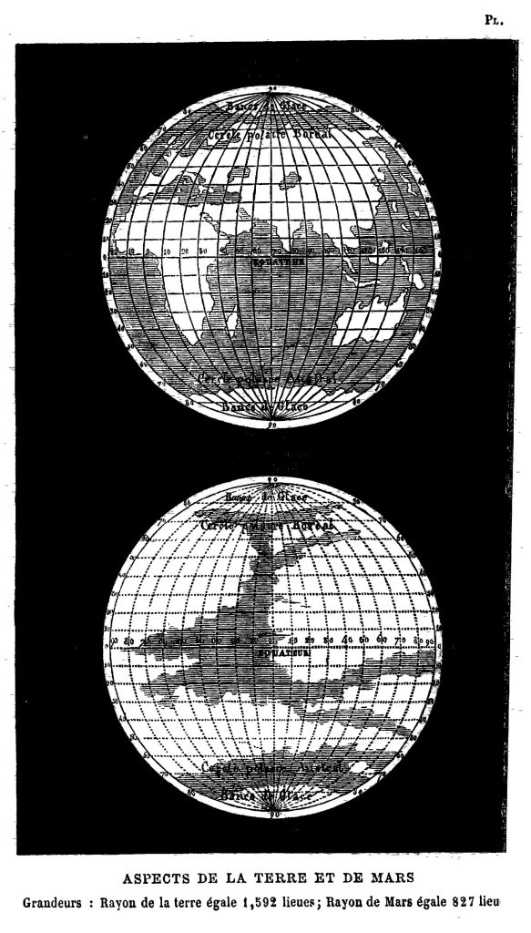
Comparative map of Earth and Mars (Flammarion 1869)

Comparative map of Earth and Mars (Flammarion 1869)

Published in Camille Flammarion: La Pluralité des Mondes Habités, Paris, 1869. (14th Ed.) One of the 1st comparative planetological figure.

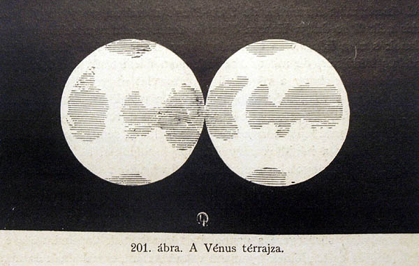
Flammarion’s map of Venus

Flammarion’s map of Venus

“A Vénus térrajza”. Camille Flammarion: Népszerű csillagászattan (Popular Astronomy), Budapest edition c. 1880-1900

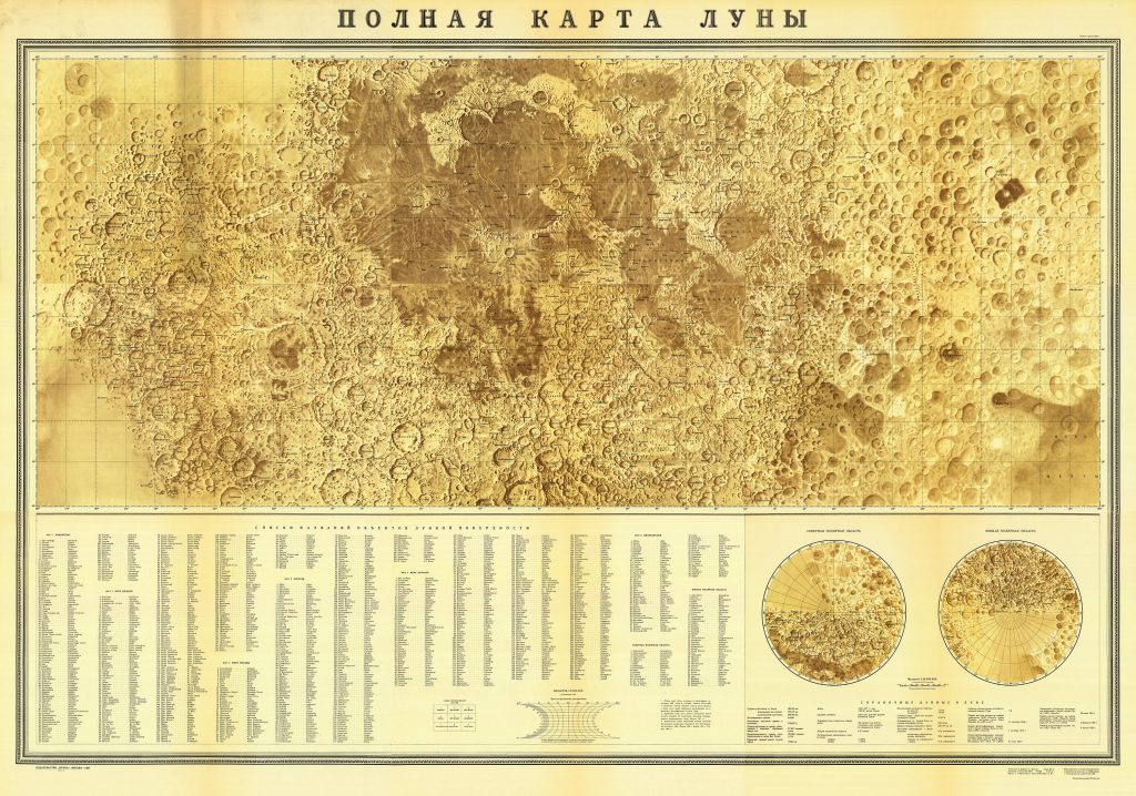
First Complete Moon Map (1967)

First Complete Moon Map (1967)

Polnaya karta Luny using Luna-3 (1959) and Zond-3 (1965) images 1:5 000 000 Nauka, Moskva, 1967. Projection: „arbitrary cylindrical projection” 9 sheets, 7 with relief and two with names. From 90E to 180 it uses low resolution Luna 3, from 180 to 90W is uses higher resolution Zond 3 images. The first full map of […]

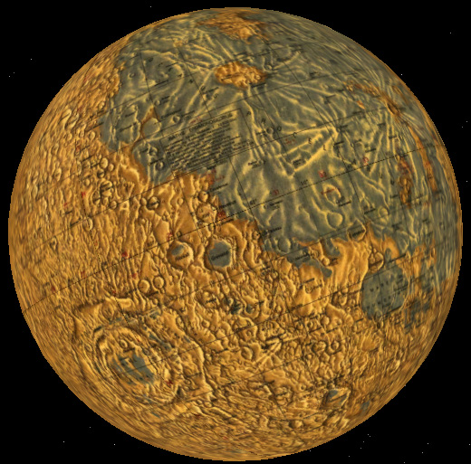
First Complete Moon Globe 1967

1:10 000 000 Nauka, Moskva, 1967. Prepared at the same time as the first complete map of the Moon in 1967, both at Sternberg Astronomical Institute, for the International Congress of Astronomical Union in Prague. K.B. Shingareva have presented the map and globe in the Prage Congress. About 10 globes were made. One was brought […]

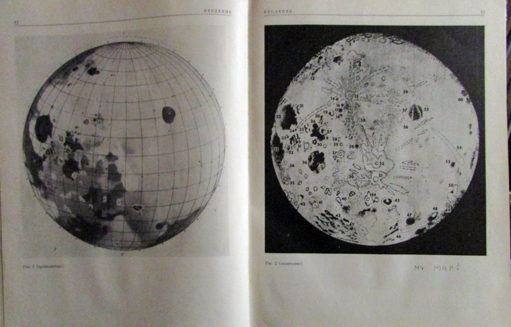
Soviet Farside Maps/Atlases

Soviet Farside Maps/Atlases

Atlas Obratnoj Storony Luny (Part 1) Akademiya Nauk SSSR Moskva 1960. Includes a map of the far side in 4 pages 1:10 000 000 (It is centered at 120 deg, partly overlaps the near side) Left: Luna-3 image from Atlas Obratnoj Storony Luny (Tsast’ 2) 1967 Right: Image composite by P Stooke (2007) A globe of […]

Raths Erdmondglobus (1976)

Raths Erdmondglobus (1976)

33 cm 1:10 500 000 Ed. Hellmuth Wolf Gotha/Leipzig, 1976 DDR Virtual Globe for Google Earth. Google Earth Add-on: DDR Lunar Globe Download kmz file for Google Earth Downoad VRML file for Flux Player or orther VR players

Dopplemeyer’s double Map of the Moon

Dopplemeyer’s double Map of the Moon

Publication Date: 1707?/1730/42? Based on: the map of the Moon by Hevelius and Riccioli (slightly changed nomenclature) Place of Publishing: Nurenberge Language of nomenclature: Latin Author: Doppelmayr, Johann Gabriel, 1742, Atlas Coelestis. Published in Plate 11 of “Atlas coelestis in quo mundus spectabilis et in eodem stellarum omnium phoenomena notabilia… secundum Nic. Copernici et ex parte Tychonis […]