

The Catalog of Planetary Maps.
Sources: The research that led to this catalog was supported by Fulbright Hungary Grant No. 1222202, awarded to H. Hargitai for research at USGS Astrogeology, Flagstaff, Arizona (advisor: Trent Hare), and by the ICA Commission on Planetary Cartography (advisor: Kira Shingareva). Most of the data is based on the inventory of the map library of USGS Astrogeology.
Copyright and Use Notice: Published U.S. Geological Survey and U.S. Air Force maps are generally in the public domain. Some maps reproduced or displayed on this site may be protected by copyright.
This website includes thumbnail images or excerpts of maps for identification, documentation, research, and educational purposes only. These uses are believed to qualify as fair use under U.S. copyright law. Full-resolution copyrighted maps are not hosted unless explicit permission has been obtained or the material is confirmed to be in the public domain.
The inclusion of any map or photograph in this catalog does not imply that it is free of copyright restrictions. Responsibility for determining copyright status and obtaining necessary permissions rests entirely with the user.
If you are a copyright holder and believe material on this site is used inappropriately, please contact the curator (hargitai.henrik@btk.elte.hu) with details so we can review and address your concerns promptly.
Photos: Unless otherwise indicated, all photographs are by H. Hargitai. Several photographs are from the USGS Astrogeology Map Library and Lowell Observatory, both in Flagstaff, Arizona. Several photographs of Soviet maps were taken at MIIGAiK, Moscow.
Contact: The catalog is curated by H. Hargitai, ELTE, Budapest, hargitai.henrik@btk.elte.hu.
Main_theme: relief
48 maps
| # | Title | Map No. | Lead Author | Artist | Target | Quad. | Scale | Year | Publisher | |
|---|---|---|---|---|---|---|---|---|---|---|
| #145 | Die sichtbare Seite der Mond-Oberfläche bei voller Beleuchtung : nach Beer u. Mädler's Karte The visible side of the lunar surface at full illumination: after Beer and Madler's map | Ausfeld, Johann Carl | Moon | 1876 | Justus Perthes | |||||
| #141 |
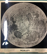 |
Mondkarte mittle Libration Moon map at mean libration | Opelt, O. M. | Moon | 1874 | |||||
| #137 | Die sichtbare Seite der Mond-Oberfläche bei voller Beleuchtung : nach Beer u. Mädler's Karte The visible side of the lunar surface at full illumination: after Beer and Madler's map | Ausfeld, Johann Carl | Moon | 13M | 1872 | Justus Perthes | ||||
| #135 | Die sichtbare Seite der Mond-Oberfläche bei voller Beleuchtung : nach Beer u. Mädler's Karte The visible side of the lunar surface at full illumination: after Beer and Madler's map | Ausfeld, Johann Carl | Moon | 1870 | Justus Perthes | |||||
| #122 |
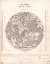 |
Carte générale de la Lune General map of the Moon Lecouturier, MM; A Chapuis Carte générale de la Lune Tones, rays and clear rings and "worms" of terrain Paris Librari… | Lecouturier, M. M. | Moon | 1860 | Librairie des Sciences | ||||
| #124 |
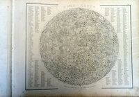 |
Mond—Karte Nach dem besten Quellen entworfen und gezeichnet Map of the Moon Meyer's Kriegs- u. Friedens- oder grosser Zeitungs-Atlas in 148 karten... J. Meyer. Hildburohausen et New-York . Schleif… | Radefeld, C. C. | Moon | 1860 | J. Meyer | ||||
| #116 | Die sichtbare Seite der Mond-Oberfläche bei voller Beleuchtung : nach Beer u. Mädler's Karte. Ausgabe in 63 B1 No1 The visible side of the lunar surface at full illumination: after Beer and Madler's map. Edition in 63 sheets, no. 1 | Ausfeld, Johann Carl | Moon | 46M | 1853 | Justus Perthes | ||||
| #114 |
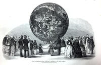 |
Relief der sichtbaren Halbkugel des Mondes, angefertigt von Th. Dickert in Bonn. Relief of the visible hemisphere of the Moon, made by Th. Dickert in Bonn. Location: Bonn, Germany, 1850, transported to the Field Museum of Natural History, Chicago (189x-190x) Constructed b… | Dickert, Th | Moon | 600k | 1850 | ||||
| #109 |
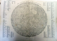 |
Die Sichtbare seite der Mond-Oberflache The visible side of the lunar surface Vollständiger Hand-Atlas der neueren Erdbeschreibung ueber alle Theile der Erde : in 80 Blättern / herausgegeben von K. … | Flemming, Carl Glockau | Moon | 1844 | K. Sohr | ||||
| #105 |
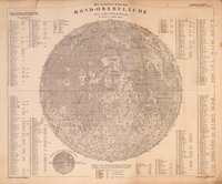 |
Die sichtbare Seite der Mond-Oberfläche bei voller Beleuchtung : nach Beer u. Mädler's Karte. Ausgabe in 63 B1 No1 The visible side of the lunar surface at full illumination: after Beer and Madler's map. Edition in 63 sheets, no. 1 Stieler's Hand Atlas 1841. (monochormatic) Steel engraved Johann Carl Ausfeld, engr. | Ausfeld, Johann Carl | Moon | 46M | 1841 | Justus Perthes | |||
| #104 |
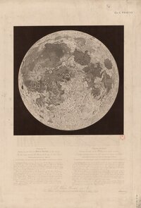 |
Exhibiting the same view of the Moon’s surface as plate the first Plate the 2nd Exhibiting the same view of the Moon’s surface as plate the first. The first plate presents the Moon… | Russell, John | Moon | 1840 | James Wyld, Charing Cross East | ||||
| #101 |
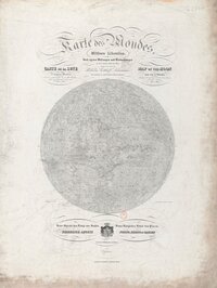 |
Karte des Mondes in einem mittleren Librationzustand Map of the Moon in a mean state of libration. According to the measurements and observations taken by the author in the years 1822 to 1836 Map of the Moon in a mean state of libration. According to the measurings and observations taken by th… | Lohrmann, Wilhelm Gothelf | Moon | 1838 | Verlag von Johann Ambrosius Barth | ||||
| #93 |
 |
Nach der Natur und mit Benützung der Schrötter'schen Special-Karten auf der K. K. Sternwarte in Wien, unter der Leitung des Herrn Direktors und Professors der Astronomie J. J. Littrow, gezeichnet von Albert Richard von 1819 bis 1830, und in Stein gestochen von demselben Drawn from nature and using Schroeter's special maps at the Imperial-Royal Observatory in Vienna, under the direction of J. J. Littrow, by Albert Richard from 1819 to 1830, and lithographed by him | Richard, Albert | Moon | 1832 | |||||
| #90 | Topographie der sichtbaren Mondoberflaeche Topography of the visible lunar surface Cartographer: Wilhelm G Lohrman Sheets: 25 The map series was produced and started by Lohrman but publication was fini… | Lohrmann, Wilhelm Gothelf | Moon | 3.6M | 1824 | Auf Kosten des Verfassers | ||||
| #81 | Der Volle Mond The full Moon | Meissner, A. G. | Moon | 1805 | ||||||
| #78 |
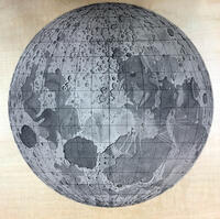 |
Tob. Mayeri tabula selenograhica Tobias Mayer's selenographic table/map Publication Date: 1791 Published in Selenotopographische Fragmente zur genauern Kenntniss der Mondfläche, ihrer erlit… | Schröter, Johann Hieronymus | Mayer, Tobias Johann | Moon | 1791 | Carl Gotthelf Fleckeisen | |||
| #58 |
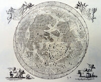 |
Tabula Selenographica Selenographic table/map 1746 Map of Hevelius, re-drawn by Lemonnier, C.P. 1746; Institutions astronomiques, Paris Image courtesy of Ton Linde… | Hevelius, Johnnis | Moon | 1746 | Typis Hünefeldianis | ||||
| #38 |
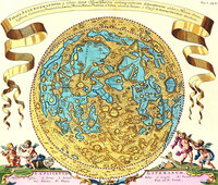 |
Tabula Selenographica : in visibilis Lunae Hemisphaerio orthographicam delineationem exhibens Marium, Sinuum, Insularum, Continentium, Promontoriorum, Lacium, Paludum, Montium, Planitierum, et Vallium / adminiculo Tubi Optici à Clariss. D. Ioanne Hevelio detectorum Selenographic table showing the visible hemisphere of the Moon in orthographic projection 1696 Joanne Zahn (1696) Specula physico-mathematico-historica notabilium ac mirablium sciendorum in qua MUNDI MIRAB… | Hevelius, Johnnis | Moon | 1696 | |||||
| #12 |
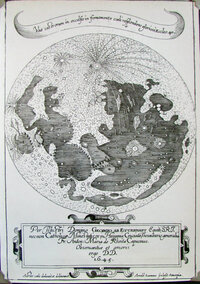 |
Perillustri Domino Georgio ab Ettenhart, Equiti S.R.I., necnon Catholicae Maiestatis et in Hispania Cruciatae Thesaurario generali, Frater Anton Maria de Rheita, Capucinus, observantiae et amoris ergo dedit dedicavit. Dedicated by Brother Anton Maria de Rheita, Capuchin, to the illustrious Georg von Ettenhart, Knight of the Holy Roman Empire and general treasurer of the Catholic Majesty and of the Crusade in Spain Cartographer: Anton Maria Schyrle of Rhaetia Date: 1645 Nomenlcature: None Perillustri Domino Georgio ab Ettenhart, … | Schyrle of Rhaetia, Anton Maria | Moon | 1645 | |||||
| #13 |
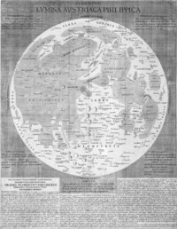 |
Plenilunii lumina Austriaca Philippica Austrian-Philippic light of the full Moon Publication Date: 1645 Cartographer: Michael van Langren (Langrenus) Source: Plenilunii lumina Austriaca Philippica. [By… | Van Langren, Michael | Moon | 1645 | |||||
| #6204 |
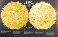 |
Luna (multilingual) Moon (multilingual) Buchroithner M.F.(Dresden University of Technology), B. V. Krasnopevtseva, K. B. Shingareva, Moscow State University for… | Buchroithner, Manfred F. | Moon | 1.3M | |||||
| #6762 |
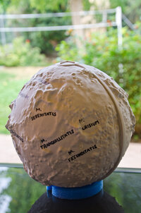 |
Tactile Globe of the Moon Authors: Amelia Ortiz-Gil (University of Valencia, Spain), Fernando Ballesteros (University of Valencia, Spain), and Alb… | Ortiz-Gil, Amelia | Moon | ||||||
| #6741 |
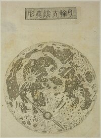 |
日月写真図 True pictures of the Sun and Moon This image was posted on Tumbl. Accoding to the post, it was a copper plate print made by 松田緑山 in the 1860s. The figure… | Matsuda, Midoriyama | Moon |