|
#5176
|
|
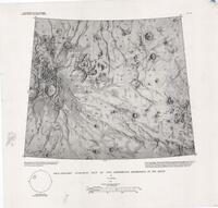
Geologic Map of the Tempe-Mareotis Region of Mars |
I-2727 |
Moore, Henry J. |
|
Mars |
|
1M |
2001 |
U. S. Geological Survey |
|
#4954
|
|
V-49 Mahuea Tholus quadrangle - Mena colles geologic map making set (manuscript) |
|
Moore, Henry J. |
|
Venus |
V-49 |
5M |
1993 |
|
|
#4438
|
|
Viking I and II Maps of Rock and Drift Areas |
|
Moore, Henry J. |
|
Mars |
|
|
1989 |
|
|
#4230
|
|
Generalized maps of the Viking Lander 1 Sample Field |
Plate 1 |
Moore, Henry J. |
|
Mars |
|
|
1987 |
U. S. Geological Survey |
|
#4231
|
|
Generalized maps of the Viking Lander 2 Sample Field |
Plate 1 |
Moore, Henry J. |
|
Mars |
|
|
1987 |
U. S. Geological Survey |
|
#4234
|
 |
Geologic Map of the Maasaw Patera Area of Io |
I-1851 |
Moore, Henry J. |
|
Io |
|
1M |
1987 |
U. S. Geological Survey |
|
#3393
|
|
Experimental lunar topographic map of a mare dome north of the Aristarchus Plateau |
Professional Paper 1046-D |
Wu, Sherman S. C. |
|
Moon |
|
15k |
1980 |
|
|
#3394
|
|
Experimental lunar topographic map of scabland region north of Artistarchus Plateau |
Professional Paper 1046-D Plate 1 |
Wu, Sherman S. C. |
|
Moon |
|
50k |
1980 |
|
|
#3395
|
|
Experimental lunar topographic map of southeast Krieger area |
Professional Paper 1046-D |
Wu, Sherman S. C. |
|
Moon |
|
10k |
1980 |
|
|
#3396
|
|
Experimental topographic map of area north of Diophantus |
Professional Paper 1046-D Plate 4 |
Wu, Sherman S. C. |
|
Moon |
|
50k |
1980 |
|
|
#3397
|
|
Generalized Working Map of Sample Field Viking Lander 1 Showing Locations of Rocks 5cm and Larger (manuscript) |
|
Moore, Henry J. |
|
Mars |
|
|
1980 |
|
|
#3398
|
|
Generalized Working Map of Sample Field Viking Lander 2 Showing Locations of Rocks 5cm and Larger (manuscript) |
|
Moore, Henry J. |
|
Mars |
|
|
1980 |
|
|
#3400
|
|
Geologic Map of the Sinus Sabaeus Quadrangle of Mars |
I-1196 |
Moore, Henry J. |
Hall, Barbara J. |
Mars |
MC-20 |
5M |
1980 |
U. S. Geological Survey |
|
#3149
|
|
Generalized maps of the Viking Lander 1 Sample Field A) End of the primary mission, B) End of the extended mission (2 maps in one sheet) (manuscript) |
Professional Paper 1389 |
Moore, Henry J. |
|
Mars |
|
1B |
1978 |
|
|
#3150
|
|
Generalized maps of the Viking Lander 2 Sample Field A) End of the primary mission, B) End of the extended mission (2 maps in one sheet) (manuscript) |
Professional Paper 1389 |
Moore, Henry J. |
|
Mars |
|
|
1978 |
|
|
#3229
|
|
Viking I and II Generalized Working Maps of Sample Fields Set |
|
Moore, Henry J. |
|
Mars |
|
|
1978 |
|
|
#3231
|
|
Viking Lander 2 Generalized Working Map of Sample Field Showing Locations of Rocks 5cm and Larger - Plate 1A |
|
Moore, Henry J. |
|
Mars |
|
|
1978 |
|
|
#3232
|
|
Viking Lander 2 Generalized Working Map of Sample Field Showing Locations of Rocks 5cm and Larger - Plate 1B |
|
Moore, Henry J. |
|
Mars |
|
|
1978 |
|
|
#3233
|
|
Viking Lander 2 Generalized Working Map of Sample Field Showing Locations of Rocks 5cm and Larger - Plate 1C |
|
Moore, Henry J. |
|
Mars |
|
|
1978 |
|
|
#3234
|
|
Viking Lander 2 Generalized Working Map of Sample Field Showing Locations of Rocks 5cm and Larger - Plate 2A |
|
Moore, Henry J. |
|
Mars |
|
|
1978 |
|
|
#3235
|
|
Viking Lander 2 Generalized Working Map of Sample Field Showing Locations of Rocks 5cm and Larger - Plate 2B |
|
Moore, Henry J. |
|
Mars |
|
|
1978 |
|
|
#3236
|
|
Viking Lander 2 Generalized Working Map of Sample Field Showing Locations of Rocks 5cm and Larger - Plate 2C |
|
Moore, Henry J. |
|
Mars |
|
|
1978 |
|
|
#1382
|
|
Surveyor VII Landing Site Map Making Set Folder (manuscript) |
|
Shoemaker, E. M. |
|
Moon |
|
|
1968 |
US Air Force, Aeronautical Chart and Information Center |
|
#948
|
|
Geologic Map of the Aristarchus Region of the Moon |
I-465 |
Moore, Henry J. |
|
Moon |
LAC 39 |
1M |
1967 |
U. S. Geological Survey |
|
#952
|
|
Geologic Map of the Seleucus Quadrangle of the Moon |
I-527 |
Moore, Henry J. |
|
Moon |
LAC 38 |
1M |
1967 |
U. S. Geological Survey |
|
#954
|
|
Geologic mission traverses in the Aristarchus Plaeau and Harbinger Mountains |
|
Moore, Henry J. |
|
Moon |
|
|
1967 |
U. S. Geological Survey |
|
#1153
|
|
Preliminary Geologic Map of the Seleucus Quadrangle of the Moon |
|
Moore, Henry J. |
|
Moon |
LAC 38 |
1M |
1967 |
US Air Force, Aeronautical Chart and Information Center |
|
#685
|
|
Preliminary Geologic Map of the Aristarchus Region of the Moon |
|
Moore, Henry J. |
|
Moon |
LAC 39 |
|
1964 |
US Air Force, Aeronautical Chart and Information Center |
|
#5969
|
|
F-MIDRP 38S165 (Mahuea Tholus) geologic mapping making set (center of V-49 Mena Colles) (manuscript) |
|
Moore, Henry J. |
|
Venus |
V-49 |
|
|
|
|
#5987
|
|
Generalized working map of sample field Viking Lander 1 after dust storm of sol 1742 |
|
Moore, Henry J. |
|
Mars |
|
|
|
|
|
#5994
|
|
Geologic Map of Harbinger Mountains Area (manuscript) |
V-188M |
Moore, Henry J. |
|
Moon |
|
237k |
|
NASA Langley Research Center |
|
#6001
|
|
Geologic Map of Rimae Prinz I & II Area (manuscript) |
V-188H2 |
Moore, Henry J. |
|
Moon |
|
31k |
|
NASA Langley Research Center |
|
#6051
|
|
H. Moore Venus Cochran Crater Geology making set (manuscript) |
|
Moore, Henry J. |
|
Venus |
|
|
|
|