|
#3558
|
|
Geology (Scott&Carr) simple cylindical projection (manuscript) |
|
Scott, David H. S. |
|
Mars |
|
|
1981 |
|
|
#3559
|
|
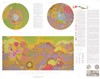
Geology in sinusoidal equal area projection with dinosaur (manuscript) |
|
Scott, David H. S. |
|
Mars |
|
|
1981 |
|
|
#3151
|
 |
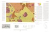
Geologic Map of Mars |
I-1083 |
Scott, David H. S. |
Inge, Jay L. |
Mars |
Global |
25M |
1978 |
U. S. Geological Survey |
|
#2898
|
|
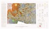
Geologic map of Mars |
76-573, I-1083 |
Scott, David H. S. |
|
Mars |
Mars |
25M |
1976 |
U. S. Geological Survey |
|
#2766
|
|
Geologic Map of the Tharsis Quadrangle of Mars |
I-893 |
Carr, Michael H. |
Bridges, Patricia M. |
Mars |
MC-9 |
5M |
1975 |
U. S. Geological Survey |
|
#2257
|
|
Preliminary geologic map of the Tritonius Lacus Region of Mars, Candidate Viking Mars 1975 Landing Site 11 |
|
Carr, Michael H. |
|
Mars |
|
250k |
1973 |
|
|
#2256
|
|
Preliminary geologic map of the Tritonius Lacus Region of Mars, Candidate Viking Mars 1975 Landing Site 11 |
|
Carr, Michael H. |
|
Mars |
|
1M |
1973 |
|
|
#1879
|
|
Apollo 17 (Taurus-Littrow) Geologic/Traverse/Topo Map Set |
|
Carr, Michael H. |
|
Moon |
LAC 43 |
|
1972 |
|
|
#1901
|
|
Candidate Viking landing site 4, Uraniae |
|
Carr, Michael H. |
|
Mars |
|
1M |
1972 |
|
|
#1903
|
|
Candidate Viking landing site 5, Candor |
|
Carr, Michael H. |
|
Mars |
|
250k |
1972 |
|
|
#1943
|
|
Geologic map of the Littrow region of the Moon (manuscript) |
|
Carr, Michael H. |
|
Moon |
LAC 43 |
250k |
1972 |
|
|
#1950
|
|
Geologic Map of the Taurus-Littrow Region of the Moon - Apollo 17 Pre-Mission Map Sheet 1 of 2 |
I-800 |
Scott, David H. S. |
|
Moon |
LAC 43 |
250k |
1972 |
U. S. Geological Survey |
|
#2027
|
|
Preliminary geologic map MC 22 |
|
Carr, Michael H. |
|
Mars |
|
5M |
1972 |
|
|
#2959
|
|
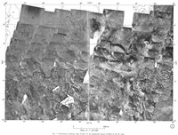
Preliminary geologic map of part of the equatorial region of Mars |
|
Carr, Michael H. |
|
Mars |
|
|
1972 |
Icarus |
|
#2031
|
|
Preliminary Geologic Map of part of the Equatorial Region of Mars (MC-8, 9, 16, 17) |
|
Carr, Michael H. |
|
Mars |
MC-8, MC-9, MC-16, MC-17 |
|
1972 |
U. S. Geological Survey |
|
#2032
|
|
Preliminary geologic map of part of the equatorial region of Mars by M. H. Carr Copyright © 1972 by Academic Press, Inc.
"The rationale and methods employed in the mapping were similar to those use… |
|
Carr, Michael H. |
|
Mars |
|
|
1972 |
|
|
#2033
|
|
Preliminary Geologic Map of the (Taurus) Littrow Quadrangle of the Moon Map Set |
|
Carr, Michael H. |
|
Moon |
LAC 43 |
50k |
1972 |
|
|
#2038
|
|
Preliminary geologic map of the equatorial region of Mars |
WO-8122 |
Carr, Michael H. |
|
Mars |
|
15M |
1972 |
|
|
#2040
|
|
Preliminary geologic map of the Mare Tyrrhenum quadrangle (MC-22) of Mars |
|
Carr, Michael H. |
|
Mars |
MC-22 |
5M |
1972 |
|
|
#2073
|
|
Surface Operational Map of the Rima-Hadley Site |
|
Carr, Michael H. |
|
Moon |
|
|
1972 |
|
|
#1742
|
|
Geologic Map of Part of the Apennine-Hadley Region of the Moon - Apollo 15 Pre-Mission Map |
I-723 |
Carr, Michael H. |
|
Moon |
LAC 41 |
250k |
1971 |
U. S. Geological Survey |
|
#1590
|
|
Geologic Map of the Maskelyne Da Region of the Moon Lunar Orbiter Site II P-2, Southeastern Mare Tranquillitatis Including Apollo Landing Site 1 |
I-616 [ORB 2 - 2 (100)] |
Carr, Michael H. |
|
Moon |
|
100k |
1970 |
U. S. Geological Survey |
|
#1429
|
|
Geologic Map of the Alphonsus Region of the Moon |
I-599 |
Carr, Michael H. |
|
Moon |
|
250k |
1969 |
U. S. Geological Survey |
|
#1432
|
|
Geologic Map of the Maestlin G Region of the Moon Lunar Orbiter Site II P-13, Oceanus Procellarum Including Apollo Landing Site 5 |
I-622 [ORB 2 - 13 (100)] |
Carr, Michael H. |
|
Moon |
|
100k |
1969 |
U. S. Geological Survey |
|
#1194
|
|
Geologic Map of Lunar Orbiter Site II P-13, Oceanus Procellarum north of equator |
Orb II P-13 |
Carr, Michael H. |
|
Moon |
|
100k |
1968 |
U. S. Geological Survey |
|
#1195
|
|
Geologic Map of Lunar Orbiter Site II P-2 |
Orb II P-2 |
Carr, Michael H. |
|
Moon |
|
|
1968 |
U. S. Geological Survey |
|
#953
|
|
Geologic mission traverses in the Alphonsus Region |
|
Carr, Michael H. |
|
Moon |
|
|
1967 |
U. S. Geological Survey |
|
#1131
|
|
Preliminary Geologic Map of Lunar Orbiter Site II P-2 |
|
Carr, Michael H. |
|
Moon |
|
100k |
1967 |
U. S. Geological Survey |
|
#1141
|
|
Preliminary geologic map of site II P-2 |
|
Carr, Michael H. |
|
Moon |
|
|
1967 |
National Aeronautics and Space Administration |
|
#807
|
|
Geologic Map of the Mare Serenitatis Region of the Moon |
I-489 |
Carr, Michael H. |
|
Moon |
LAC 42 |
1M |
1966 |
U. S. Geological Survey |
|
#884
|
|
Preliminary Photogeologic Map of the Alphonsus Region of the Moon (manuscript) |
|
Carr, Michael H. |
|
Moon |
|
250k |
1966 |
US Air Force, Aeronautical Chart and Information Center |
|
#737
|
|
Geologic Map and Section of the Timocharis Region of the Moon |
I-462 |
Carr, Michael H. |
|
Moon |
LAC 40 |
1M |
1965 |
U. S. Geological Survey |
|
#772
|
|
Preliminary Geologic Map of the Mare Serenitatis Quadrangle of the Moon |
|
Carr, Michael H. |
|
Moon |
LAC 42 |
|
1965 |
|
|
#786
|
|
Sketch of Mare Serenitatis showing concentric rilles and radial mare ridges outside an inner circle of concentric ridges. Stipple indicates terra. (Carr 1966) 5m |
|
Carr, Michael H. |
|
Moon |
|
5M |
1965 |
|
|
#6462
|
|
Preliminary Geologic Map of the Timocharis Quadrangle of the Moon Map Set |
|
Carr, Michael H. |
|
Moon |
|
1M |
|
U. S. Geological Survey |
|
#6464
|
|
Preliminary geologic map, Littrow region of the Moon |
|
Carr, Michael H. |
|
Moon |
LAC 43 |
|
|
|