Production_technique: lithography
6 maps
| # | Title | Map No. | Lead Author | Artist | Target | Quad. | Scale | Year | Publisher | |
|---|---|---|---|---|---|---|---|---|---|---|
| #361 | Map 361 | Fauth, Philipp J. H. | Moon | 1932 | ||||||
| #119 |
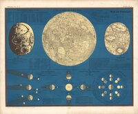 |
Karte der sichtbaren Seite der Mond-Oberfläche Map of the visible side of the lunar surface Moon and Eclipses Karte der sichtbaren Seite der Mond-Oberfläche Editor: L. Ewald 1857 Publisher Verlag von Jonghaus … | Wirtz, F. | Wirtz, F. | Moon | 18M | 1857 | Verlag von Jonghaus und Venator, Kartographisch-artistische Anstalt | ||
| #101 |
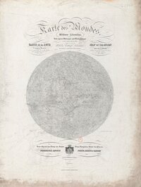 |
Karte des Mondes in einem mittleren Librationzustand Map of the Moon in a mean state of libration. According to the measurements and observations taken by the author in the years 1822 to 1836 Map of the Moon in a mean state of libration. According to the measurings and observations taken by th… | Lohrmann, Wilhelm Gothelf | Moon | 1838 | Verlag von Johann Ambrosius Barth | ||||
| #102 |
 |
Karte des Mondes. Mittlere Libration. Map of the Moon in a mean state of libration. Carte de la Lune, dans l'etat de moyenne libration Map of the Moon in a mean state of libration | Lohrmann, Wilhelm Gothelf | Moon | 9M | 1838 | Leipzig, Johann Ambrosius Barth | |||
| #93 |
 |
Nach der Natur und mit Benützung der Schrötter'schen Special-Karten auf der K. K. Sternwarte in Wien, unter der Leitung des Herrn Direktors und Professors der Astronomie J. J. Littrow, gezeichnet von Albert Richard von 1819 bis 1830, und in Stein gestochen von demselben Drawn from nature and using Schroeter's special maps at the Imperial-Royal Observatory in Vienna, under the direction of J. J. Littrow, by Albert Richard from 1819 to 1830, and lithographed by him | Richard, Albert | Moon | 1832 | |||||
| #87 |
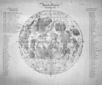 |
Mondkarte Map of the Moon Cartographer: Gruithuisen, spelled Gruidhuisen on the map Publication Date: 1821? Note: This edition is the first … | von Gruithuisen, Paula Franz | Moon | 1821 |