|
#4395
|
|
Map Showing Surface Materials at Viking 2 Site |
|
Keller, J. M. |
|
Mars |
|
|
1989 |
|
|
#4438
|
|
Viking I and II Maps of Rock and Drift Areas |
|
Moore, Henry J. |
|
Mars |
|
|
1989 |
|
|
#3966
|
 |
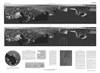
Viking Lander 2 Rectified Photomosaics - Evening scene - Camera 1 |
I-1517 |
|
|
Mars |
|
|
1984 |
U. S. Geological Survey |
|
#3967
|
|
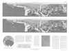
Viking Lander 2 Rectified Photomosaics - Evening scene - Camera 2 |
I-1518 |
|
|
Mars |
|
|
1984 |
U. S. Geological Survey |
|
#3968
|
|
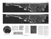
Viking Lander 2 Rectified Photomosaics - morning scene - camera 1 |
I-1515 |
|
|
Mars |
|
|
1984 |
U. S. Geological Survey |
|
#3969
|
|
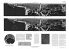
Viking Lander 2 Rectified Photomosaics - Morning scene - Camera 2 |
I-1516 |
|
|
Mars |
|
|
1984 |
U. S. Geological Survey |
|
#3745
|
|
Topographic map of Viking 2 landing site |
fig. 12 |
|
|
Mars |
|
10 |
1982 |
|
|
#3398
|
|
Generalized Working Map of Sample Field Viking Lander 2 Showing Locations of Rocks 5cm and Larger |
|
Moore, Henry J. |
|
Mars |
|
|
1980 |
|
|
#3367
|
|
Viking Lander 2 |
|
Liebens, S. |
|
Mars |
|
20 |
1979 |
? |
|
#3368
|
|
Viking Lander 2 (in local gravity normal coordinates) |
|
Liebens, S. |
|
Mars |
|
10 |
1979 |
|
|
#3150
|
|
Generalized maps of the Viking Lander 2 Sample Field A) End of the primary mission, B) End of the extended mission (2 maps in one sheet) |
Professional Paper 1389 |
Moore, Henry J. |
|
Mars |
|
|
1978 |
|
|
#3164
|
|
Geologic sketch map showing relation between Lander 2 site and crater Mie. |
|
|
|
Mars |
|
|
1978 |
|
|
#3229
|
|
Viking I and II Generalized Working Maps of Sample Fields Set |
|
Moore, Henry J. |
|
Mars |
|
|
1978 |
|
|
#3230
|
|
Viking Lander 1 & 2 Maps & Diagrams Folder |
|
|
|
Mars |
|
|
1978 |
|
|
#3231
|
|
Viking Lander 2 Generalized Working Map of Sample Field Showing Locations of Rocks 5cm and Larger - Plate 1A |
|
Moore, Henry J. |
|
Mars |
|
|
1978 |
|
|
#3232
|
|
Viking Lander 2 Generalized Working Map of Sample Field Showing Locations of Rocks 5cm and Larger - Plate 1B |
|
Moore, Henry J. |
|
Mars |
|
|
1978 |
|
|
#3233
|
|
Viking Lander 2 Generalized Working Map of Sample Field Showing Locations of Rocks 5cm and Larger - Plate 1C |
|
Moore, Henry J. |
|
Mars |
|
|
1978 |
|
|
#3234
|
|
Viking Lander 2 Generalized Working Map of Sample Field Showing Locations of Rocks 5cm and Larger - Plate 2A |
|
Moore, Henry J. |
|
Mars |
|
|
1978 |
|
|
#3235
|
|
Viking Lander 2 Generalized Working Map of Sample Field Showing Locations of Rocks 5cm and Larger - Plate 2B |
|
Moore, Henry J. |
|
Mars |
|
|
1978 |
|
|
#3236
|
|
Viking Lander 2 Generalized Working Map of Sample Field Showing Locations of Rocks 5cm and Larger - Plate 2C |
|
Moore, Henry J. |
|
Mars |
|
|
1978 |
|
|
#3026
|
|
Controlled Mosaic of the Canberra Region of Mars (Viking 2 Landing Site) |
I-1060 |
|
|
Mars |
|
250k |
1977 |
U. S. Geological Survey |
|
#3029
|
|
Controlled Mosaic of the Utopia Panitia Region of Mars (Viking 2 Landing Site) |
I-1061 |
|
|
Mars |
|
1M |
1977 |
U. S. Geological Survey |
|
#3042
|
|
Geologic map of the Viking 2 landing site |
Fig 1b |
|
|
Mars |
|
|
1977 |
|
|
#3119
|
|
Shaded Relief Map of the Tritonis Lacus Region of Mars (Viking A2 Landing Site) |
I-1055 |
Inge, Jay L. |
Inge, Jay L. |
Mars |
|
1M |
1977 |
U. S. Geological Survey |
|
#3014
|
|
Viking Lander 1 & 2 Maps & Diagrams |
|
|
|
Mars |
|
|
1976 |
|
|
#6399
|
|
Named Rocks Viking Lander 2: Utopia Planitia |
|
|
|
Mars |
|
|
|
|
|
#6692
|
|
Viking 1-2 Resolution Coverage Maps (in yellow envelope) |
|
|
|
Mars |
|
|
|
|
|
#6701
|
|
Viking I and II Map of Lander Area - Extended Mission Set |
|
|
|
Mars |
|
|
|
|
|
#6710
|
|
VL 2 Mosaic Left of Center |
|
Keller, J. M. |
|
Mars |
|
|
|
|