

The Catalog of Planetary Maps.
Sources: The research that led to this catalog was supported by Fulbright Hungary Grant No. 1222202, awarded to H. Hargitai for research at USGS Astrogeology, Flagstaff, Arizona (advisor: Trent Hare), and by the ICA Commission on Planetary Cartography (advisor: Kira Shingareva). Most of the data is based on the inventory of the map library of USGS Astrogeology.
Copyright and Use Notice: Published U.S. Geological Survey and U.S. Air Force maps are generally in the public domain. Some maps reproduced or displayed on this site may be protected by copyright.
This website includes thumbnail images or excerpts of maps for identification, documentation, research, and educational purposes only. These uses are believed to qualify as fair use under U.S. copyright law. Full-resolution copyrighted maps are not hosted unless explicit permission has been obtained or the material is confirmed to be in the public domain.
The inclusion of any map or photograph in this catalog does not imply that it is free of copyright restrictions. Responsibility for determining copyright status and obtaining necessary permissions rests entirely with the user.
If you are a copyright holder and believe material on this site is used inappropriately, please contact the curator (hargitai.henrik@btk.elte.hu) with details so we can review and address your concerns promptly.
Photos: Unless otherwise indicated, all photographs are by H. Hargitai. Several photographs are from the USGS Astrogeology Map Library and Lowell Observatory, both in Flagstaff, Arizona. Several photographs of Soviet maps were taken at MIIGAiK, Moscow.
Contact: The catalog is curated by H. Hargitai, ELTE, Budapest, hargitai.henrik@btk.elte.hu.
Main_theme: albedo
459 maps
| # | Title | Map No. | Lead Author | Artist | Target | Quad. | Scale | Year | Publisher | |
|---|---|---|---|---|---|---|---|---|---|---|
| #1695 | Photoelectric-Photographic Map of the Normal Albedo of the Far Side of the Moon | Swann, Gordon A. | Moon | 1970 | ||||||
| #1696 |
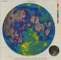 |
Photoelectric-photographic map of the normal albedo of the Moon These are the first maps where photographic albedo was converted into exact numerical values. Source: A photoelectri… | Pohn, Howard A. | Moon | 5M | 1970 | ||||
| #1697 |
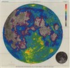 |
Photoelectric-Photographic Map of the Normal Albedo of the Moon ("Albedo map of the Moon" in the accompanying paper) | PP-599E | Pohn, Howard A. | Moon | 5M | 1970 | |||
| #1523 | Marte Oppositione 1956 Mars opposition of 1956 | de Mottoni, Glauco Y. Palacios | Mars | 1969 | ||||||
| #1551 |
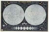 |
The Earth's Moon (National Geographic) Publisher: (c) The National Geography Society Feb 1969 / 1976 / 2003 editions Nomenclature: 1969: English/Latin, 2004: L… | Riddiford, Charles Ernest | Toth, Tibor | Moon | 10.5M | 1969 | National Geographic Society | ||
| #944 | Consolidated Lunar Atlas : supplement no. 3 and 4 to the photographic lunar atlas (cla) | Kuiper, Gerard P. | Moon | 2.4M | 1967 | University of Arizona Press | ||||
| #960 | Lunar Albedo Reference Chart | ARC-1 | Moon | 5M | 1967 | US Air Force, Aeronautical Chart and Information Center | ||||
| #961 |
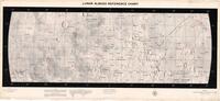 |
Lunar Albedo Reference Chart | ARC-2 | Moon | 1967 | US Air Force, Aeronautical Chart and Information Center | ||||
| #1182 | Map 1182 | Slipher, Earl C. | Mars | 1967 | ||||||
| #1093 |
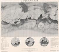 |
Mariner 69 Mars Chart Prepared under the direction of the Department of Defense, Aeronautical Chart and Information Center, US Air Force for N… | MEC-2 | Slipher, Earl C. | Mars | 25M | 1967 | US Air Force, Aeronautical Chart and Information Center | ||
| #1095 |
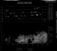 |
Marte Opposizione 1907 Mars opposition of 1907 Motton G, 1967 Cartografia del Pianeta Marte Basata su Documentazione Fotografica Internazionale a Partire dal 1907. Opp… | de Mottoni, Glauco Y. Palacios | Mars | 1967 | |||||
| #5772 | MEC-2 75S-70N Prepared by Lowell Observatory | MEC-2 | Maulfair, M. J. | Inge, Jay L. | Mars | 25M | 1967 | Lowell Observatory | ||
| #5773 | MEC-2 librated orthographics 8deg22' Prepared by Lowell Observatory | MEC-2 | Maulfair, M. J. | Inge, Jay L. | Mars | 25M | 1967 | Lowell Observatory | ||
| #1160 | The Martian Surface | Capen, Charles F. | Mars | 1967 | NASA Jet Propulsion Laboratory | |||||
| #1170 | Полная карта Луны (9 листов) с английскими переводами (пометки карандашом) Complete map of the Moon (9 sheets) with English translations (pencil marks) | Moon | Moon, full | 5M | 1967 | Nauka | ||||
| #866 | Mars Exploration - General Electric Mariner 4 Mars Map | Scarfo, Roy | Mars | 35M | 1966 | General Electric | ||||
| #725 | Albedo of the Lunar Equatorial Belt | West, Mareta N. | Moon | 5M | 1965 | |||||
| #726 | Albedo of the Lunar Equatorial Belt (preliminary version) | West, Mareta N. | Moon | 1965 | ||||||
| #758 |
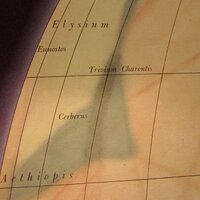 |
Pictorial Representation of Mars 1:10M Orthographic projection Edition 1-AMS Prepared by the Army Map Service, Corps of Engineers, US Army, Washington D.… | 1-AMS | Mars | 10M | 1965 | Army Map Service, Corps of Engineers | |||
| #759 |
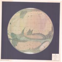 |
Pictorial Representation of Mars, Centered on 0 longitude | Mars | 10M | 1965 | Army Map Service | ||||
| #760 |
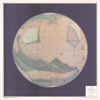 |
Pictorial Representation of Mars, Centered on 180 longitude | Mars | 10M | 1965 | Army Map Service | ||||
| #761 |
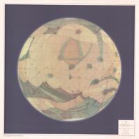 |
Pictorial Representation of Mars, Centered on 220 longitude | Mars | 10M | 1965 | Army Map Service | ||||
| #762 |
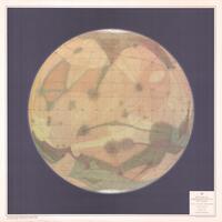 |
Pictorial Representation of Mars, Centered on 270 longitude | Mars | 10M | 1965 | Army Map Service | ||||
| #763 |
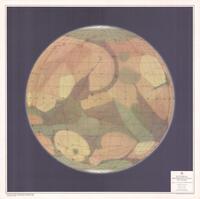 |
Pictorial Representation of Mars, Centered on 90 longitude | Mars | 10M | 1965 | Army Map Service | ||||
| #781 | Provisional topographic map of Mars, Mariner 4 Region | TN-701-66-8 | Tombaugh, Clide | Mars | 1965 | |||||
| #657 | LAC 58 Full Moon apparition | Dungan, Fred | Moon | LAC 58 | 1M | 1964 | ||||
| #672 | Lunar surface albedo | Moon | 1964 | |||||||
| #710 |
 |
Topographic Lunar Map - Euclides Sheet 2 | Lunar 2T250 | Moon | 250k | 1964 | Army Map Service | |||
| #582 | Isotonal Map of the Lansberg Region of the Moon. Plate 3 of (envelop): Astrogeologic studies, Annual progress report, Aug 25, 1961 to Aug 24, 1962. Supplement to Part A Lunar and Panetary Investigations. USGS | LVC-20 | Hackman, Robert J. | Moon | LVC 20 | 2M | 1963 | |||
| #601 | Planisphere of Mars after the observations made at Kwasan and National Science Museum. Key map for the 1963 aspect of Martian Markings, after the osbervations made by S. Miyamoto, T. Saheki, S Muramaya and the author | Mars | 1963 | |||||||
| #608 | Räths Mondglobus | 306/68 K2/64 | Moon | 10.4M | 1963 | Paul Räth Nachf KG Leipzig | ||||
| #531 | Isotonal Map of the Lansberg Region of the Moon Map Set | Hackman, Robert J. | Moon | LAC 76 | 2M | 1962 | ||||
| #536 | LM78 coloration, revised | Bridges, Patricia M. | Moon | LM 78 | 1962 | |||||
| #553 | Mars – Key Map | Slipher, Earl C. | Mars | 50M | 1962 | |||||
| #554 |
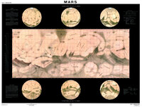 |
MEC-1 Prototype This map is the last product of the pre-space age maps, combining all possible knowledge to support the first space miss… | MEC-1 | Slipher, Earl C. | Mars | 35M | 1962 | U. S. Air Force | ||
| #560 |
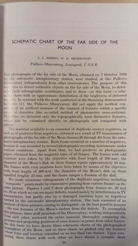 |
Schematic chart of the far side of the Moon. Pulkovo Observatory, Leningrad, U.S.S.R. The photographs of the far side of the Moon, obtained on 7 October 1959 by the… | Breido, I. I. | Moon | 1962 | D. Reidel Publishing Company | ||||
| #473 |
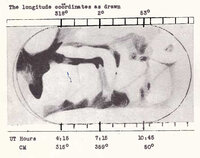 |
Clark C. Chapman's 1960-61 Map of Mars The Strolling Astronomer, 1961 (1-2) Drawing, made with a 10-inch reflector, 1960. Source Chapman… | Chapman, Clark R. | Mars | 1961 | |||||
| #486 |
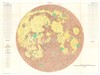 |
Lunar Rays - Engineer Special Study of the Surface of the Moon | I-351 | Hackman, Robert J. | Moon | 3.8M | 1961 | U. S. Geological Survey | ||
| #518 |
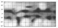 |
Map 518 Albedo maps of the Galilean satellites. Lyot examined these satellites with the 38 cm refractor in 1941, later with the… | Lyot, Bernard | Callisto | 1961 | University of Chicago Press | ||||
| #519 |
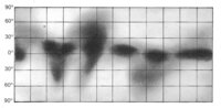 |
Map 519 Albedo maps of the Galilean satellites. Lyot examined these satellites with the 38 cm refractor in 1941, later with the… | Lyot, Bernard | Europa | 1961 | University of Chicago Press | ||||
| #520 |
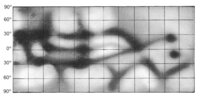 |
Map 520 Ganymedes | Lyot, Bernard | Ganymede | 1961 | University of Chicago Press | ||||
| #521 |
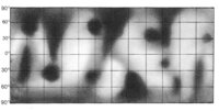 |
Map 521 Io Courtesy of Ton Lindemann | Lyot, Bernard | Io | 1961 | University of Chicago Press | ||||
| #522 |
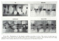 |
Map 522 Titan Titan was observed by Lyot, Dollfus, Camichel, Bruch. Source: A. Dollfus: Visual and photographic studies off p… | Lyot, Bernard | Titan | 1961 | University of Chicago Press | ||||
| #488 | Map of Mars | du Martheray, Maurice | Mars | 1961 | R. Sauerländer & Co. | |||||
| #495 |
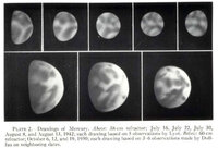 |
Planisphere of Mercury, summarizing the spots observed on 10 composite photographs obtained in 1942 and 1944. Upper row: 1942, Lyot - 25 drawings, 36 inch refractor, 300-500x magnification. Lower row: 1950, A Dollfus, 60-inch ref… | Lyot, Bernard | Mercury | 1961 | |||||
| #499 | Sketch map of the Lansberg region of the Moon showing albedo values | Morris, Eliott C. | Moon | 1961 | ||||||
| #452 | The Planet Mars | Mars | 1960 | North American Aviation, Inc. Space and Information Systems Division | ||||||
| #463 |
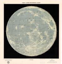 |
USAF Lunar Reference Chart - Lunar Earthside Hemisphere, 2nd advanced edition | LEC-IA | Moon | Moon, near side | 10M | 1960 | US Air Force, Aeronautical Chart and Information Center | ||
| #424 | Marskarte 1951/56 bis +55° Breite | Heintz, W. | Mars | 1959 | ||||||
| #425 | Selected rays from Tycho and Copernicus | Giamboni, L. A. | Moon | 1959 |