|
#2887
|
|
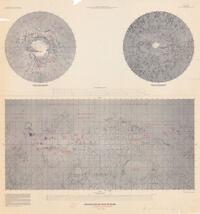
Topographic Map of the Margaritifer Sinus Quadrangle of Mars |
|
|
|
Mars |
|
|
1975 |
|
|
#2888
|
|
Venus 1:63,922,500 18 February 1975 Yes, Venus |
|
|
|
Venus |
|
63M |
1975 |
|
|
#2701
|
|
Mariner 9 B-camera coverage Mare Boreum MC-1 (revolutions 100 and subsequent) |
|
|
|
Mars |
MC-1 |
4.3M |
1974 |
U. S. Geological Survey |
|
#2705
|
 |
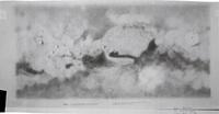
Mars equatorial airbrush with albedo |
|
|
Inge, Jay L. |
Mars |
|
|
1974 |
U. S. Geological Survey |
|
#2713
|
|
MC-1 Albedo and ice cap |
|
|
Inge, Jay L. |
Mars |
MC-1 |
5M |
1974 |
|
|
#2714
|
|
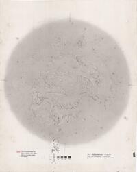
MC-1: Martian north pole |
|
|
Inge, Jay L. |
Mars |
MC-1 |
5M |
1974 |
|
|
#2717
|
|
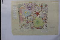
MC-19 Margaritifer Sinus Relief Map, Airbrush original, with grid overlay attached |
|
|
Bridges, Patricia M. |
Mars |
MC-19 |
|
1974 |
|
|
#2735
|
|
Region North of Aristarchus Plateau |
S-222 |
|
|
Moon |
|
100k |
1974 |
|
|
#2742
|
|
Topographic map of Lee-Lincoln Scarp Strip map - Moon |
|
|
|
Moon |
|
25k |
1974 |
|
|
#6770
|
|
Geologic Map of the Purbach Quadrangle of the Moon |
|
Holt, H. E. |
|
Moon |
LAC 95 |
|
1973 |
|
|
#2218
|
|
Mars 1973 Oct 13-Nov 2 Major dust storm |
|
Martin, Leonard J. |
|
Mars |
|
|
1973 |
|
|
#2265
|
|
Shaded Relief map of Mars (with nomenclature) Prepared under JPL contract WO-8122
1:25M
Mercator projection
Preliminary map made from Mariner 9 data.
Topographic … |
MM 25M IR |
Bridges, Patricia M. |
|
Mars |
|
25M |
1973 |
|
|
#1877
|
|
Apollo 16 preliminary EVA-II traverse map |
|
Apollo Field Geology Investigation Team |
|
Moon |
LAC 78 |
|
1972 |
|
|
#1878
|
|
Apollo 16 preliminary EVA-III traverse map |
|
Apollo Field Geology Investigation Team |
|
Moon |
LAC 78 |
|
1972 |
|
|
#1886
|
|
Apollo 17 preliminary EVA-I traverse map |
|
Apollo Field Geology Investigation Team |
|
Moon |
LAC 43 |
12.5k |
1972 |
|
|
#1887
|
|
Apollo 17 preliminary EVA-II traverse map |
|
Apollo Field Geology Investigation Team |
|
Moon |
LAC 43 |
12.5k |
1972 |
|
|
#1888
|
|
Apollo 17 preliminary EVA-III traverse map |
|
Apollo Field Geology Investigation Team |
|
Moon |
LAC 43 |
12.5k |
1972 |
|
|
#1919
|
|
Descartes Preliminary topo map North Ray - Kiva |
|
|
|
Moon |
LAC 78 |
10k |
1972 |
|
|
#1927
|
|
Geologic map of the Apollo 16 (Descartes) landing site area |
|
Elston, Donald P. |
|
Moon |
LAC 78 |
25k |
1972 |
U. S. Geological Survey |
|
#1928
|
|
Geologic map of the Apollo 16 (Descartes) region |
|
Elston, Donald P. |
|
Moon |
LAC 78 |
100k |
1972 |
|
|
#1943
|
|
Geologic map of the Littrow region of the Moon |
|
Carr, Michael H. |
|
Moon |
LAC 43 |
250k |
1972 |
|
|
#1960
|
|
Index of Mariner 9 specially targeted pictures of Mars |
|
|
|
Mars |
|
|
1972 |
|
|
#1981
|
|
Map of Large Craters on Mars |
|
Hartmann, W. K. |
|
Mars |
|
|
1972 |
|
|
#2004
|
|
Mars North Pole 1:5M |
|
|
|
Mars |
|
5M |
1972 |
|
|
#2020
|
|
Operational geologic map - Apollo 17 (Taurus-Littrow) landing area |
|
Wolfe, E. W. |
|
Moon |
LAC 43 |
25k |
1972 |
|