

Search the catalog
Target: Earth and the Moon
2752 maps found
#6789
 Atlas Lunaire
#252
Niveaukarte des Mondes nach J. Franz, Breslau.
#246
Map 246
#245
Mond-Atlas entworten nach den Beobachtungen an der Pia-Sternwarte in Triest,I Band
#235
Photographischer Mond-Atlas
#228
Atlas Photographic de la Lune
#229
Lick Observatory Atlas of the Moon
1: 3 620 000
#231
Map 231
#223
Atlas von 25 Topographischen Spezialkarten des Mondes
1: 1 000 000
#225
Map of the Moon
1: 7 560 000
#5699
A látható holdfelület
#205
Chart of the Moon
#206
Plate 23-26
Chart of the Moon, quadrant
#214
Mondkarte in 25 sektionen von Wilhelm Gotthelf Lohrmann, mit einer beschreubung der einzelnen Karten von Dr J F Julius Schmidt
#192
Index map of the Moon
#186
Astronomy with an opera-glass -- Map of the Moon
#187
Carte générale de la Lune.
#188
Flammarion - Popular Astronomy
1: 5 470 000
#189
Map 189
#179
Tab XII
Die Mondkarte
#180
Tab XV
Legenda zu Rutherford's Mondphotographie
#165
Carte Géographique de la Lune
#166
Karte des Mondes
#171
Map 171
#169
Fig. 81
Mondansicht
#5697
Mondkarte
#162
Die sichtbare Seite der Mond-Oberfläche bei voller Beleuchtung : nach Beer u. Mädler's Karte
#163
Mondoberfläche
#160
Map of the Moon
#151
Charte der Gebirge des Mondes
#152
Full Moon as seen through a powerful glass
#156
Tafel III
Map 156
#157
Map 157
#155
Mondcharte 25 sectionen un 2 erlautersungstafeln
1: 1 780 000
#150
Mondoberfläche
#143
(overview map)
#144
Detail maps of craters Gassendi, Maginus, Theophilus
1: 5 790 000
#145
Die sichtbare Seite der Mond-Oberfläche bei voller Beleuchtung : nach Beer u. Mädler's Karte
#146
Mondoberfläche
#142
Map 142
#141
Mondkarte mittle Libration
#139
Telescopic view of the Moon from the rare original "Adams Chart of History"
#137
Die sichtbare Seite der Mond-Oberfläche bei voller Beleuchtung : nach Beer u. Mädler's Karte
1: 13 000 000
#138
Mondoberfläche
#135
Die sichtbare Seite der Mond-Oberfläche bei voller Beleuchtung : nach Beer u. Mädler's Karte
#136
Mondoberfläche
#131
Map 131
#127
Index Map of the Moon
#128
Lunar Map Zone II, Zone IV
1: 695 000
#125
Map 125
#122
Carte générale de la Lune
#123
Map of the Moon
#124
Mond—Karte Nach dem besten Quellen entworfen und gezeichnet
#121
Map 121
#120
MAP OF THE MOON with the names given by Riccioli in the 17th century, and others added by succeeding observers.
#119
Karte der sichtbaren Seite der Mond-Oberfläche
1: 18 000 000
#117
Der Mondkarte
#118
Map 118
#6788
Copernico cratere della Luna
#116
Die sichtbare Seite der Mond-Oberfläche bei voller Beleuchtung : nach Beer u. Mädler's Karte. Ausgabe in 63 B1 No1
1: 46 000 000
#115
Telescopic Appearance of the Moon
#112
Mond-Karte
#114
Relief der sichtbaren Halbkugel des Mondes, angefertigt von Th. Dickert in Bonn.
1: 600 000
#113
Selenographic map of the whole hemisphere of the Moon
#111
Map 111
#110
Mond—Karte Nach dem besten Quellen entworfen und gezeichnet
#109
Die Sichtbare seite der Mond-Oberflache
#108
Map 108
#107
The Nomenclature of the Lunar spots
#105
Die sichtbare Seite der Mond-Oberfläche bei voller Beleuchtung : nach Beer u. Mädler's Karte. Ausgabe in 63 B1 No1
1: 46 000 000
#104
Exhibiting the same view of the Moon’s surface as plate the first
#103
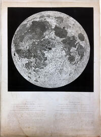
The Moon in Plano
#101
Karte des Mondes in einem mittleren Librationzustand
#102
Karte des Mondes. Mittlere Libration. Map of the Moon in a mean state of libration. Carte de la Lune, dans l'etat de moyenne libration
1: 8 980 000
#97
General Karte der sichbaren Seite der Mondoberflaeche
1: 10 900 000
#98
Mappa SELENOGRAPHICA
1: 46 000 000
#99
Mondk...
#100
Mondoberflaeche
#96
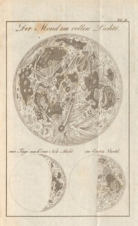
Der Mond .. Vollichte
#94
Die sichtbare Seite der Mond-Oberfläche bei voller Beleuchtung
1: 3 680 000
#95
Mappa Selenographica totam Lunae hemisphaeram risibilem complectons chorratinibus propriis secundum projectionem othographicam quatuor Sectionibus constructa et delineata Suae Majestati Friderico Sexto regi daniae illustrissimo .... Guilelmo Beer et Joanne Henrico Mädler Ediio Genuina Berolini MDCCCXXXIV Ex autographico in lapudem inciduit Carolus Vogel Apud Simon Schropp et Soc
#93
Nach der Natur und mit Benützung der Schrötter'schen Special-Karten auf der K. K. Sternwarte in Wien, unter der Leitung des Herrn Direktors und Professors der Astronomie J. J. Littrow, gezeichnet von Albert Richard von 1819 bis 1830, und in Stein gestochen von demselben
#92
Karte des Vollmondes nach Mayer Schröter und Gruithuisen
#91
Map 91
#89
Telescopic appereance of the Moon
#90
Topographie der sichtbaren Mondoberflaeche
1: 3 570 000
#88
Map 88
#87
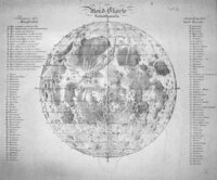
Mondkarte
#86
Plate illustrating Russel's system of triangulation (from: A description of the lunar planispheres)
#83
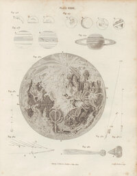
The appearance of the moon, in an inverted position.
#81
Der Volle Mond
#6796
The Moon in Plano
#80
The Moon in her mean libration, with the Spots according to Riccioli, Cassini & c.
#6791
inv.52085
The visible surface of the Moon constructed from Trianules measured with micrometer and accurately drawn and engraved from a long series of telescopic observations
#6790
Inv.39338
The Moon (pastel)
1: 2 280 000
#79
Torn III Pag 344 / Astronomie Pl. XXXX / Fig. 282 Cette figure est renversé
Figure de la Lune dans ses moyennes librations, avec les noms de ses principales taches suivant Riccioli et suivant Hevelius.
#78
Tob. Mayeri tabula selenograhica
#77
Réduction de la Grande Carte de la Lune
#76
Selenography or the map of the Moon,according to Father Riccioli
#74
Map 74
Atlas Lunaire
#252
Niveaukarte des Mondes nach J. Franz, Breslau.
#246
Map 246
#245
Mond-Atlas entworten nach den Beobachtungen an der Pia-Sternwarte in Triest,I Band
#235
Photographischer Mond-Atlas
#228
Atlas Photographic de la Lune
#229
Lick Observatory Atlas of the Moon
1: 3 620 000
#231
Map 231
#223
Atlas von 25 Topographischen Spezialkarten des Mondes
1: 1 000 000
#225
Map of the Moon
1: 7 560 000
#5699
A látható holdfelület
#205
Chart of the Moon
#206
Plate 23-26
Chart of the Moon, quadrant
#214
Mondkarte in 25 sektionen von Wilhelm Gotthelf Lohrmann, mit einer beschreubung der einzelnen Karten von Dr J F Julius Schmidt
#192
Index map of the Moon
#186
Astronomy with an opera-glass -- Map of the Moon
#187
Carte générale de la Lune.
#188
Flammarion - Popular Astronomy
1: 5 470 000
#189
Map 189
#179
Tab XII
Die Mondkarte
#180
Tab XV
Legenda zu Rutherford's Mondphotographie
#165
Carte Géographique de la Lune
#166
Karte des Mondes
#171
Map 171
#169
Fig. 81
Mondansicht
#5697
Mondkarte
#162
Die sichtbare Seite der Mond-Oberfläche bei voller Beleuchtung : nach Beer u. Mädler's Karte
#163
Mondoberfläche
#160
Map of the Moon
#151
Charte der Gebirge des Mondes
#152
Full Moon as seen through a powerful glass
#156
Tafel III
Map 156
#157
Map 157
#155
Mondcharte 25 sectionen un 2 erlautersungstafeln
1: 1 780 000
#150
Mondoberfläche
#143
(overview map)
#144
Detail maps of craters Gassendi, Maginus, Theophilus
1: 5 790 000
#145
Die sichtbare Seite der Mond-Oberfläche bei voller Beleuchtung : nach Beer u. Mädler's Karte
#146
Mondoberfläche
#142
Map 142
#141
Mondkarte mittle Libration
#139
Telescopic view of the Moon from the rare original "Adams Chart of History"
#137
Die sichtbare Seite der Mond-Oberfläche bei voller Beleuchtung : nach Beer u. Mädler's Karte
1: 13 000 000
#138
Mondoberfläche
#135
Die sichtbare Seite der Mond-Oberfläche bei voller Beleuchtung : nach Beer u. Mädler's Karte
#136
Mondoberfläche
#131
Map 131
#127
Index Map of the Moon
#128
Lunar Map Zone II, Zone IV
1: 695 000
#125
Map 125
#122
Carte générale de la Lune
#123
Map of the Moon
#124
Mond—Karte Nach dem besten Quellen entworfen und gezeichnet
#121
Map 121
#120
MAP OF THE MOON with the names given by Riccioli in the 17th century, and others added by succeeding observers.
#119
Karte der sichtbaren Seite der Mond-Oberfläche
1: 18 000 000
#117
Der Mondkarte
#118
Map 118
#6788
Copernico cratere della Luna
#116
Die sichtbare Seite der Mond-Oberfläche bei voller Beleuchtung : nach Beer u. Mädler's Karte. Ausgabe in 63 B1 No1
1: 46 000 000
#115
Telescopic Appearance of the Moon
#112
Mond-Karte
#114
Relief der sichtbaren Halbkugel des Mondes, angefertigt von Th. Dickert in Bonn.
1: 600 000
#113
Selenographic map of the whole hemisphere of the Moon
#111
Map 111
#110
Mond—Karte Nach dem besten Quellen entworfen und gezeichnet
#109
Die Sichtbare seite der Mond-Oberflache
#108
Map 108
#107
The Nomenclature of the Lunar spots
#105
Die sichtbare Seite der Mond-Oberfläche bei voller Beleuchtung : nach Beer u. Mädler's Karte. Ausgabe in 63 B1 No1
1: 46 000 000
#104
Exhibiting the same view of the Moon’s surface as plate the first
#103
The Moon in Plano
#101
Karte des Mondes in einem mittleren Librationzustand
#102
Karte des Mondes. Mittlere Libration. Map of the Moon in a mean state of libration. Carte de la Lune, dans l'etat de moyenne libration
1: 8 980 000
#97
General Karte der sichbaren Seite der Mondoberflaeche
1: 10 900 000
#98
Mappa SELENOGRAPHICA
1: 46 000 000
#99
Mondk...
#100
Mondoberflaeche
#96
Der Mond .. Vollichte
#94
Die sichtbare Seite der Mond-Oberfläche bei voller Beleuchtung
1: 3 680 000
#95
Mappa Selenographica totam Lunae hemisphaeram risibilem complectons chorratinibus propriis secundum projectionem othographicam quatuor Sectionibus constructa et delineata Suae Majestati Friderico Sexto regi daniae illustrissimo .... Guilelmo Beer et Joanne Henrico Mädler Ediio Genuina Berolini MDCCCXXXIV Ex autographico in lapudem inciduit Carolus Vogel Apud Simon Schropp et Soc
#93
Nach der Natur und mit Benützung der Schrötter'schen Special-Karten auf der K. K. Sternwarte in Wien, unter der Leitung des Herrn Direktors und Professors der Astronomie J. J. Littrow, gezeichnet von Albert Richard von 1819 bis 1830, und in Stein gestochen von demselben
#92
Karte des Vollmondes nach Mayer Schröter und Gruithuisen
#91
Map 91
#89
Telescopic appereance of the Moon
#90
Topographie der sichtbaren Mondoberflaeche
1: 3 570 000
#88
Map 88
#87
Mondkarte
#86
Plate illustrating Russel's system of triangulation (from: A description of the lunar planispheres)
#83
The appearance of the moon, in an inverted position.
#81
Der Volle Mond
#6796
The Moon in Plano
#80
The Moon in her mean libration, with the Spots according to Riccioli, Cassini & c.
#6791
inv.52085
The visible surface of the Moon constructed from Trianules measured with micrometer and accurately drawn and engraved from a long series of telescopic observations
#6790
Inv.39338
The Moon (pastel)
1: 2 280 000
#79
Torn III Pag 344 / Astronomie Pl. XXXX / Fig. 282 Cette figure est renversé
Figure de la Lune dans ses moyennes librations, avec les noms de ses principales taches suivant Riccioli et suivant Hevelius.
#78
Tob. Mayeri tabula selenograhica
#77
Réduction de la Grande Carte de la Lune
#76
Selenography or the map of the Moon,according to Father Riccioli
#74
Map 74
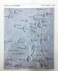 Atlas Lunaire
#252
Atlas Lunaire
#252
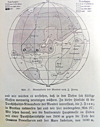 Niveaukarte des Mondes nach J. Franz, Breslau.
#246
Niveaukarte des Mondes nach J. Franz, Breslau.
#246
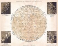 Map 246
#245
Mond-Atlas entworten nach den Beobachtungen an der Pia-Sternwarte in Triest,I Band
#235
Photographischer Mond-Atlas
#228
Atlas Photographic de la Lune
#229
Map 246
#245
Mond-Atlas entworten nach den Beobachtungen an der Pia-Sternwarte in Triest,I Band
#235
Photographischer Mond-Atlas
#228
Atlas Photographic de la Lune
#229
 Lick Observatory Atlas of the Moon
1: 3 620 000
#231
Lick Observatory Atlas of the Moon
1: 3 620 000
#231
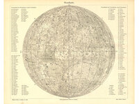 Map 231
#223
Atlas von 25 Topographischen Spezialkarten des Mondes
1: 1 000 000
#225
Map of the Moon
1: 7 560 000
#5699
Map 231
#223
Atlas von 25 Topographischen Spezialkarten des Mondes
1: 1 000 000
#225
Map of the Moon
1: 7 560 000
#5699
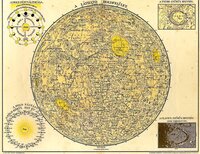 A látható holdfelület
#205
A látható holdfelület
#205
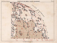 Chart of the Moon
#206
Plate 23-26
Chart of the Moon, quadrant
#214
Mondkarte in 25 sektionen von Wilhelm Gotthelf Lohrmann, mit einer beschreubung der einzelnen Karten von Dr J F Julius Schmidt
#192
Index map of the Moon
#186
Chart of the Moon
#206
Plate 23-26
Chart of the Moon, quadrant
#214
Mondkarte in 25 sektionen von Wilhelm Gotthelf Lohrmann, mit einer beschreubung der einzelnen Karten von Dr J F Julius Schmidt
#192
Index map of the Moon
#186
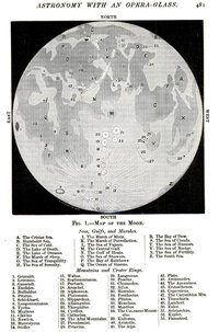 Astronomy with an opera-glass -- Map of the Moon
#187
Astronomy with an opera-glass -- Map of the Moon
#187
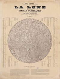 Carte générale de la Lune.
#188
Flammarion - Popular Astronomy
1: 5 470 000
#189
Carte générale de la Lune.
#188
Flammarion - Popular Astronomy
1: 5 470 000
#189
 Map 189
#179
Tab XII
Die Mondkarte
#180
Tab XV
Legenda zu Rutherford's Mondphotographie
#165
Map 189
#179
Tab XII
Die Mondkarte
#180
Tab XV
Legenda zu Rutherford's Mondphotographie
#165
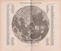 Carte Géographique de la Lune
#166
Carte Géographique de la Lune
#166
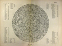 Karte des Mondes
#171
Map 171
#169
Fig. 81
Mondansicht
#5697
Karte des Mondes
#171
Map 171
#169
Fig. 81
Mondansicht
#5697
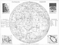 Mondkarte
#162
Die sichtbare Seite der Mond-Oberfläche bei voller Beleuchtung : nach Beer u. Mädler's Karte
#163
Mondkarte
#162
Die sichtbare Seite der Mond-Oberfläche bei voller Beleuchtung : nach Beer u. Mädler's Karte
#163
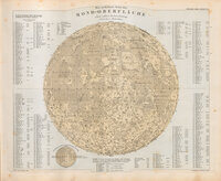 Mondoberfläche
#160
Mondoberfläche
#160
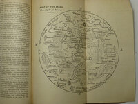 Map of the Moon
#151
Charte der Gebirge des Mondes
#152
Map of the Moon
#151
Charte der Gebirge des Mondes
#152
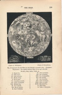 Full Moon as seen through a powerful glass
#156
Tafel III
Full Moon as seen through a powerful glass
#156
Tafel III 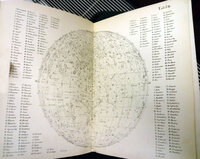 Map 156
#157
Map 156
#157
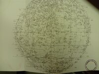 Map 157
#155
Mondcharte 25 sectionen un 2 erlautersungstafeln
1: 1 780 000
#150
Map 157
#155
Mondcharte 25 sectionen un 2 erlautersungstafeln
1: 1 780 000
#150
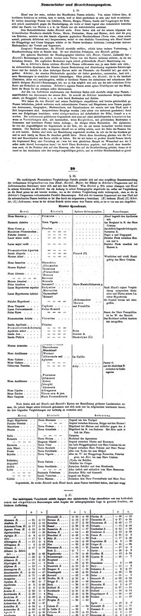 Mondoberfläche
#143
(overview map)
#144
Detail maps of craters Gassendi, Maginus, Theophilus
1: 5 790 000
#145
Die sichtbare Seite der Mond-Oberfläche bei voller Beleuchtung : nach Beer u. Mädler's Karte
#146
Mondoberfläche
#143
(overview map)
#144
Detail maps of craters Gassendi, Maginus, Theophilus
1: 5 790 000
#145
Die sichtbare Seite der Mond-Oberfläche bei voller Beleuchtung : nach Beer u. Mädler's Karte
#146
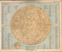 Mondoberfläche
#142
Map 142
#141
Mondoberfläche
#142
Map 142
#141
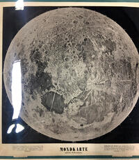 Mondkarte mittle Libration
#139
Mondkarte mittle Libration
#139
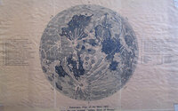 Telescopic view of the Moon from the rare original "Adams Chart of History"
#137
Die sichtbare Seite der Mond-Oberfläche bei voller Beleuchtung : nach Beer u. Mädler's Karte
1: 13 000 000
#138
Mondoberfläche
#135
Die sichtbare Seite der Mond-Oberfläche bei voller Beleuchtung : nach Beer u. Mädler's Karte
#136
Mondoberfläche
#131
Telescopic view of the Moon from the rare original "Adams Chart of History"
#137
Die sichtbare Seite der Mond-Oberfläche bei voller Beleuchtung : nach Beer u. Mädler's Karte
1: 13 000 000
#138
Mondoberfläche
#135
Die sichtbare Seite der Mond-Oberfläche bei voller Beleuchtung : nach Beer u. Mädler's Karte
#136
Mondoberfläche
#131
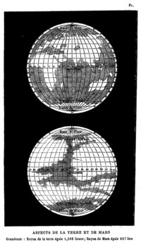 Map 131
#127
Index Map of the Moon
#128
Map 131
#127
Index Map of the Moon
#128
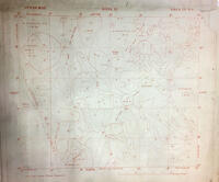 Lunar Map Zone II, Zone IV
1: 695 000
#125
Lunar Map Zone II, Zone IV
1: 695 000
#125
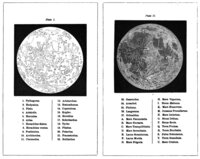 Map 125
#122
Map 125
#122
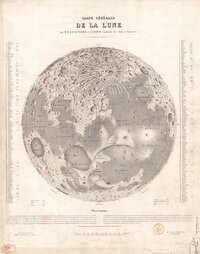 Carte générale de la Lune
#123
Map of the Moon
#124
Carte générale de la Lune
#123
Map of the Moon
#124
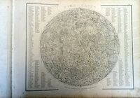 Mond—Karte Nach dem besten Quellen entworfen und gezeichnet
#121
Map 121
#120
Mond—Karte Nach dem besten Quellen entworfen und gezeichnet
#121
Map 121
#120
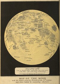 MAP OF THE MOON with the names given by Riccioli in the 17th century, and others added by succeeding observers.
#119
MAP OF THE MOON with the names given by Riccioli in the 17th century, and others added by succeeding observers.
#119
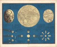 Karte der sichtbaren Seite der Mond-Oberfläche
1: 18 000 000
#117
Karte der sichtbaren Seite der Mond-Oberfläche
1: 18 000 000
#117
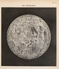 Der Mondkarte
#118
Der Mondkarte
#118
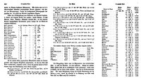 Map 118
#6788
Map 118
#6788
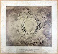 Copernico cratere della Luna
#116
Die sichtbare Seite der Mond-Oberfläche bei voller Beleuchtung : nach Beer u. Mädler's Karte. Ausgabe in 63 B1 No1
1: 46 000 000
#115
Telescopic Appearance of the Moon
#112
Copernico cratere della Luna
#116
Die sichtbare Seite der Mond-Oberfläche bei voller Beleuchtung : nach Beer u. Mädler's Karte. Ausgabe in 63 B1 No1
1: 46 000 000
#115
Telescopic Appearance of the Moon
#112
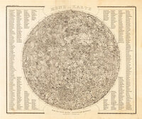 Mond-Karte
#114
Mond-Karte
#114
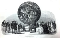 Relief der sichtbaren Halbkugel des Mondes, angefertigt von Th. Dickert in Bonn.
1: 600 000
#113
Relief der sichtbaren Halbkugel des Mondes, angefertigt von Th. Dickert in Bonn.
1: 600 000
#113
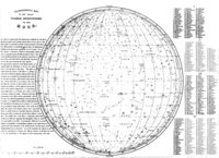 Selenographic map of the whole hemisphere of the Moon
#111
Map 111
#110
Mond—Karte Nach dem besten Quellen entworfen und gezeichnet
#109
Selenographic map of the whole hemisphere of the Moon
#111
Map 111
#110
Mond—Karte Nach dem besten Quellen entworfen und gezeichnet
#109
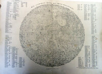 Die Sichtbare seite der Mond-Oberflache
#108
Die Sichtbare seite der Mond-Oberflache
#108
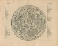 Map 108
#107
Map 108
#107
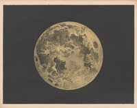 The Nomenclature of the Lunar spots
#105
The Nomenclature of the Lunar spots
#105
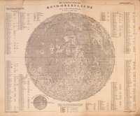 Die sichtbare Seite der Mond-Oberfläche bei voller Beleuchtung : nach Beer u. Mädler's Karte. Ausgabe in 63 B1 No1
1: 46 000 000
#104
Die sichtbare Seite der Mond-Oberfläche bei voller Beleuchtung : nach Beer u. Mädler's Karte. Ausgabe in 63 B1 No1
1: 46 000 000
#104
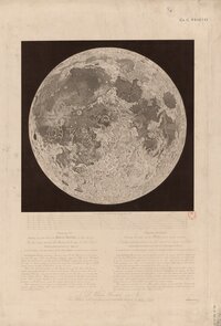 Exhibiting the same view of the Moon’s surface as plate the first
#103
Exhibiting the same view of the Moon’s surface as plate the first
#103
 The Moon in Plano
#101
The Moon in Plano
#101
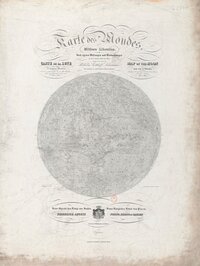 Karte des Mondes in einem mittleren Librationzustand
#102
Karte des Mondes in einem mittleren Librationzustand
#102
 Karte des Mondes. Mittlere Libration. Map of the Moon in a mean state of libration. Carte de la Lune, dans l'etat de moyenne libration
1: 8 980 000
#97
General Karte der sichbaren Seite der Mondoberflaeche
1: 10 900 000
#98
Karte des Mondes. Mittlere Libration. Map of the Moon in a mean state of libration. Carte de la Lune, dans l'etat de moyenne libration
1: 8 980 000
#97
General Karte der sichbaren Seite der Mondoberflaeche
1: 10 900 000
#98
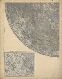 Mappa SELENOGRAPHICA
1: 46 000 000
#99
Mondk...
#100
Mappa SELENOGRAPHICA
1: 46 000 000
#99
Mondk...
#100
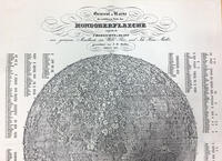 Mondoberflaeche
#96
Mondoberflaeche
#96
 Der Mond .. Vollichte
#94
Die sichtbare Seite der Mond-Oberfläche bei voller Beleuchtung
1: 3 680 000
#95
Der Mond .. Vollichte
#94
Die sichtbare Seite der Mond-Oberfläche bei voller Beleuchtung
1: 3 680 000
#95
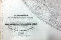 Mappa Selenographica totam Lunae hemisphaeram risibilem complectons chorratinibus propriis secundum projectionem othographicam quatuor Sectionibus constructa et delineata Suae Majestati Friderico Sexto regi daniae illustrissimo .... Guilelmo Beer et Joanne Henrico Mädler Ediio Genuina Berolini MDCCCXXXIV Ex autographico in lapudem inciduit Carolus Vogel Apud Simon Schropp et Soc
#93
Mappa Selenographica totam Lunae hemisphaeram risibilem complectons chorratinibus propriis secundum projectionem othographicam quatuor Sectionibus constructa et delineata Suae Majestati Friderico Sexto regi daniae illustrissimo .... Guilelmo Beer et Joanne Henrico Mädler Ediio Genuina Berolini MDCCCXXXIV Ex autographico in lapudem inciduit Carolus Vogel Apud Simon Schropp et Soc
#93
 Nach der Natur und mit Benützung der Schrötter'schen Special-Karten auf der K. K. Sternwarte in Wien, unter der Leitung des Herrn Direktors und Professors der Astronomie J. J. Littrow, gezeichnet von Albert Richard von 1819 bis 1830, und in Stein gestochen von demselben
#92
Karte des Vollmondes nach Mayer Schröter und Gruithuisen
#91
Nach der Natur und mit Benützung der Schrötter'schen Special-Karten auf der K. K. Sternwarte in Wien, unter der Leitung des Herrn Direktors und Professors der Astronomie J. J. Littrow, gezeichnet von Albert Richard von 1819 bis 1830, und in Stein gestochen von demselben
#92
Karte des Vollmondes nach Mayer Schröter und Gruithuisen
#91
 Map 91
#89
Telescopic appereance of the Moon
#90
Topographie der sichtbaren Mondoberflaeche
1: 3 570 000
#88
Map 91
#89
Telescopic appereance of the Moon
#90
Topographie der sichtbaren Mondoberflaeche
1: 3 570 000
#88
 Map 88
#87
Map 88
#87
 Mondkarte
#86
Plate illustrating Russel's system of triangulation (from: A description of the lunar planispheres)
#83
Mondkarte
#86
Plate illustrating Russel's system of triangulation (from: A description of the lunar planispheres)
#83
 The appearance of the moon, in an inverted position.
#81
Der Volle Mond
#6796
The appearance of the moon, in an inverted position.
#81
Der Volle Mond
#6796
 The Moon in Plano
#80
The Moon in her mean libration, with the Spots according to Riccioli, Cassini & c.
#6791
inv.52085
The Moon in Plano
#80
The Moon in her mean libration, with the Spots according to Riccioli, Cassini & c.
#6791
inv.52085 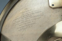 The visible surface of the Moon constructed from Trianules measured with micrometer and accurately drawn and engraved from a long series of telescopic observations
#6790
Inv.39338
The visible surface of the Moon constructed from Trianules measured with micrometer and accurately drawn and engraved from a long series of telescopic observations
#6790
Inv.39338 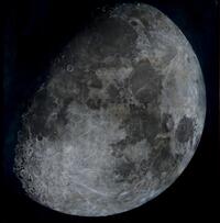 The Moon (pastel)
1: 2 280 000
#79
Torn III Pag 344 / Astronomie Pl. XXXX / Fig. 282 Cette figure est renversé
The Moon (pastel)
1: 2 280 000
#79
Torn III Pag 344 / Astronomie Pl. XXXX / Fig. 282 Cette figure est renversé 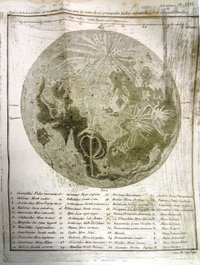 Figure de la Lune dans ses moyennes librations, avec les noms de ses principales taches suivant Riccioli et suivant Hevelius.
#78
Figure de la Lune dans ses moyennes librations, avec les noms de ses principales taches suivant Riccioli et suivant Hevelius.
#78
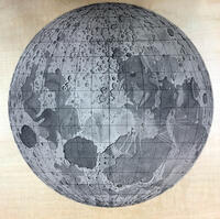 Tob. Mayeri tabula selenograhica
#77
Tob. Mayeri tabula selenograhica
#77
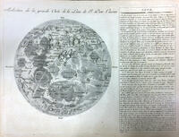 Réduction de la Grande Carte de la Lune
#76
Selenography or the map of the Moon,according to Father Riccioli
#74
Réduction de la Grande Carte de la Lune
#76
Selenography or the map of the Moon,according to Father Riccioli
#74
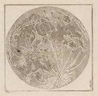 Map 74