
Proctor’s Mars Maps (1865-1892)
Cartographer: R. A. Proctor
Projection: Stereographic
1864
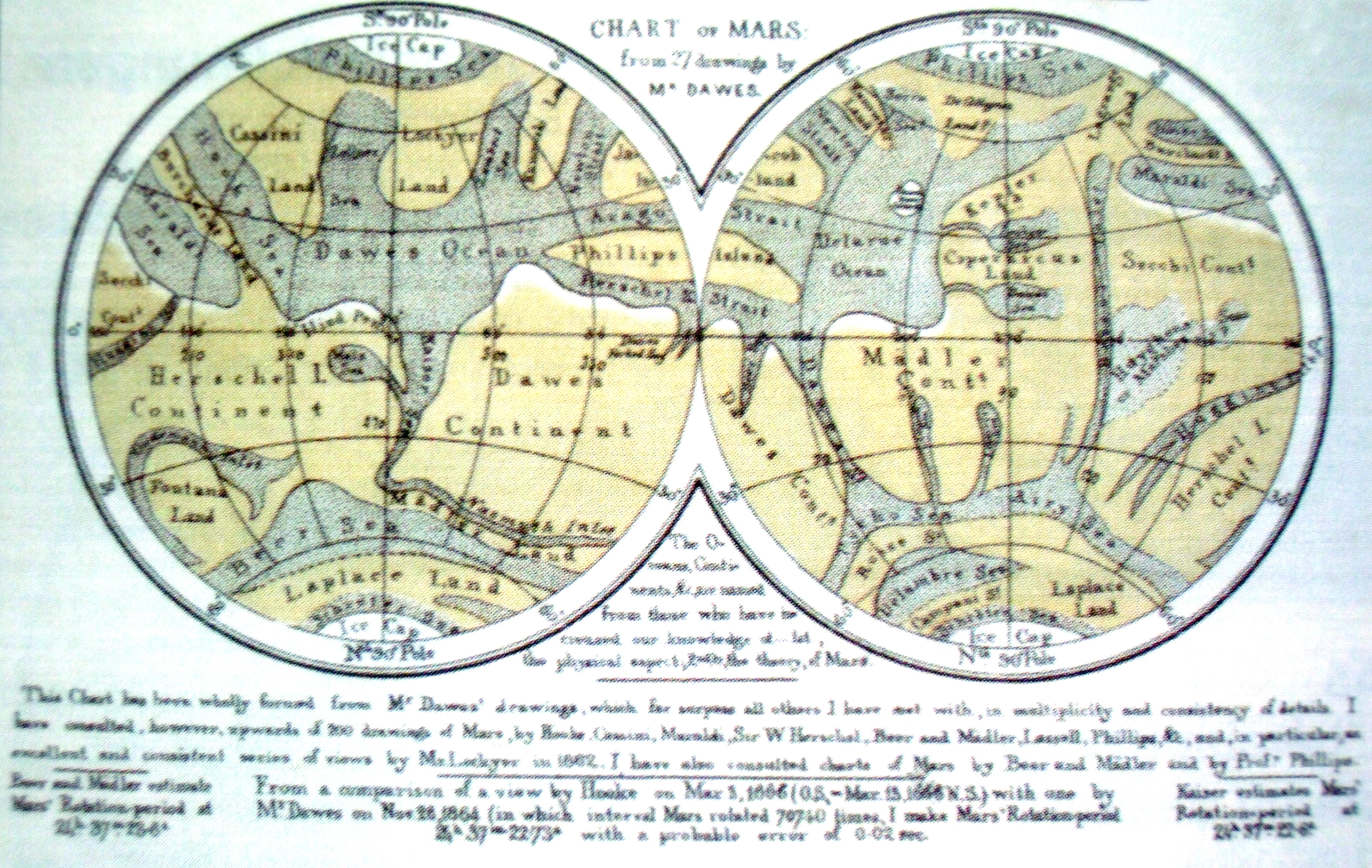
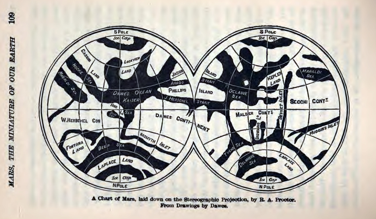
Chart of Mars
R. A. Proctor; using drawings by W. R. Dawes 1864/65
The names like Dawes Sea can be viewed as „the seas in Dawes’ drawing”
1867
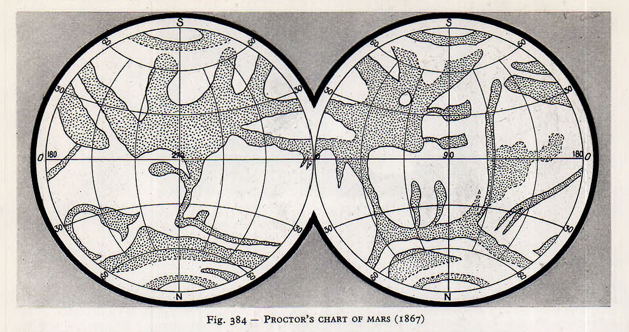
1867. Source: Rudaux, L. et al 1962; Larousse Encyclopaedia Of Astronomy; London
Image courtesy Ton Lindemann
1869
RA Proctor: Half-hours with the Telescope. London 1869. p. 6.
1870
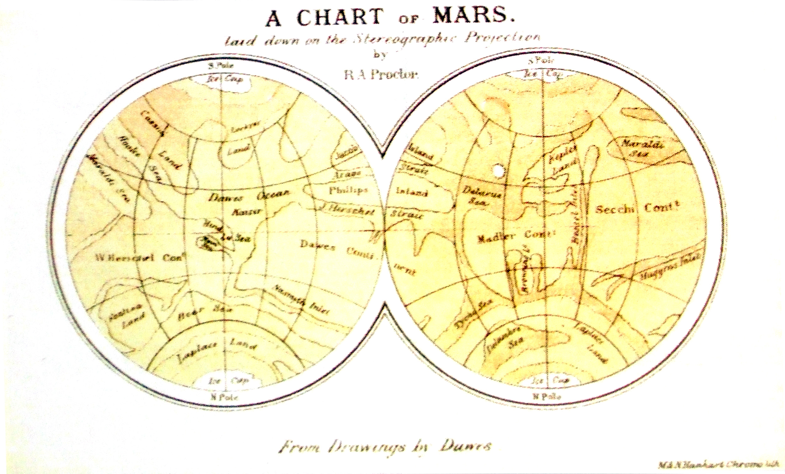
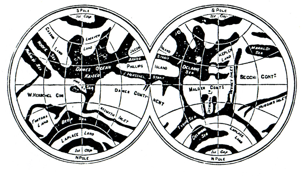
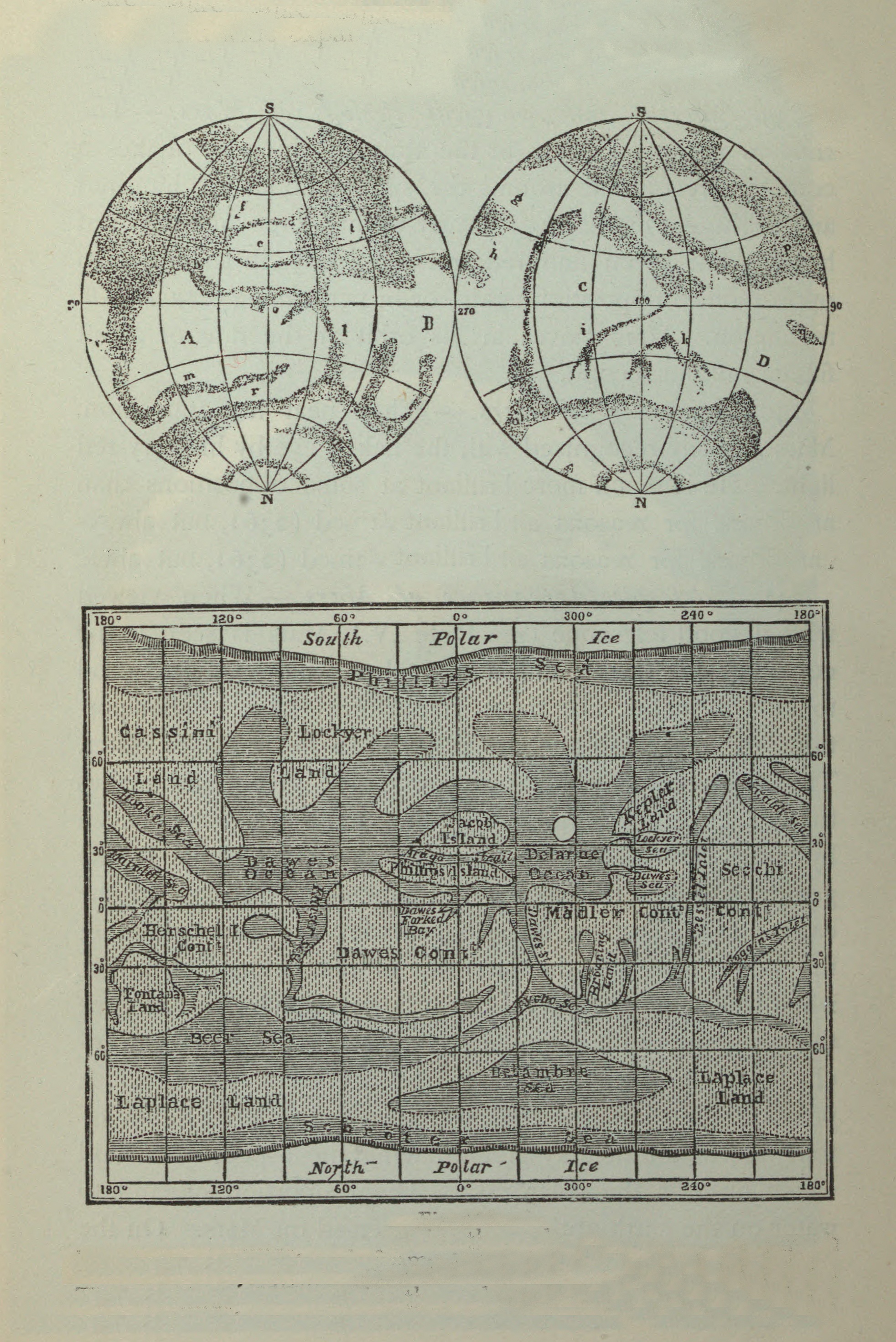
A Chart of Mars laid down on the Stereographic Projection
R. A. Proctor, from drawings by Dawes.
in: RA Proctor: Other Worlds than Ours. London 1870, p 94.
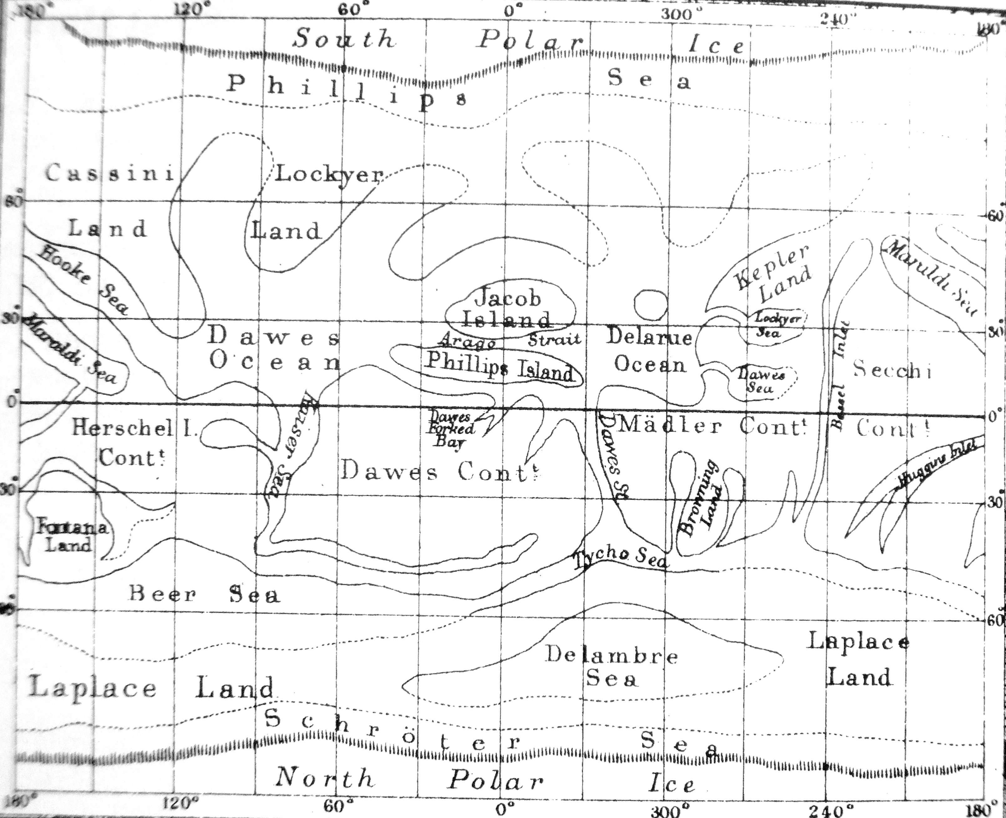
1871
Drawing of 1868 published in 1871, 1892.
Other Worlds than Ours 1901.
1873
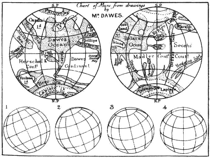
Map based on the drawings of William R Daves
“Chart of Mars from Drawings of Mr. Dawes”
Comments: “In Plate 6 I have given a series of views of Mars much more distinct than an observer may expect to obtain with moderate powers. I add a chart of Mars, a 83miniature of one I have prepared from a charming series of tracings supplied me by Mr. Dawes. The views taken by this celebrated observer in 1852, 1856, 1860, 1862, and 1864, are far better than any others I have seen. The views by Beer and Mädler are good, as are some of Secchi’s (though they appear badly drawn), Nasmyth’s and Phillips’; Delarue’s two views are also admirable; and Lockyer has given a better set of views than any of the others. But there is an amount of detail in Mr. Dawes’ views which renders them superior to any yet taken. I must confess I failed at a first view to see the full value of Mr. Dawes’ tracings. Faint marks appeared, which I supposed to be merely intended to represent shadings scarcely seen. A more careful study shewed me that every mark is to be taken as the representative of what Mr. Dawes actually saw. The consistency of the views is perfectly wonderful, when compared with the vagueness and inconsistency observable in nearly all other views. And this consistency is not shown by mere resemblance, which might have been an effect rather of memory (unconsciously exerted) than observation. The same feature changes so much in figure, as it appears on different parts of the disc, that it was sometimes only on a careful projection of different views that I could determine what certain features near the limb represented. But when this had been done, and the distortion through the effect of foreshortening corrected, the feature was found to be as true in shape as if it had been seen in the centre of the planet’s disc.
In examining Mr. Dawes’ drawings it was necessary that the position of Mars’ axis should be known. The data for determining this were taken from Dr. Oudemann’s determinations given in a valuable paper on Mars issued from Mr. Bishop’s observatory. 84But instead of calculating Mars’ presentation by the formulæ there given, I found it convenient rather to make use of geometrical constructions applied to my ‘Charts of the Terrestrial Planets.’ Taking Mädler’s start-point for Martial longitudes, that is the longitude-line passing near Dawes’ forked bay, I found that my results agreed pretty fairly with those in Prof. Phillips’ map, so far as the latter went; but there are many details in my charts not found in Prof. Phillips’ nor in Mädler’s earlier charts.
I have applied to the different features the names of those observers who have studied the physical peculiarities presented by Mars. Mr. Dawes’ name naturally occurs more frequently than others. Indeed, if I had followed the rule of giving to each feature the name of its discoverer, Mr. Dawes’ name would have occurred much more frequently than it actually does.”
Source: Richard A. Proctor: Half-hours with the Telescope. New York:G.P. Putnam’s Sons. 1873.
1879
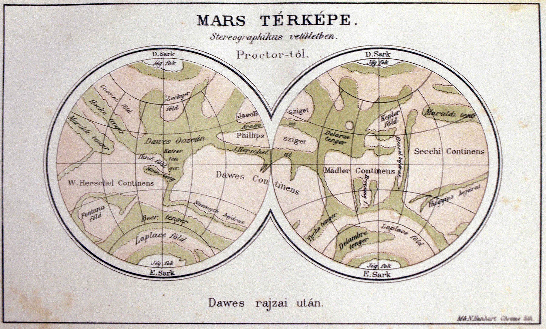
A Mars térképe – Hungarian edition, Proctor’s map “After Dawes’ drawings”
In: Proctor: Más világok mint a mienk. Translated by Károly Császár. Természettudományi Kiadó Vállalat Budapest 1879. (Free book for members of K.M: Természettudományi Társulat (Royal Society of Natural Science)
1882
1882: Gillet, J.A. et-al 1882; Astronomy for the use of schools and academies; New York = Gillet, J.A. et-al 1882; The heavens above; New York
Image courtesy Ton Lindemann
1888
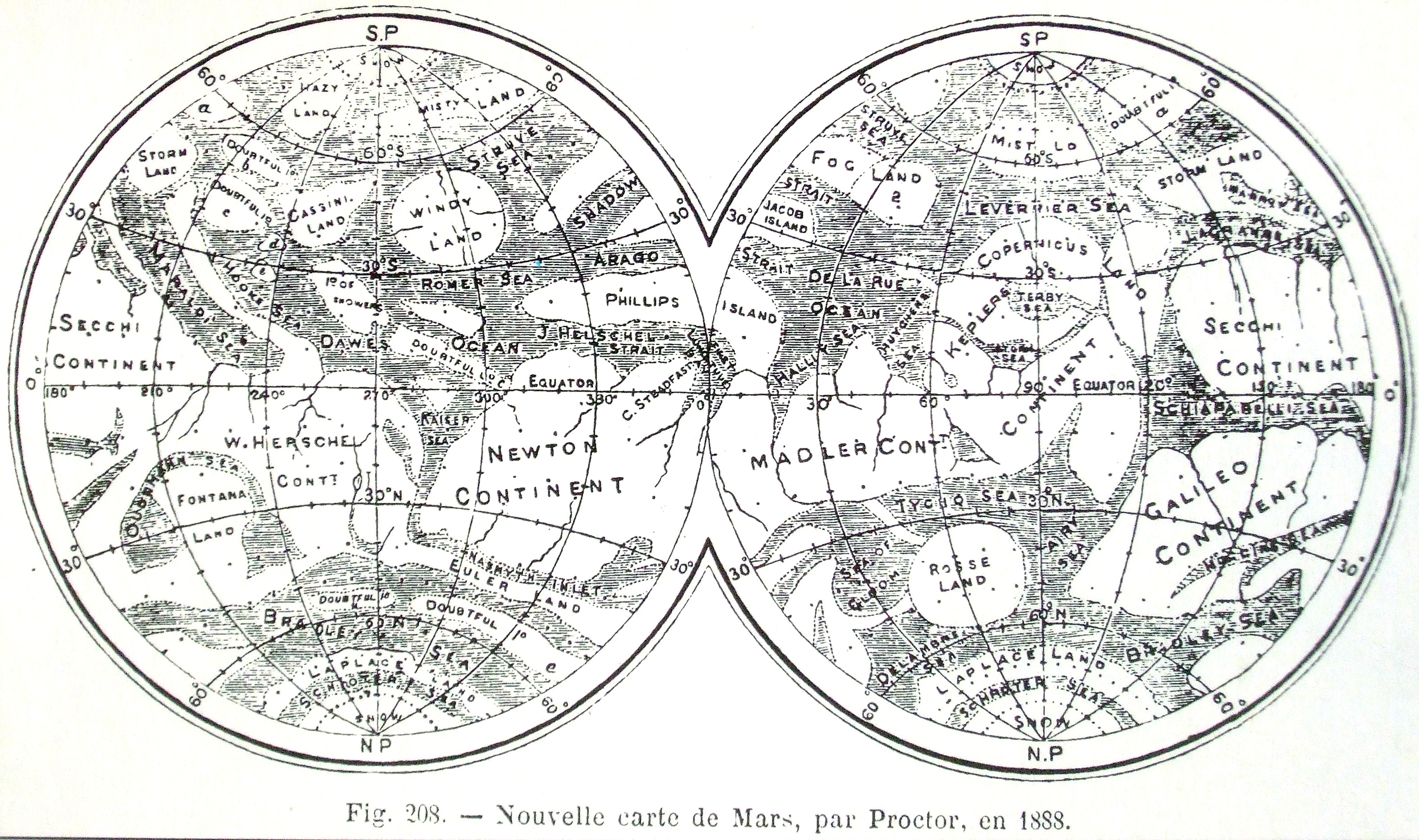
Nouvelle carte de Mars, par Proctor en 1888.
Stereographic Projection
RA Proctor: Old and new astronomy. London-New York, 1888
With the nomenclature of 1869
1892
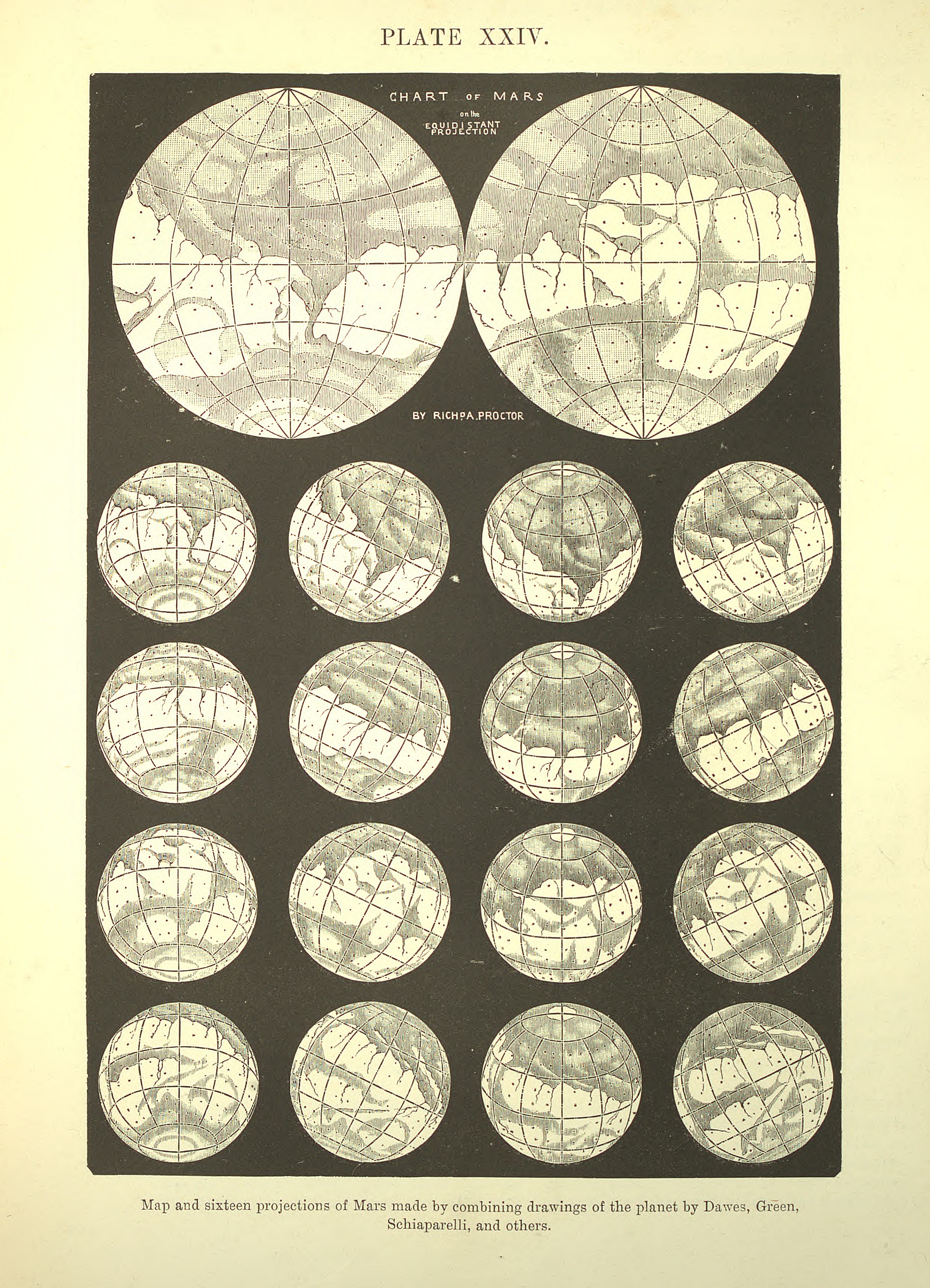
Proctor, R.A. 1892; Old and new astronomy; London
Image courtesy Ton Lindemann
1892
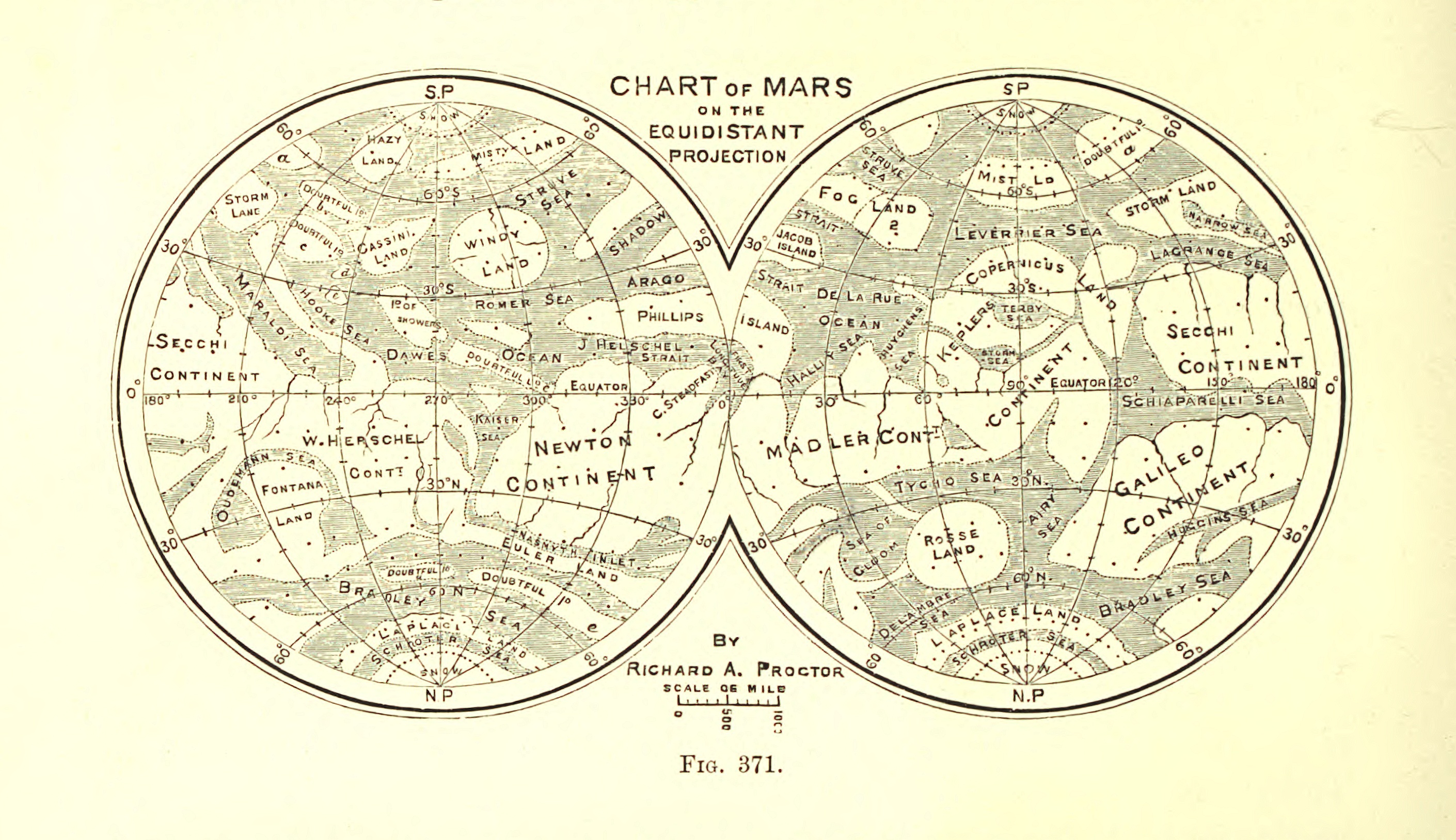
Proctor, R.A. 1892; Old and new astronomy; London
Image courtesy Ton Lindemann
