Topographic Image Map Mars series (TU/DLR/FU Berlin)

Planetary Image Map Mars 1:2,000,000 (test?)

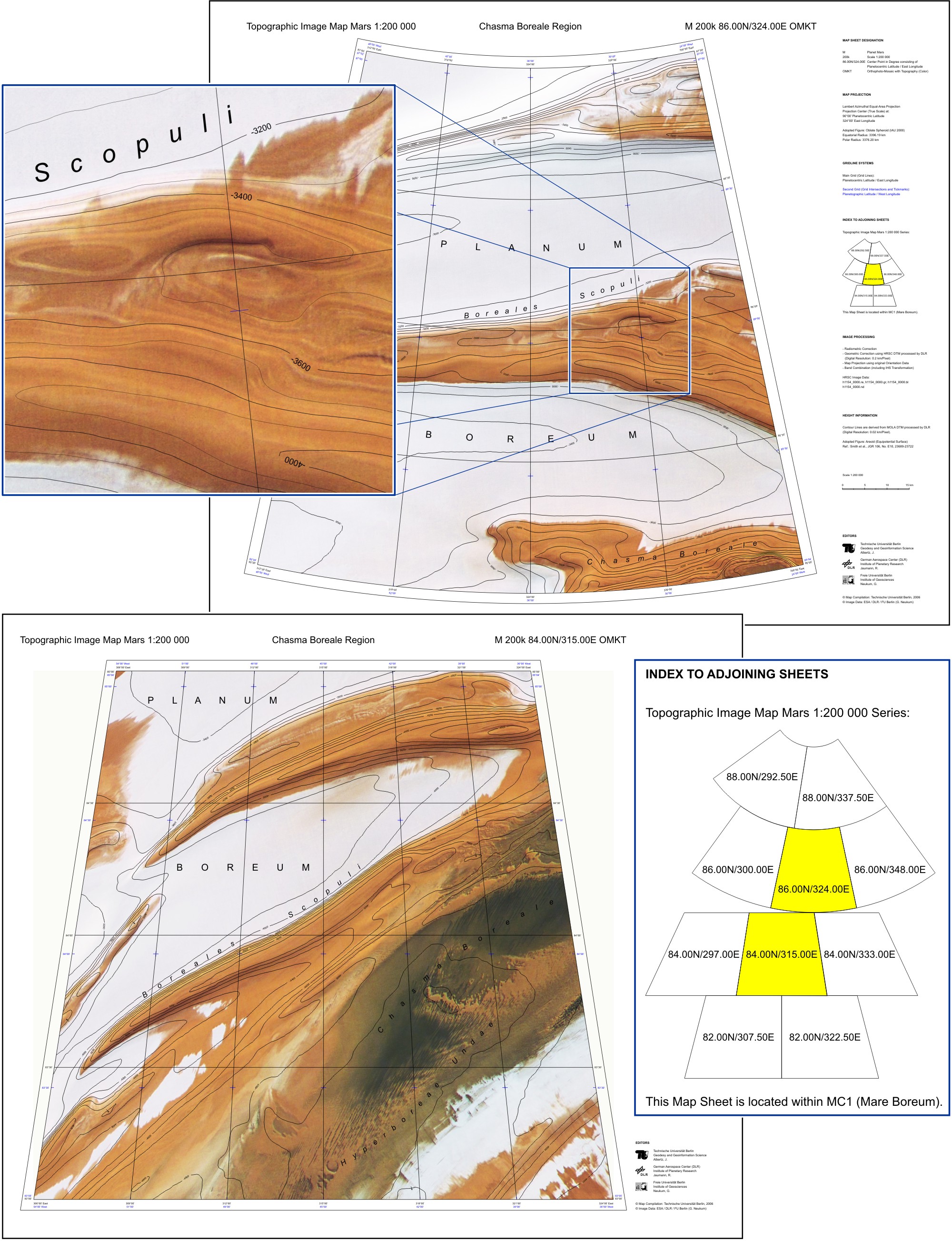
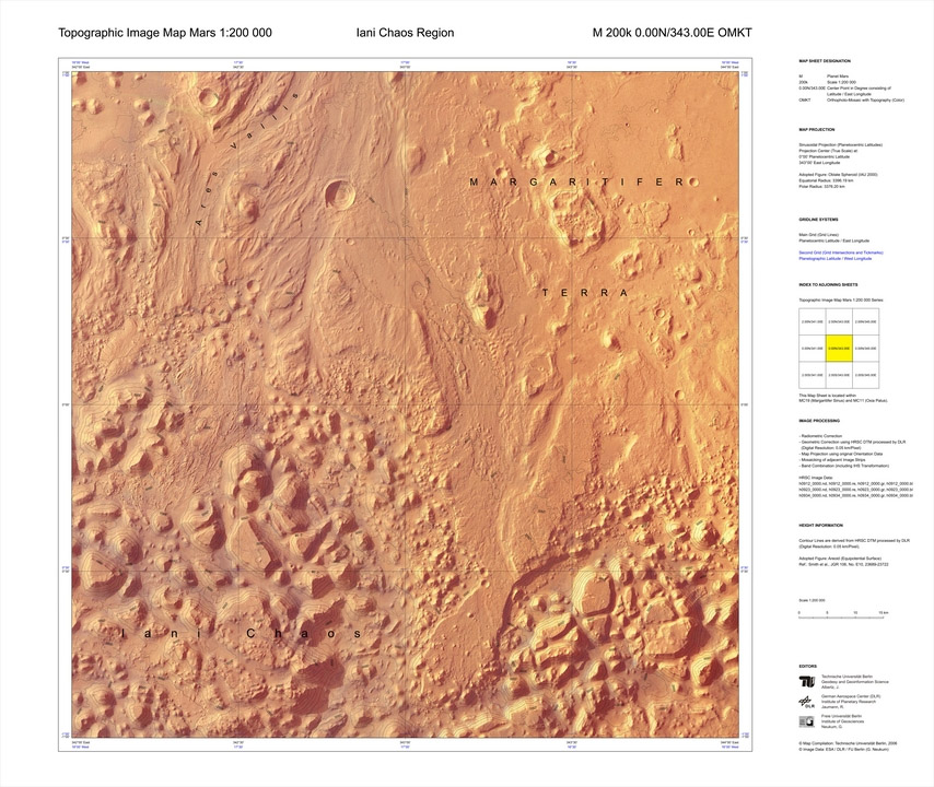
Topographic Image Map Mars 1:200,000 series

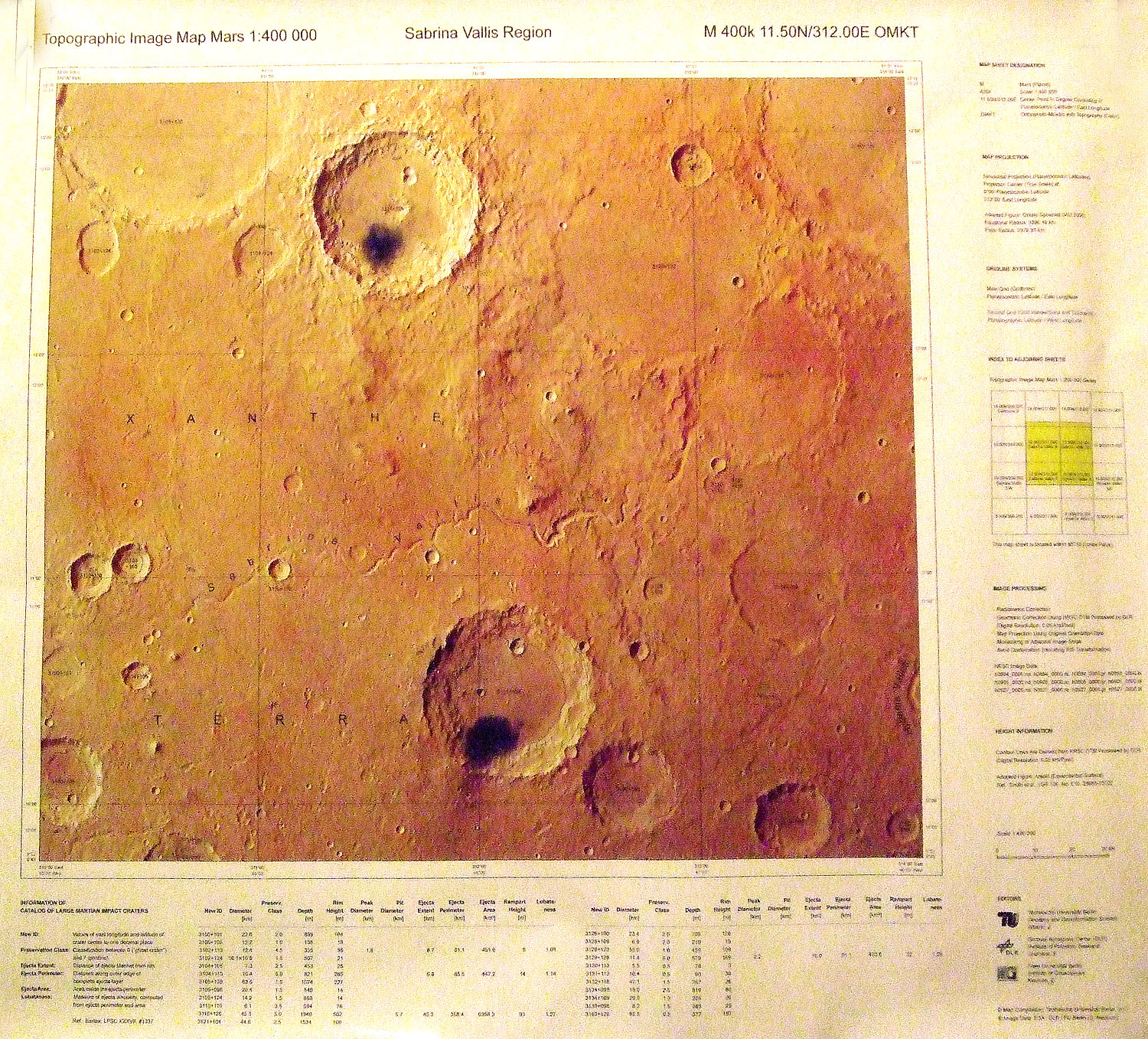
Topographic Image Map Mars 1:400,000 series

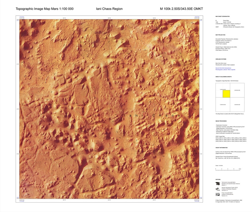
Topographic Image Map Mars 1:100,000 series

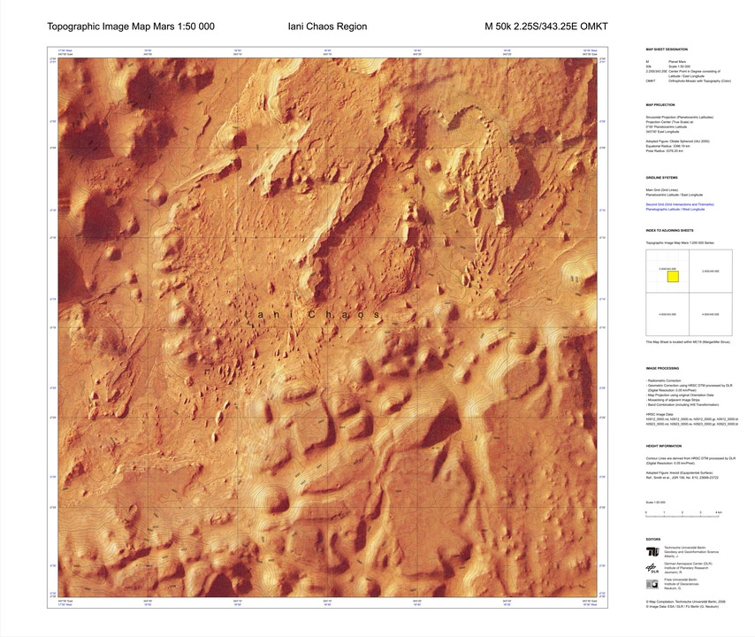
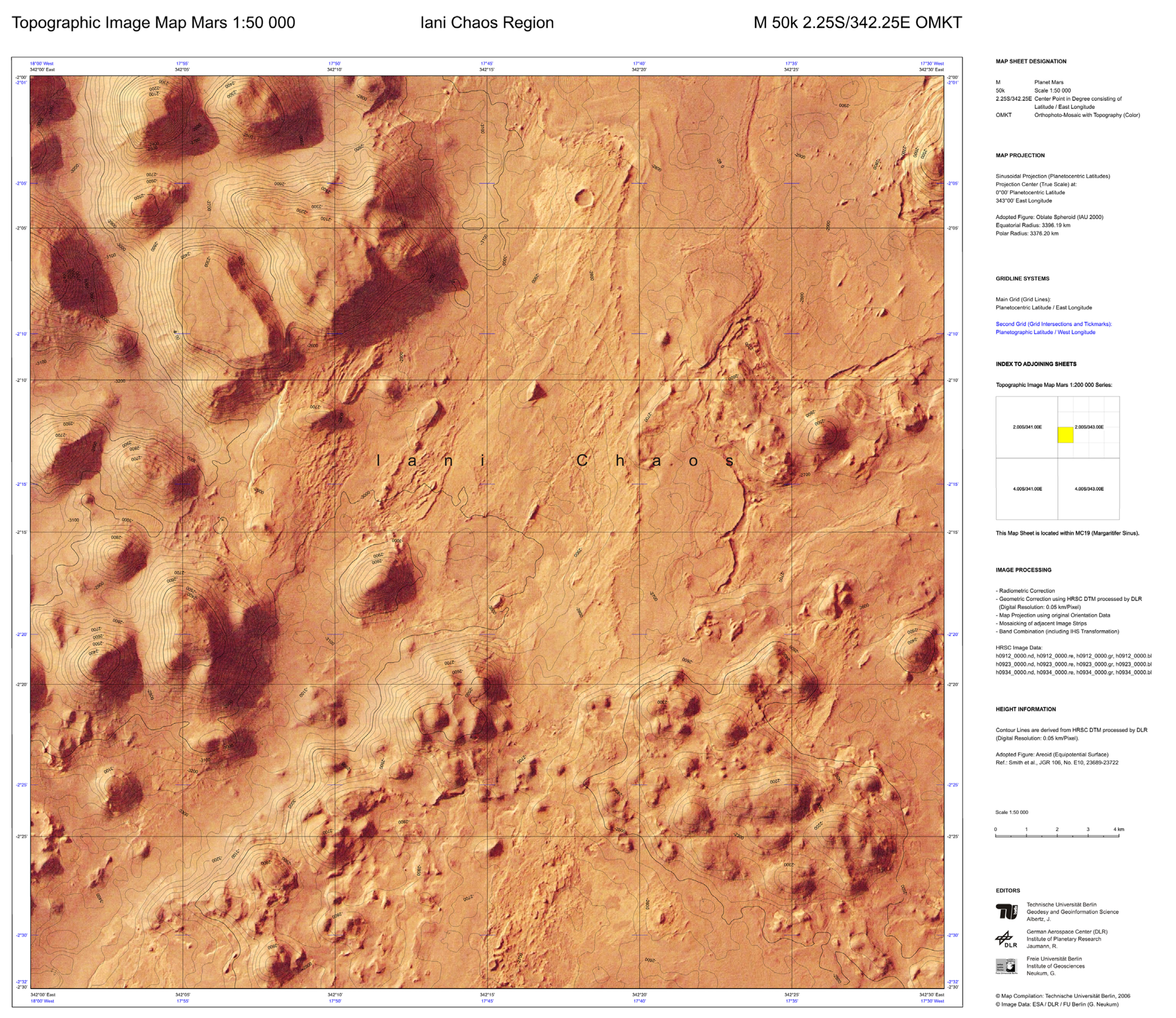
Topographic Image Map Mars 1:50,000 series

Based on: HRSC data

Editors: Alberz J, Jaumann R, Neukum G (TU, DLR, FUB)

Date: 2005-2007

References 

https://astrogeology.usgs.gov/search/map/Research/ISPRS/ISPRS_465_J_Albertz

“Each map sheet has been generated automatically using the software PIMap” (Source)
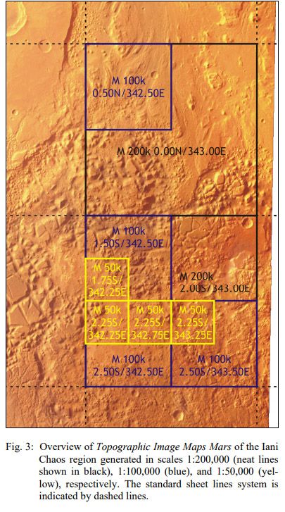
ianisheets.jpg

The 50k series

ianichaos1

The High Resolution Stereo Camera (HRSC) of Mars Express and its
Planetary and Space Science, 126 + (2016) 93-138. doi:10.1016/j.pss.2016.02.014

The 100k series

ianichaos2


The 200k series

Standard procedure: “the Martian surface is covered in 10,372 individual sheets in equal-area projections:

  • Sinusoidal Projection for latitudes between 85° north and south and
  • Lambert Azimuthal Equal-Area Projection around the poles.

While all map sheets cover 2° in latitude, the longitude extent increases from 2° in the equatorial zone towards 360° at the poles.

More Information

image003.jpg

ianichaos3

The 400k series

Name: Topographic Image Map Mars 1:400,000

Example

Title: Topographic Image Map Mars, Sabrina Vallis Region
Map number: M400k 11.50N/312.00E OMKT
Map editors: Technische Universität Berlin (Albertz, J), German Aerospace center (DLR) (Jaumann, R), Freie Universität Berlin, Inst. of Geosciences (Neukum G)
Language of nomenclature: Latin
Language of explanations: English
Map type: Orthophotomap with contour lines
Scale: 1: 400 000
Projection: Sinusoidal Planetocentric
Publisher: Technische Universität Berlin, Germany
Publication Place: Berlin, Germany
Publication Date: 2007
Features: planetocentric and planetographic grid; HRSC DTM 0,05 km/pixel; crated data


sabrina

A 2M map

imagemapofmars-coprates

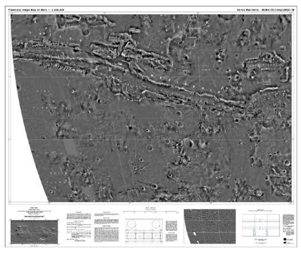
MC-18 quadrangle. Source Wahlisch et al. 2002

Explanation
Column name Column description
Catalog ID (M) N/A
Title Title of map
Author Name of mapper(s), or author, PI, map editor, illustrator, etc. with roles
Nationality Nationality of author
Start date Year when mapping began / or year or observation
Date of publication Year of publication or completion of manusctipt (empty if not published yet)
Body Target name (planetary body)
Online Online references about the map
Projection Projection of map. 2-hemisphere is shown here.
Scale N/A
Orientation Orientation of map [north up, south up] – only for historic maps (north: cartographic tradition, south: astronomical tradition)
Publication type The type of work that contains the map. [standalone, journal, conference, atlas, book figure, book supplement, book plate, encyclopedia, multisheet, digital]
Type, purpose Type of map purpose [generic, outreach, science, citizen, surface operation (pre mission), landing site (post mission), observer, opposition, index, reference, eclipse/transit/occultation] generic: not defined, outreach: maps for the general public made b
Primary Nomenclature Laguage(s) of nomenclature displayed on the map [Latin, English etc., IAU, informal]. Latin for Latin nomenclature prior to IAU.
Ref (map) Full reference of map publication or publication that contains the map
DOI DOI number of map
ID (publication) ID of map publication or figure number
Origin type If this map is not original, the following codes are used: [L: language variant, N: new print, U: updated edition, C: copied / modified from another map, R: renovation map (digital version of paper map with slight changes), F facsimile. RP: republished in
Origin ID Any maps that this map is based on or copied from. Database ID of original map.
Based on map Name of mapper
Base (spacecraft, telescope) Name of spacecraft / instrument
Original title Title of map in original langage (if not English)
Publisher Name of Publisher; manuscript or self-published. For journals and conferences, the name of the journal or conference.
Coverage Coverage of map [global, hemispheric, regional, local, landing site, landing ellipse, traverse]
Target location IAU name of target feature (if named) or near side, far side etc. (If nothing noted, it is global)
Country Country of Publisher (original/translation)
Type, content Type of map [photo, map, sketch map, drawing, globe, tactile, data]. Data for raster datasets. For vector data, see Feature DB. Drawing: no grid, scale, projection etc.
Image base Base theme of the map [shaded relief, photomosaic, photo, none]
Theme Theme of map [visual, albedo, radar, low sun, topography, elevation, geology, geomorphology, art, nomenclature reference, feature, landing site reference, opposition map, event (eclipse etc) etc.]. Low sun is optical photo with shadows and no albedo. Vis
Technique Cartographic technique [imagemap, datamap, cartographic map, unit map, airbrush, pencil, line drawing/outline, contour lines, DEM, DIM, shaded relief / hillshading, raster data etc.]
Style Details on style
Method Method how the data was obtained
Mapping scale Scale of mapping
Resolution Raster dataset resoltion [m/pixel]
Short Reference Short form of reference to the map publication
GIS / data URL where GIS or original spatial data is
Data provider N/A
Profession Profession of author (for historic maps)
Designator Sheet designator terms following Greeley and Batson (1990) Planetary Mapping. Cambridge University Press. – only if displayed on the map. First letter: target body, 5M: scale, 90/0 etc: center coordinates, OM – orthophotomosaic , T – Topographic data (nom
Control Controlled, semi-controlled, uncontrolled
Note on control Base of control
Series title Title of map series
Number of maps (in work) N/A
Number of quads N/A
Quad ID Quad ID (or quads IDs) contained on the map
Map Diameter N/A
Map width cm N/A
Map height cm N/A
Map width px N/A
Map height px N/A
Base type Type of instrument of observation of base data [naked eye, telescope, spacecraft, space telescope, lander]
Location of copy Library or archive where manuscript or rare copy is kept
Ref (literature) Reference – literature about the map, may be the source of data if the map is not available. Separated with # symbols.
Status (2017) Status of mapping [complete, in progress, in review] (mostly for USGS maps)
Aim Original aim of mapping, if available
Notes Any comments, remarks [Long text, may be multiple paragraphs]
Secondary nomenclature Other languages of the nomenclature
Nomenclature Notes Remarks on nomenclature
Photo note N/A
Reference frame ID from RefFrames
web2 Online references about the map
web3 Online references about the map
web4 Online references about the map
ocentric/ographic Map coordinate [planetographic, planetocentric]
N N/A
S N/A
W 360E N/A
E 360E N/A
W 180 N/A
E 180 N/A
W 360W N/A
R 360W N/A
fig1 N/A
fig1 caption N/A
fig2 N/A
fig2 caption N/A
fig3 N/A
fig3 caption N/A
fig4 N/A
fig4 caption N/A
fig5 N/A
fig5 caption N/A
STATUS N/A
Sum $180