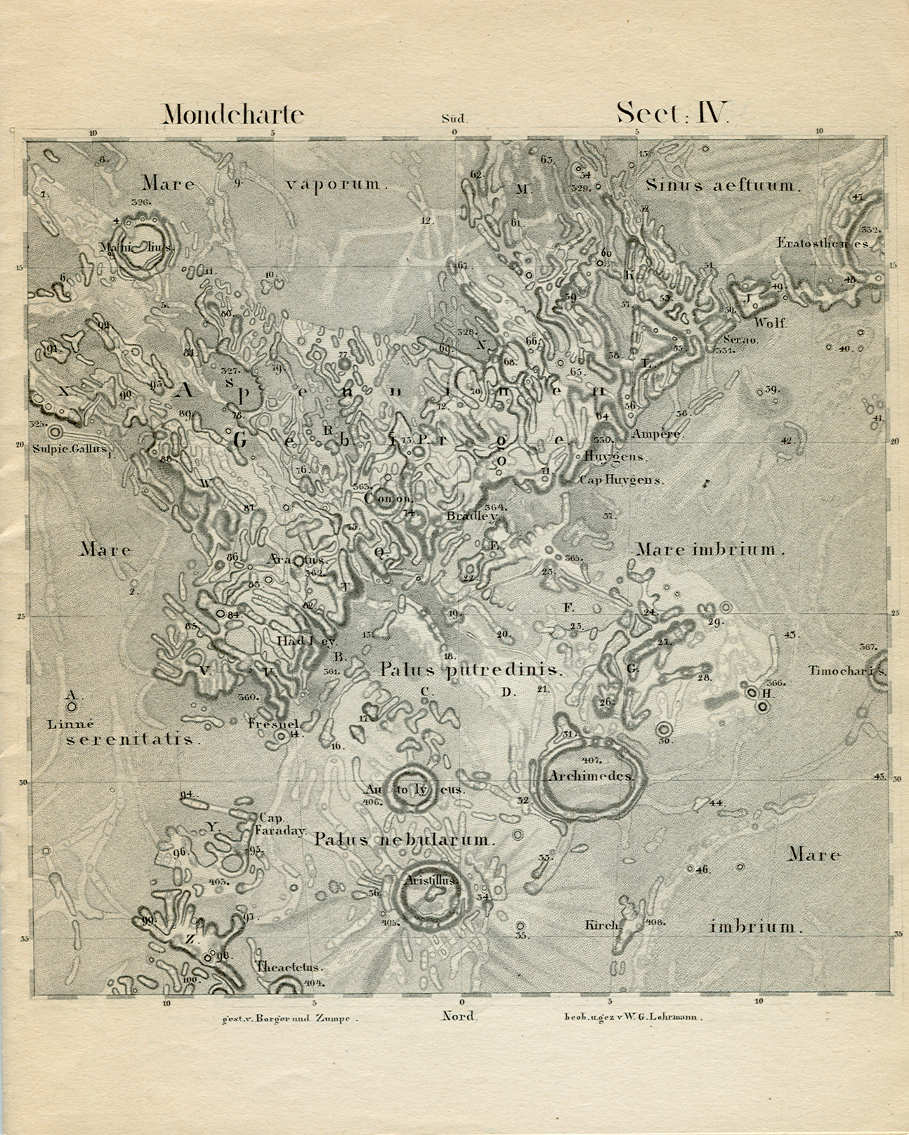
Lohrmann’s Map of the Moon
Cartographer: Wilhelm Lohrmann
Title: Topographie der sichtbaren Mondoberflaeche (Topography of the Visible Lunar Surface) Dresden: Auf Kosten des Verfassers, 1824.
25 sheets, hachure relief visualization and multiple gray shadings for albedo
1824 4 sheets
Size 227 × 227 mm
1878 Full atlas published by Julius Schmidt, reissued in 1892 Mondkarte in 25 Sectionen und 2 Erlauterungstafeln / Herausgegeben von Dr. J.F.Julius Schmidt. — Leipzig: Verlag von Johann Ambrosius Barth (Arthur Meiner),1878/92.
Originals:
- Linda Hall Library, Linda Hall Library of Science, Engineering & Technology
- Sächsische Landesbibliothek
“Lohrmann was a professional cartographer and surveyor who undertook a lunar map based on his own micrometric measurements. Using a small Fraunhofer refractor, he determined the exact position of a number of control points on the moon, from which the positions of all other lunar features could be determined. He divided his map into 25 sections, and in 1824 he published the first four of these sections, along with an explanation of his methods. Although he worked for sixteen more years, and finished drawing all the sections, Lohrmann never did publish the remainder of the atlas. Fortunately, his great successor Julius Schmidt undertook to have the drawings engraved, and the complete Lohrmann atlas finally saw the light in 1878” (Source)