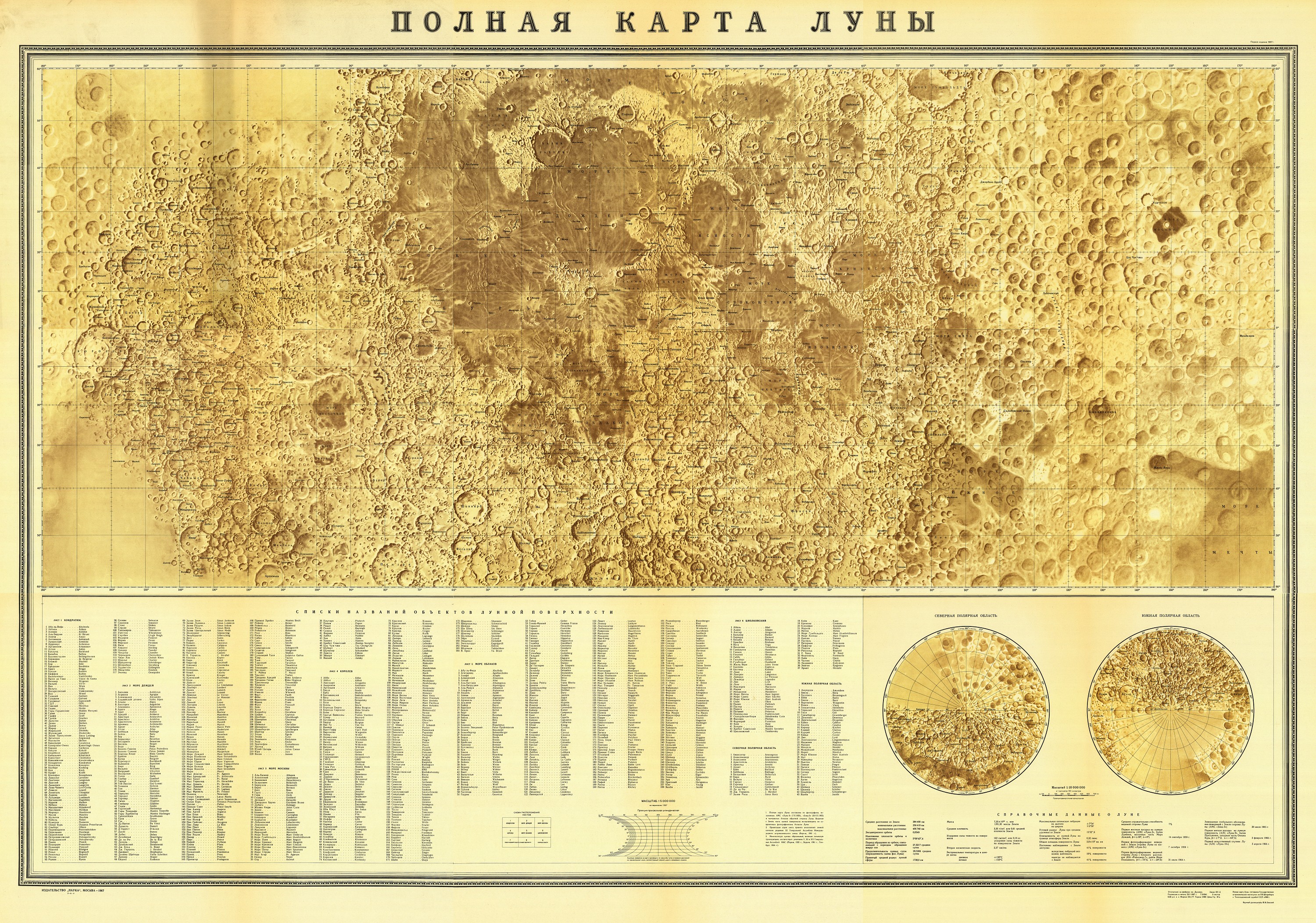
First Complete Moon Map (1967)
Polnaya karta Luny
using Luna-3 (1959) and Zond-3 (1965) images
1:5 000 000
Nauka, Moskva, 1967.
Projection: „arbitrary cylindrical projection”
9 sheets, 7 with relief and two with names.
From 90E to 180 it uses low resolution Luna 3, from 180 to 90W is uses higher resolution Zond 3 images.
The first full map of the Moon. 1st version prepared in Sternberg Astronomical Institute in 1967 to the Intl Congress of Astronomical Union in Prague. K.B. Shingareva have presented the map and globe in the Prage Congress. About 10 globes were made. One was brought to Prage as a gift. In GAISH there is one of them.
„Prepared in GAISH (State Sternberg Astronomical Institute) and military department. Maps and globes were prepared by military department. Scientific Institute for military geodesy and cartography under the consultation of GAISH scientists. The first nearside map and whole map and globe was prepared there in the military.” (Shingareva 2009)
„After 1965 using new Zond-3 data and Luna 3 data, GAISH and the topographic and geological service of SSSR under the surpervision by Yu. N. Lipsky compiled a full map of the Moon on 9 sheets of 1:5M and a globe of the moon 1:10M which reflects 95% of the lunar surface. The projection is a specially designed cylindrical projection with less than 5% angle distorsion between 50 deg lat. It gives the latin transcriptions in the index” (Rodionova 1991)
Later improved editions: 1969, 1974, 1979, 1984, 1989.
1 sheet version courtesy Ton Lindeman


