
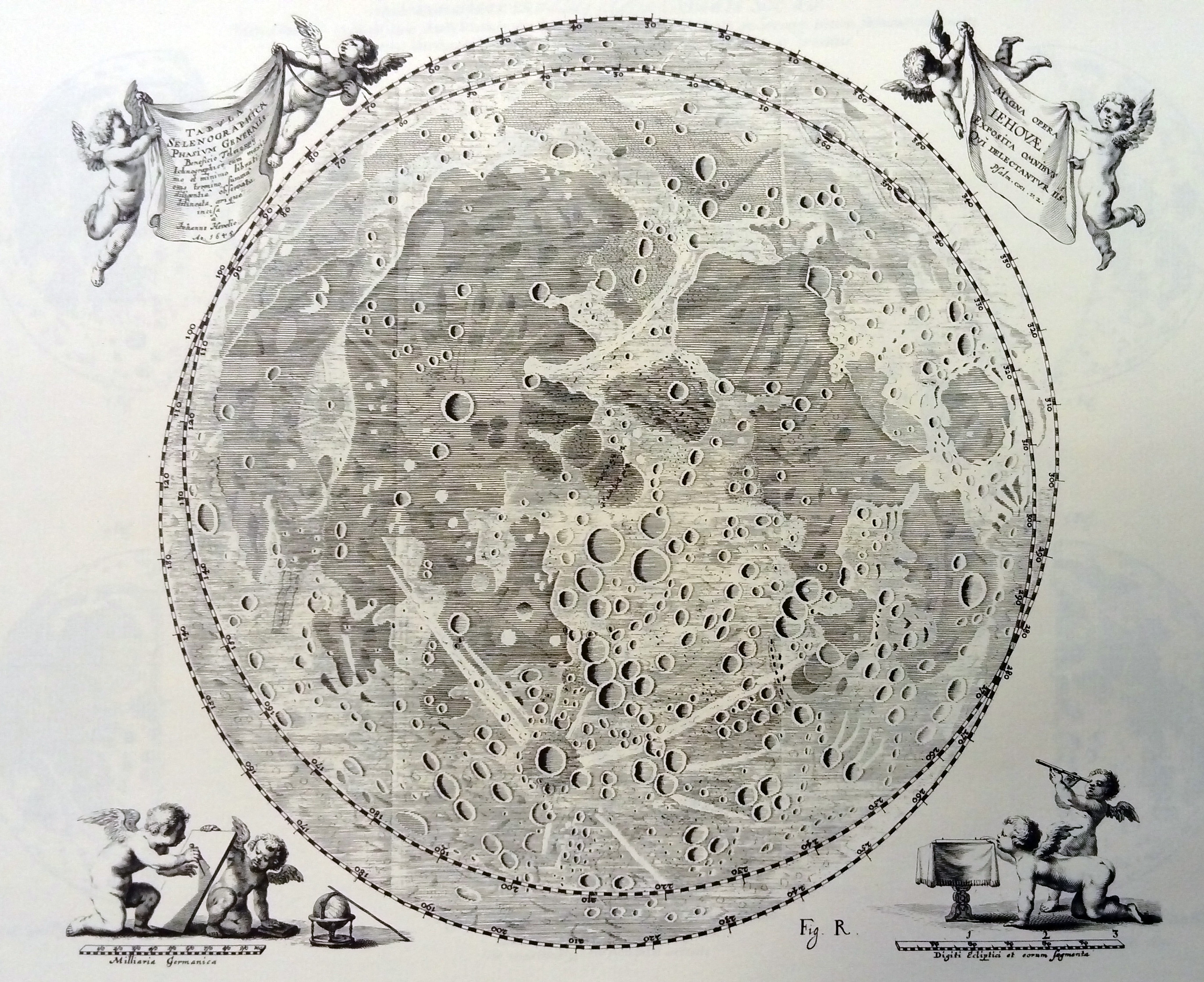
Hevelius’ map of the Moon (1645-1746)
1645
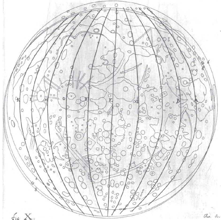
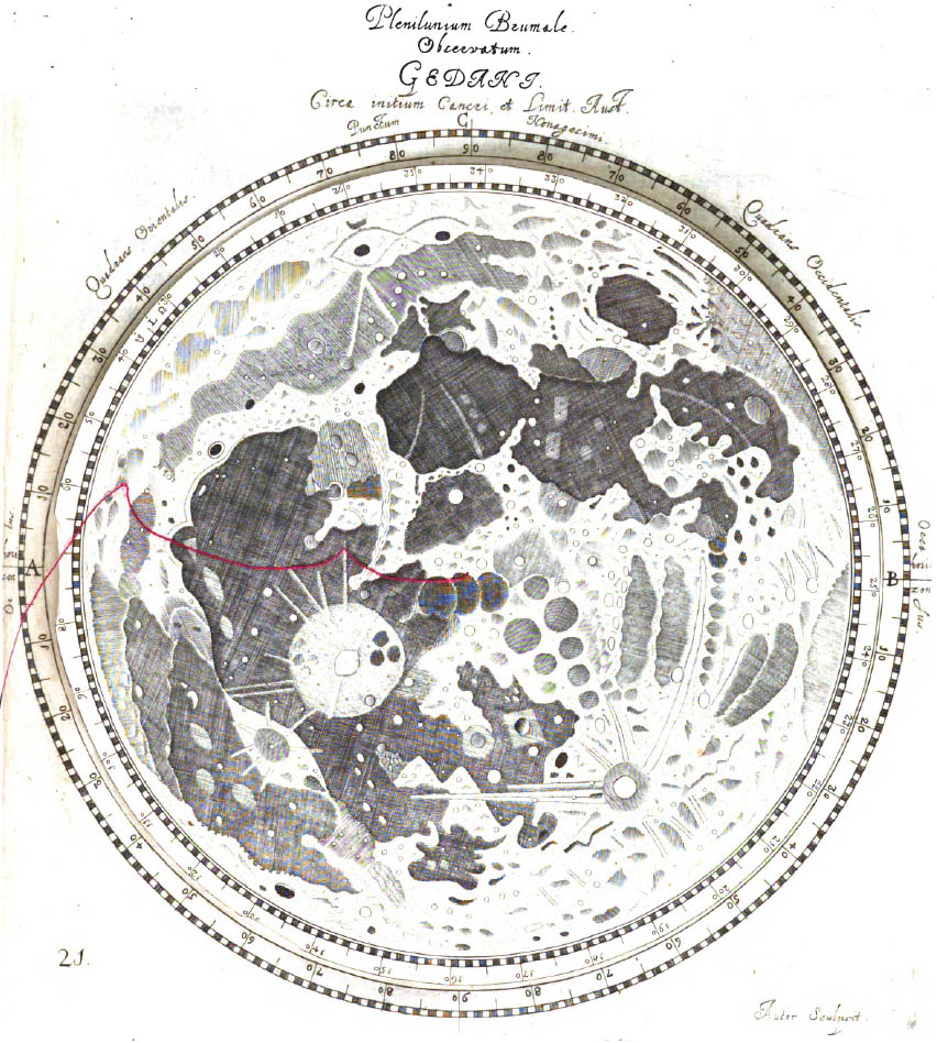
Three maps: one full moon, one shadowed synthetic realistic engraving and a map-like representation.
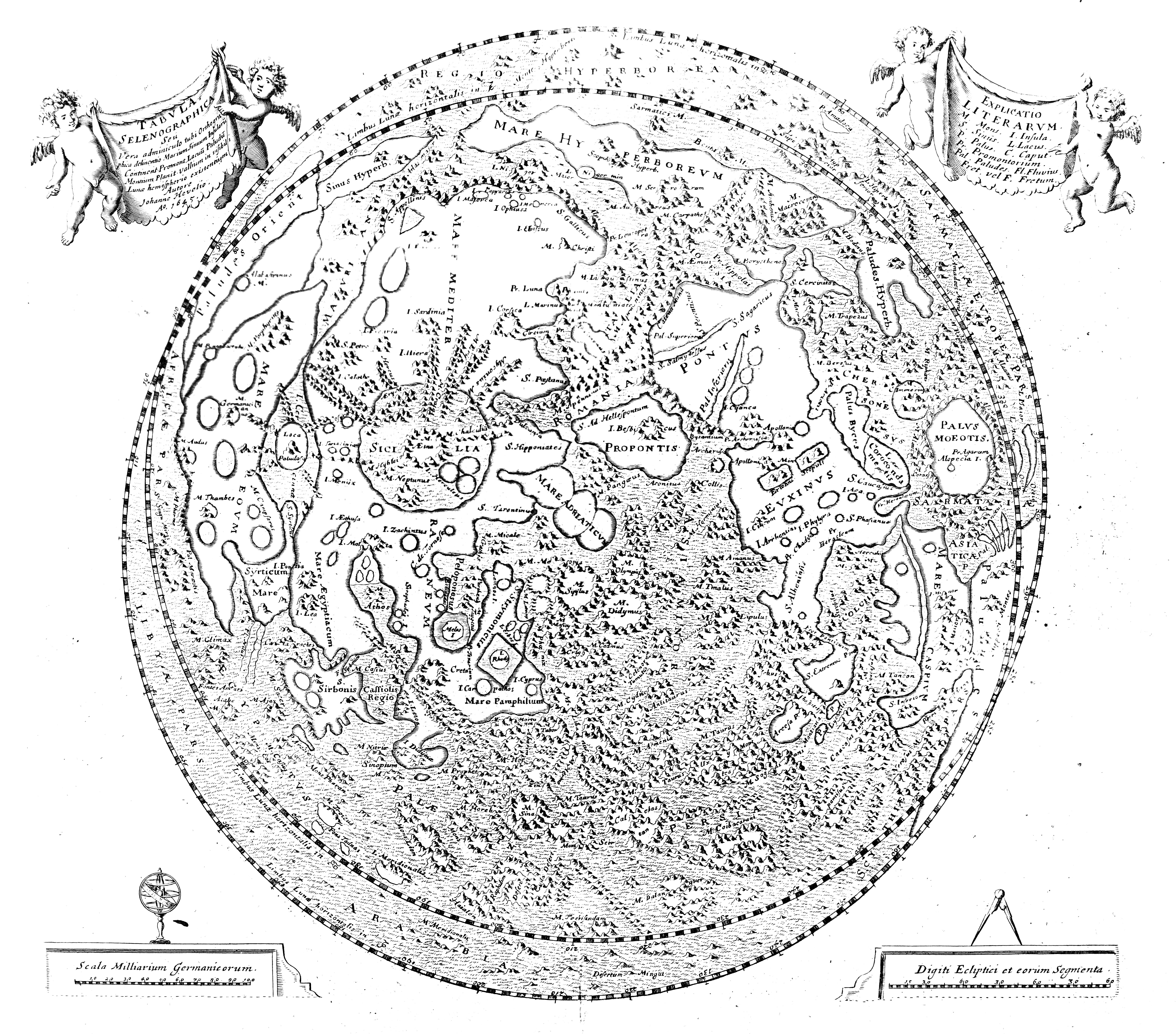
Publication : 1647, Selenographia sive lunae descriptio. Gedani:TypisHunefelianis.
Cartographer: Johann Höwelcke (Hevelius)
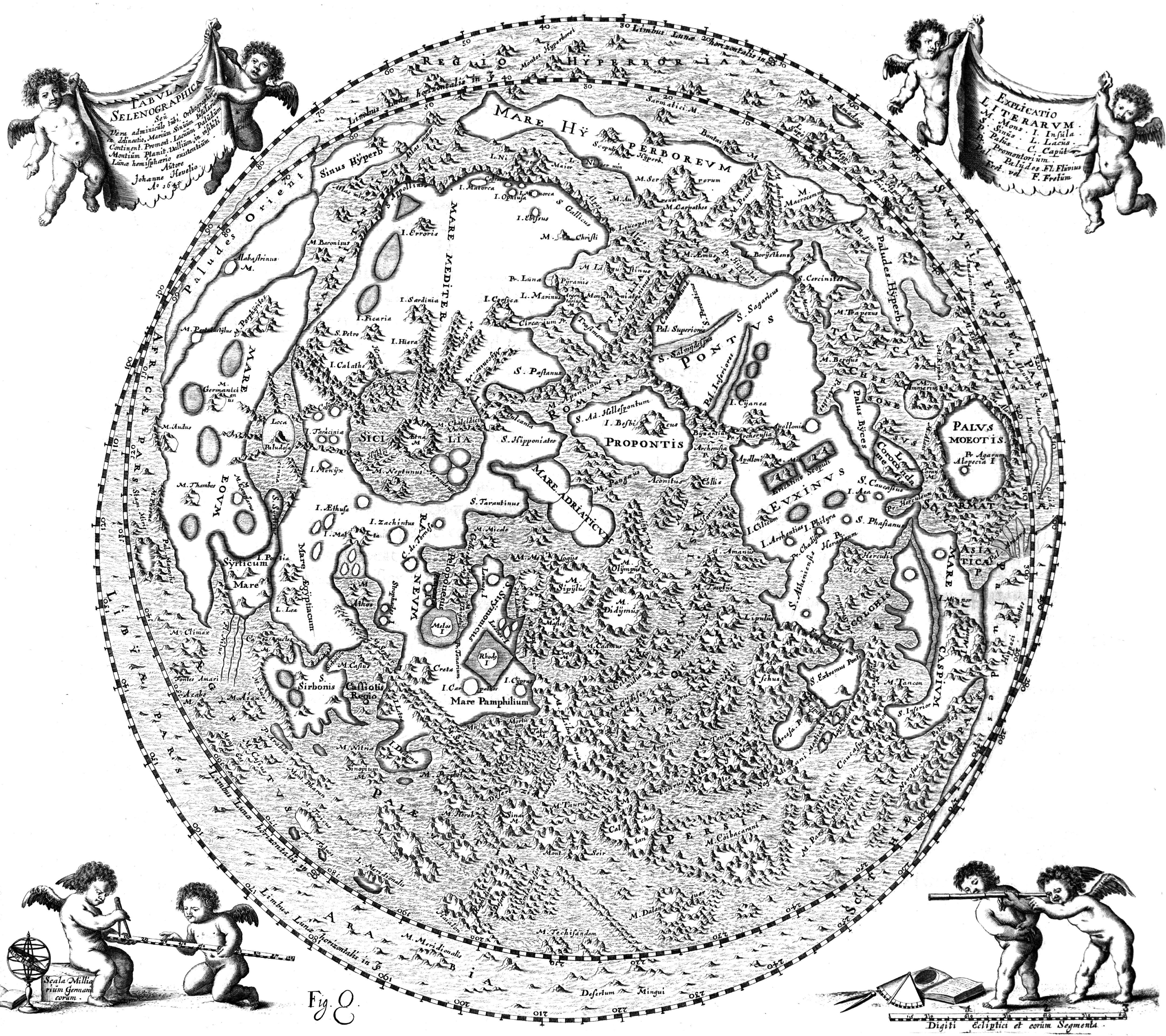
Selenographica, Source
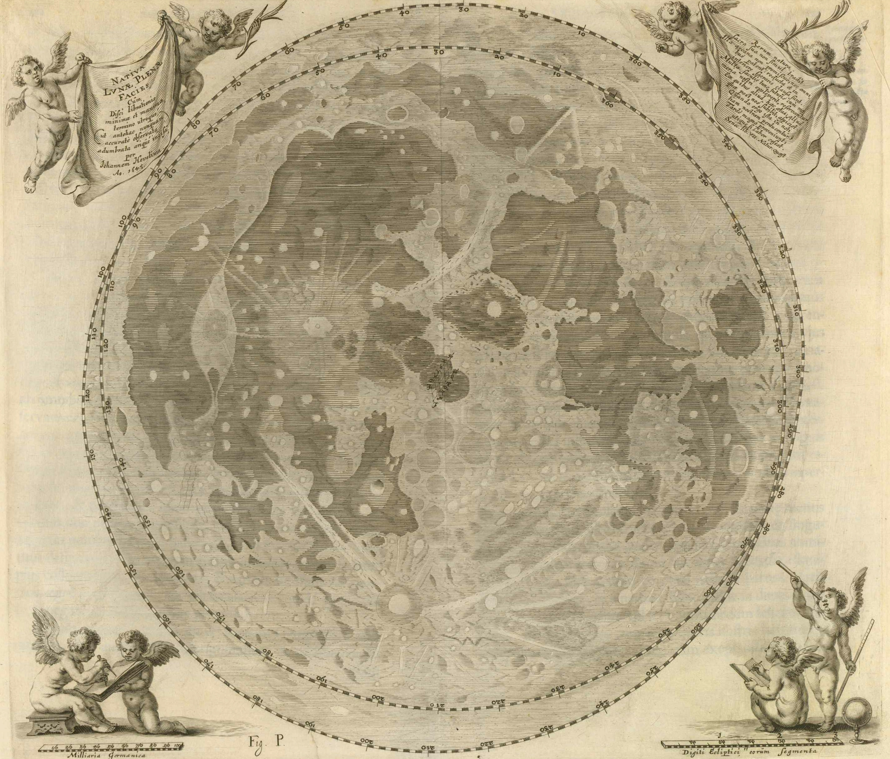
Selenographica, Caput VIII. Source (e-rara)
1696
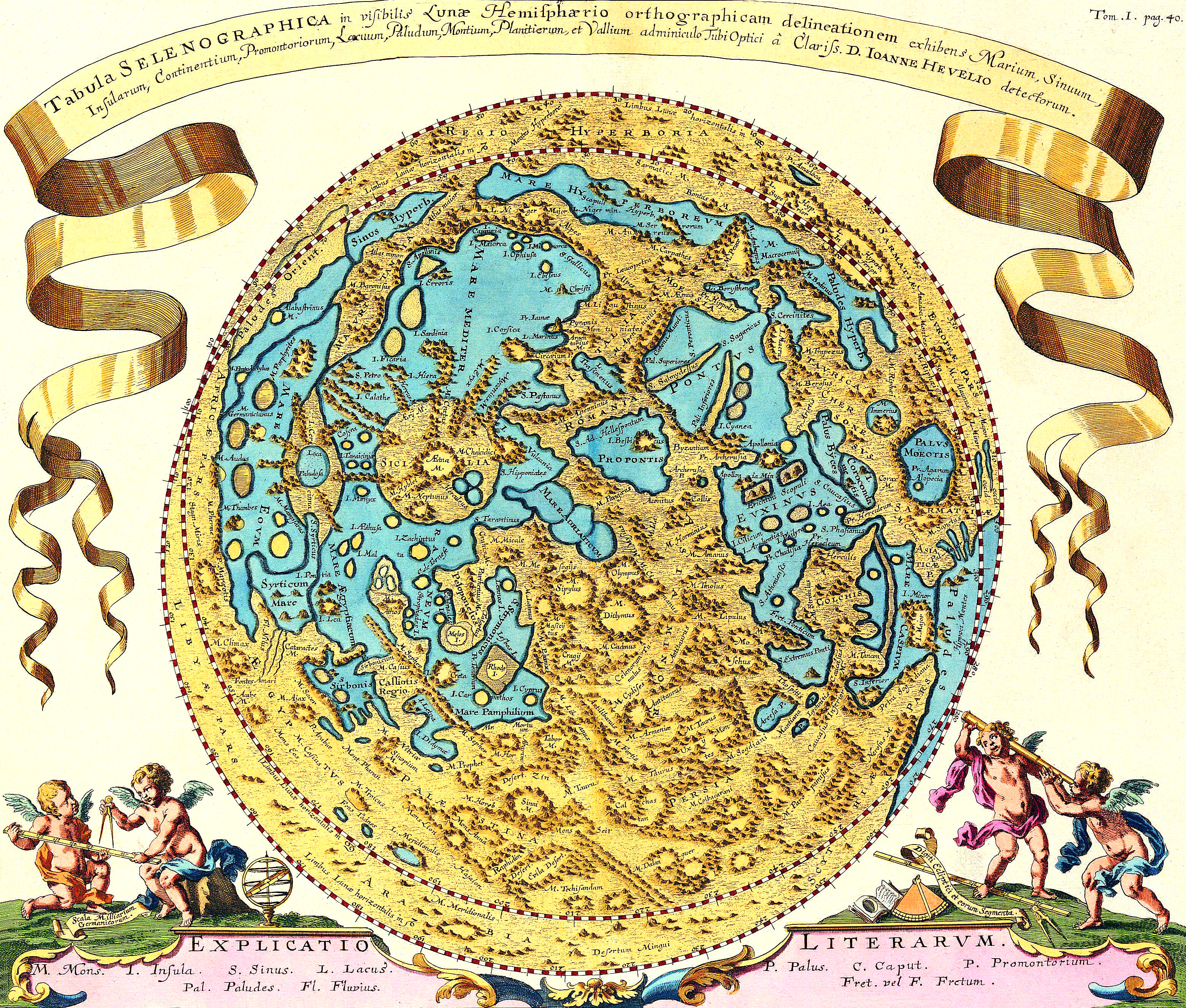
Joanne Zahn (1696) Specula physico-mathematico-historica notabilium ac mirablium sciendorum in qua MUNDI MIRABILIS OECONOMIA. Plate: Tom. 1, page 40. Norimbergae [Nuremberg] ; sumptibus Joannis Christophori Lochner bibliopolae. Literis Knorzianis. (original in black and white, in Linda Hall Library)
Lunatio Crescens
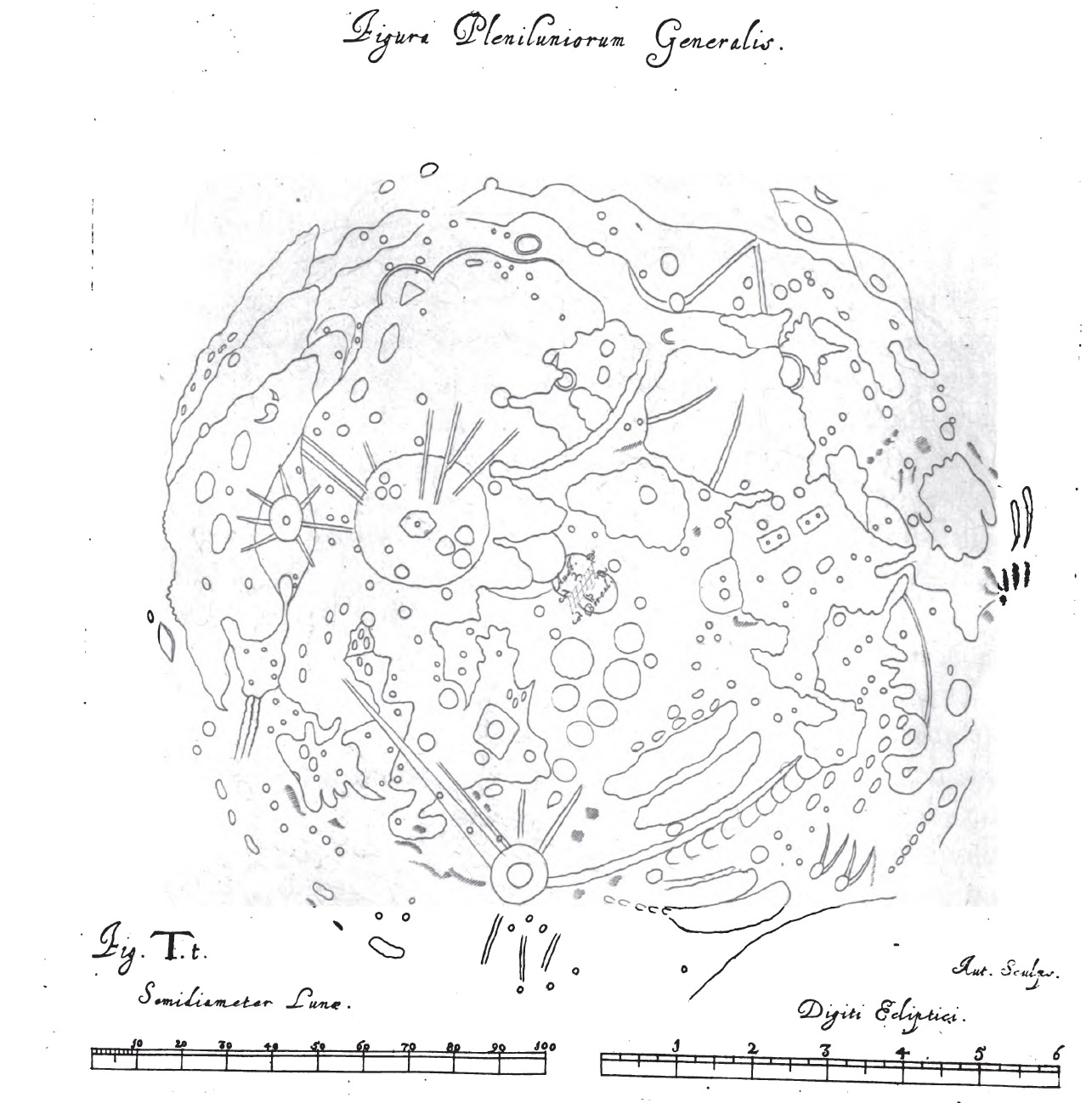
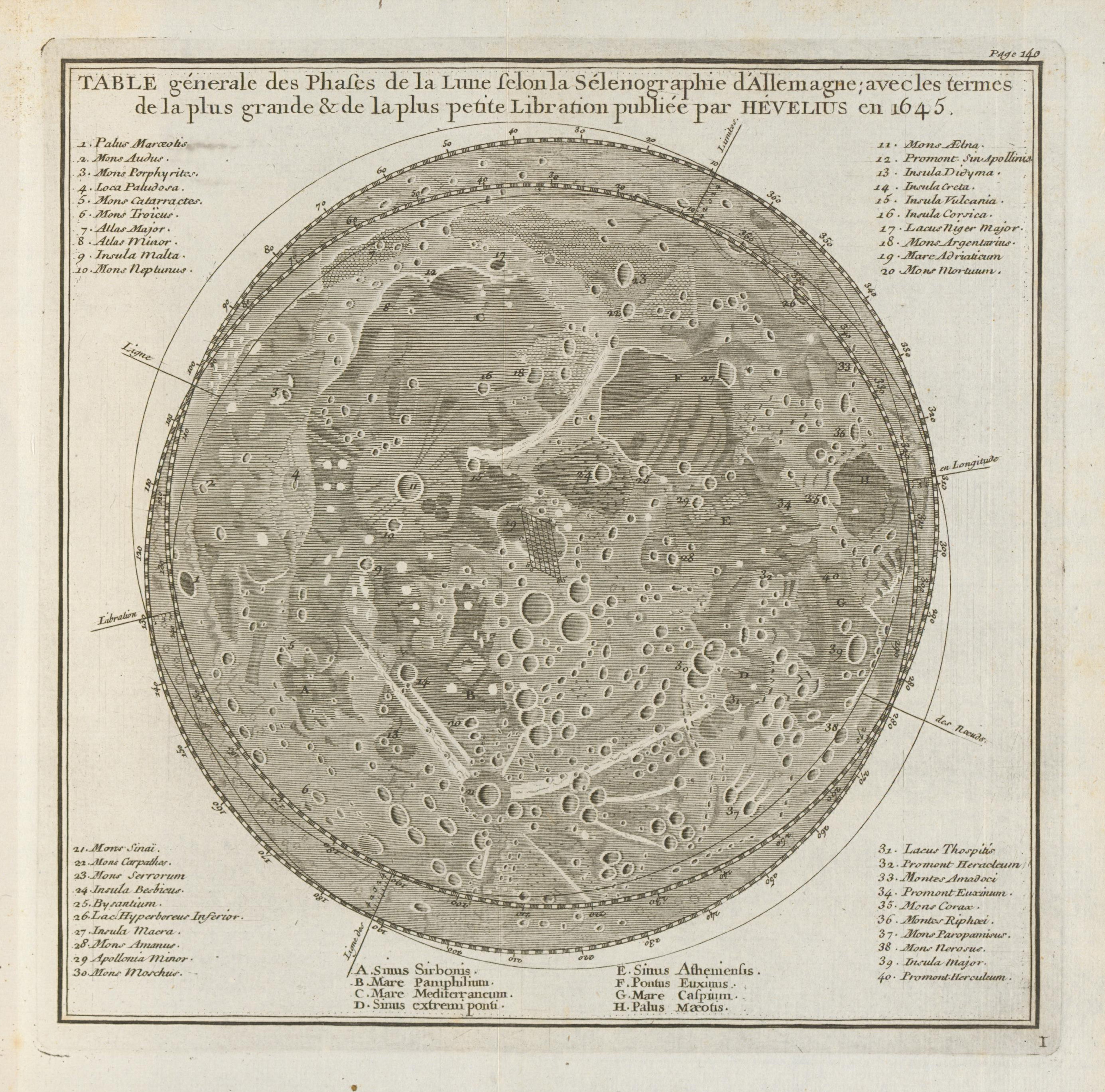
General chart of the full moon (Selenographica, appendix)
Lunar Coordinates (related to zodiacal signs) – rotatable disk (the purple line is a string around which the inner disk can be rotated)
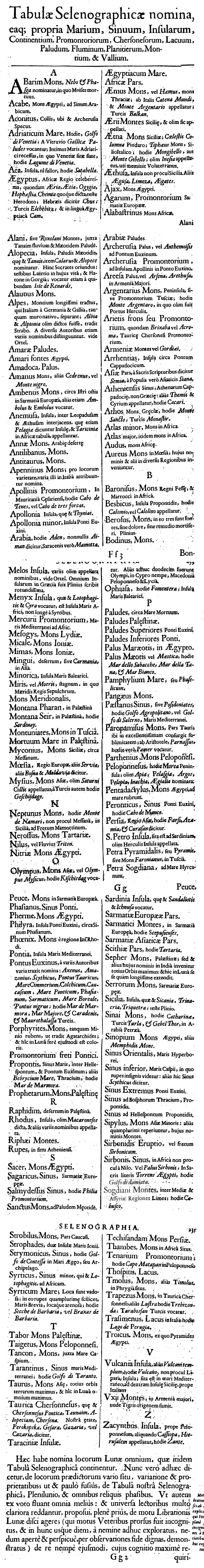
Index of names (detail)
1723
Rost, J.L. 1723; Atlas portatilis coelestis oder compendiöse Vorstellung des gantzen Welt-Gebäudes; Nürnberg/Weigel
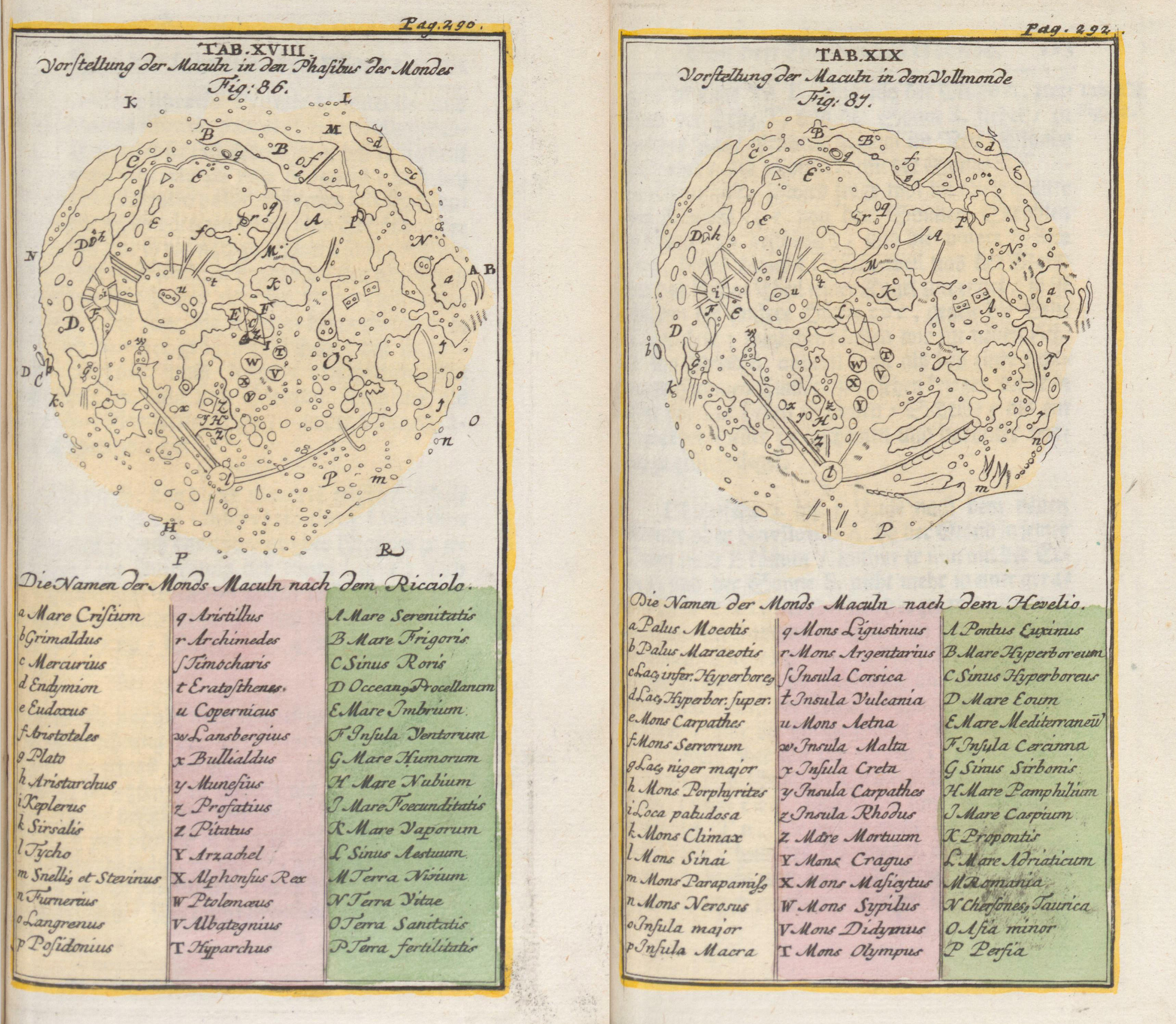
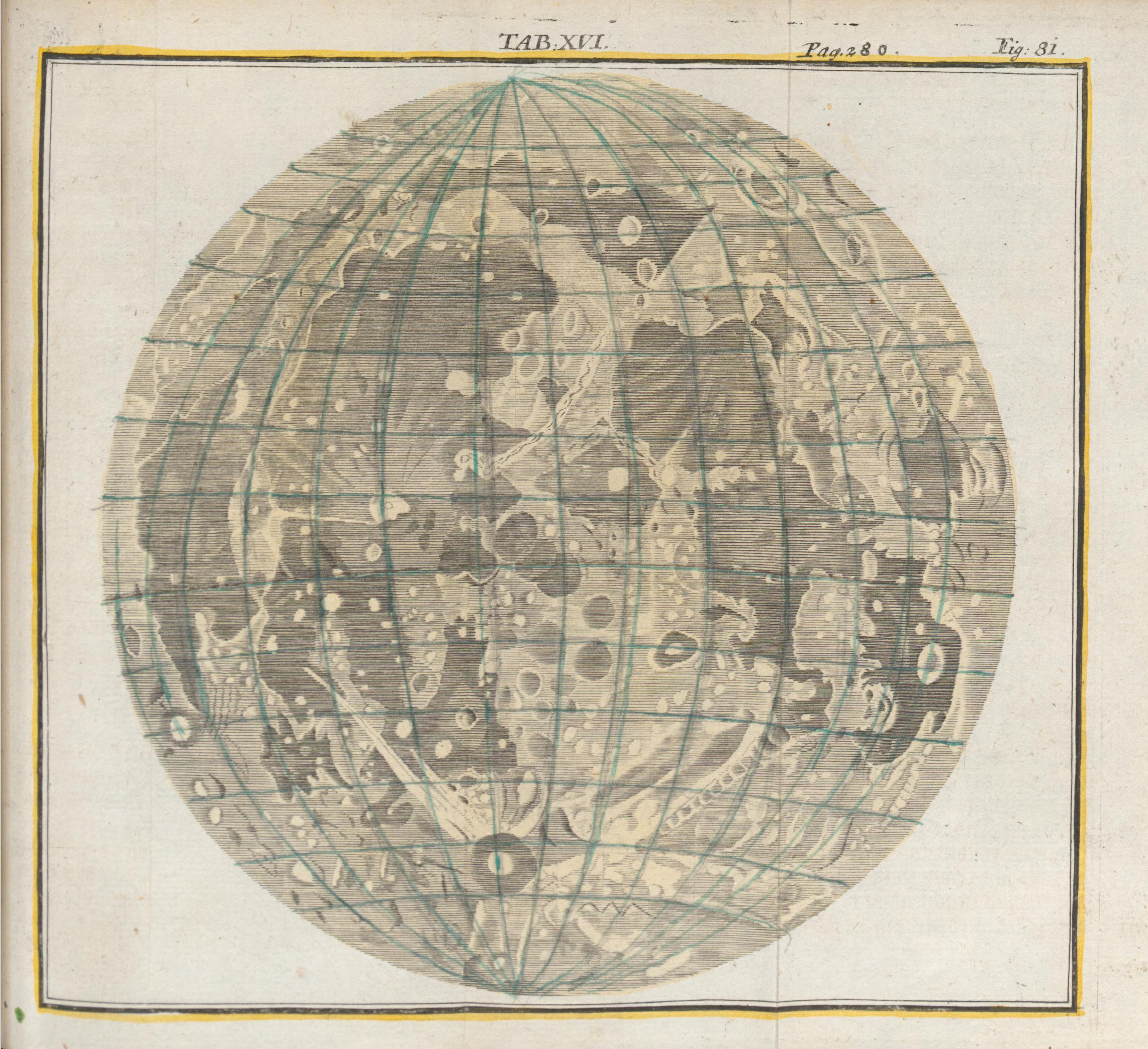
Image courtesy of Ton Lindemann.
1746
Map of Hevelius, re-drawn by Lemonnier, C.P. 1746; Institutions astronomiques, Paris
Image courtesy of Ton Lindemann.
See also Double map
See also Derham
