
Beer and Mädler’s Moon Map
‘Mondoberflaeche’ (‘Surface of the Moon’)
Die sichtbare Seite der Mond-Oberfläche bei voller Beleuchtung (The visible side of the moon’s surface with full lighting)
Hemispherical map of the Moon.
Nach Beer u. Madler’s Karte. (Based on Beer and Madler’s map)
Simplified from the Moon maps published in ‘Mappa Selenographica’ written by Wilhelm Beer and Johann Heinrich Madler (1794-1874) in Berlin, Germany, 1837
Nomenclature: German/Latin
Johann Heinrich von Madler
Scale [ca. 1:46 000 000]
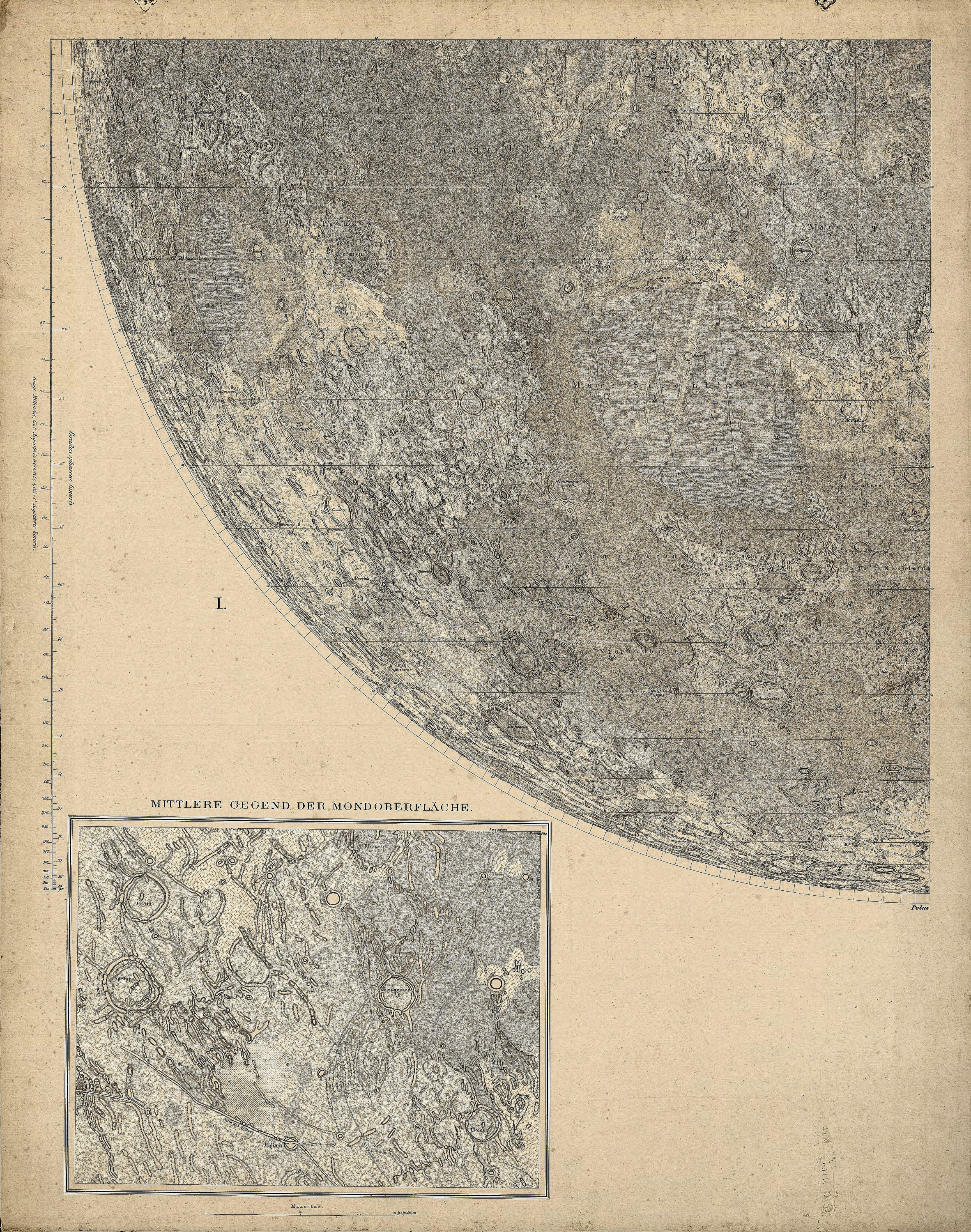
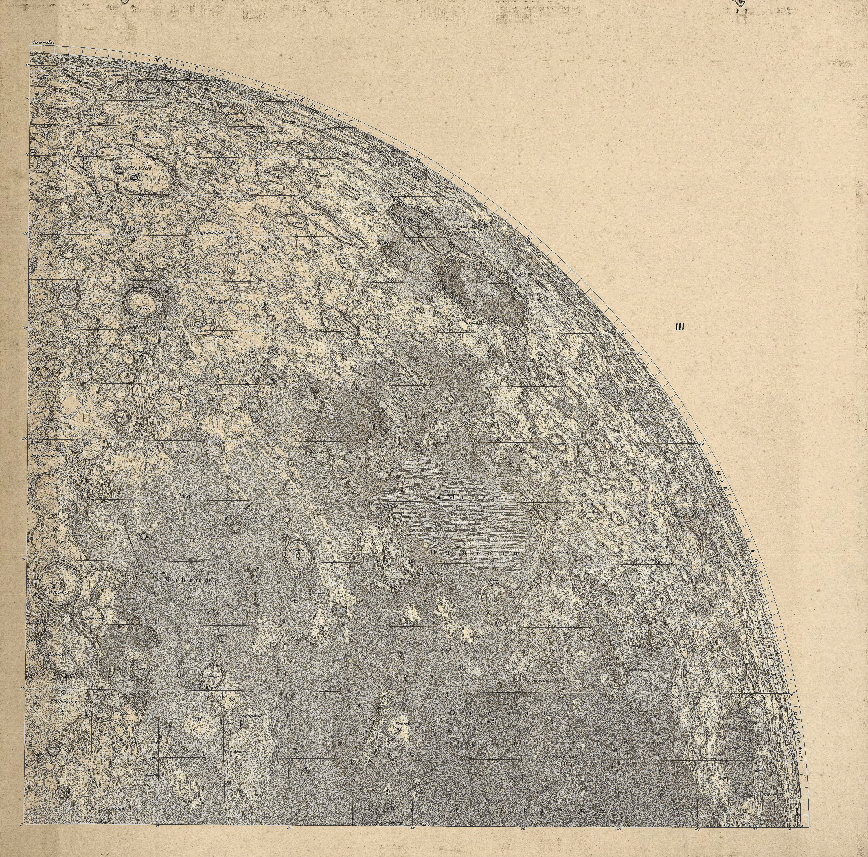
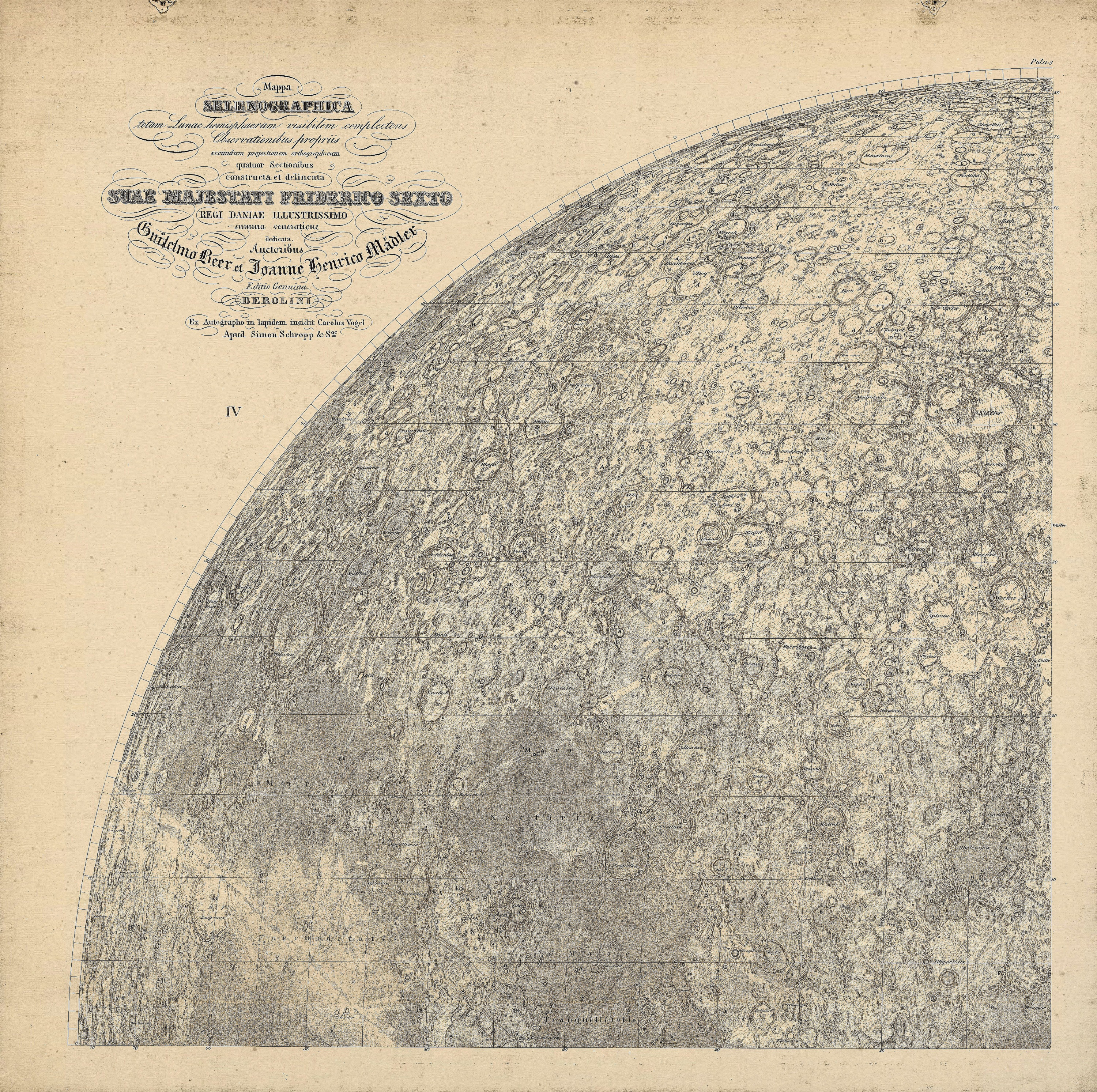
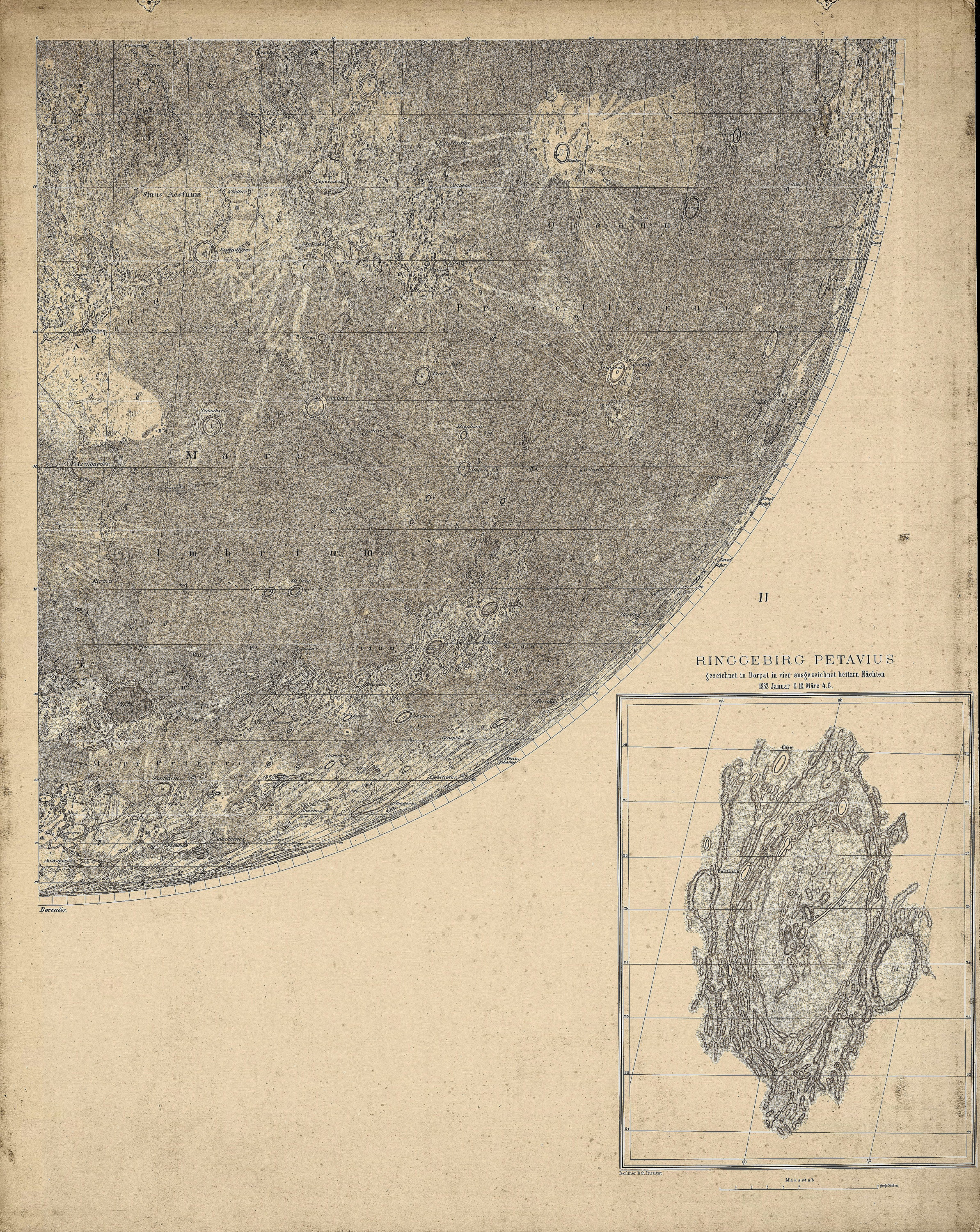
Four-part 1834 edition (courtesy Ton Lindemann)

The 12-part 1834 Edition (From Stanford University). Mappa Selenographica. Berolini, Carlus Vogel, Simon Schropp.
1837 edition (courtesy Ton Lindemann)
Further Editions:
- 1844 Vollständiger Hand-Atlas der neueren Erdbeschreibung ueber alle Theile der Erde : in 80 Blättern / herausgegeben von K. Sohr (turned north up)
- Stieler’s Hand Atlas 1841. (monochormatic) Steel engraved Johann Carl Ausfeld, engr.
- Stieler’s Hand-Atlas. Justus Perthes.. Gotha. 1870. Color lithograph. 16 x 13.8″.
- Adolf Stieler, Gotha, 1872 (also in 1882). NOT in 1891.
- In lower left margin: Gotha : Justus Perthes 1876., 27.5 cm. diam., on sheet 38.3 x 46.0 cm.
Stieler’s Hand-Atlas. 1880. High resolution scan.
- Plate no. 5 from: Stieler’s Hand-Atlas. Gotha : J. Perthes, [1877?]
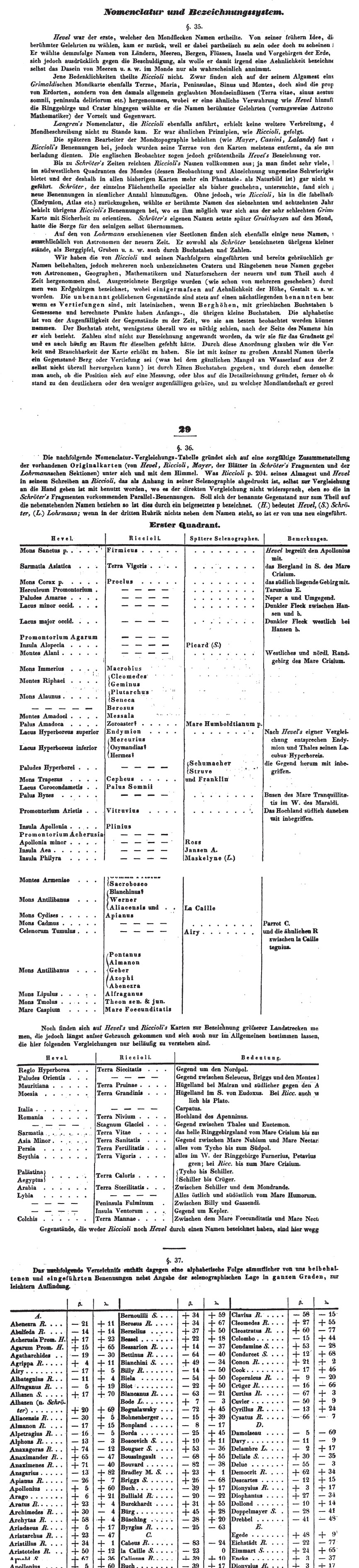
Nomenclature (detail) from Der Mond (1837 Berlin)
Original maps: http://the-moon.wikispaces.com/Beer+and+M%C3%A4dler
