

The Catalog of Planetary Maps.
Sources: The research that led to this catalog was supported by Fulbright Hungary Grant No. 1222202, awarded to H. Hargitai for research at USGS Astrogeology, Flagstaff, Arizona (advisor: Trent Hare), and by the ICA Commission on Planetary Cartography (advisor: Kira Shingareva). Most of the data is based on the inventory of the map library of USGS Astrogeology.
Copyright and Use Notice: Published U.S. Geological Survey and U.S. Air Force maps are generally in the public domain. Some maps reproduced or displayed on this site may be protected by copyright.
This website includes thumbnail images or excerpts of maps for identification, documentation, research, and educational purposes only. These uses are believed to qualify as fair use under U.S. copyright law. Full-resolution copyrighted maps are not hosted unless explicit permission has been obtained or the material is confirmed to be in the public domain.
The inclusion of any map or photograph in this catalog does not imply that it is free of copyright restrictions. Responsibility for determining copyright status and obtaining necessary permissions rests entirely with the user.
If you are a copyright holder and believe material on this site is used inappropriately, please contact the curator (hargitai.henrik@btk.elte.hu) with details so we can review and address your concerns promptly.
Photos: Unless otherwise indicated, all photographs are by H. Hargitai. Several photographs are from the USGS Astrogeology Map Library and Lowell Observatory, both in Flagstaff, Arizona. Several photographs of Soviet maps were taken at MIIGAiK, Moscow.
Contact: The catalog is curated by H. Hargitai, ELTE, Budapest, hargitai.henrik@btk.elte.hu.
Карта участка поверхности Марса (кратер Табор)
Karta uchastka poverkhnosti Marsa (krater Tabor)
Map of a section of the surface of Mars (Tabor crater)
Mars — map
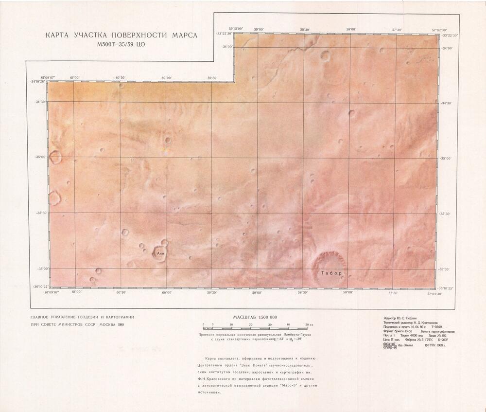
Soviet Mars probes were not a success story. Mars 1, 2, 3, 4, 5 was sentout but Mars-1 was too far from Mars with no useful information, 2 and 3 became Mars satellites but only gave limb images, no surface photos. Mars-4 had 20 low resolution (1 km/px) images. The most succesful probe was Mars 5 oribiting around Mars, which gave about 100 images in ~100 m/px resolution, so it was possible to make maps using those images. These maps were made in TSNIIKAiK (Central Institute for Geodesy and Cartography).

Karta Utsastka Poverhnosti Marsa
Moskva 1980
1:500 000
using Mars-5 images
centered 40E 35S
GUGK?