|
#1419
|
|
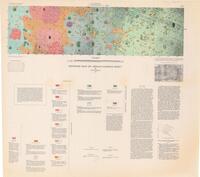
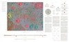
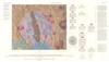
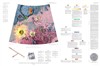
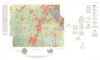
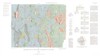
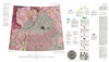
Copernicus Peaks Traverse maps |
|
|
|
Moon |
|
|
1969 |
Bellcomm Inc |
|
#1420
|
 |
Denoyer-Geppert Lunar Globe Publisher: Chicago : Denoyer-Geppert
Date: 1969
References:
http://data.onb.ac.at/rec/AC04849564 |
|
|
|
Moon |
|
|
1969 |
Denoyer-Geppert |
|
#1422
|
|
ESSO Map of the Moon |
|
|
|
Moon |
|
|
1969 |
CS. Hammond and CO. Mapplewood NJ |
|
#1423
|
|
Fra Mauro Lunar Photomap |
|
|
|
Moon |
LAC 76 |
|
1969 |
|
|
#1424
|
|
Geologic Map of Apollo Landing Site 2 Part of Sabine D Region, Lunar Orbiter Site II P-6, Southwestern Mare Tranquillitatis Map Set |
|
Grolier, Maurice J. |
|
Moon |
LAC 60 |
|
1969 |
|
|
#1425
|
|
Geologic Map of Apollo Landing Site 5 Part of Maestlin G Region, Oceanus Procellarum |
I-623 [ORB 2 - 13 (25) |
Titley, Spencer Rowe |
|
Moon |
|
25k |
1969 |
U. S. Geological Survey |
|
#1426
|
|
Geologic Map of Apollo Landing Site 7 |
Orb III P-9 |
Cannon, P. Jan |
|
Moon |
LAC 76 |
25k |
1969 |
|
|
#1427
|
|
Geologic map of Lunar Orbiter site III P-12, Oceanus Procellarum, south of equator in Flamsteed P |
Orb III P-12, I-708 |
Offield, Terry W. |
|
Moon |
|
100k |
1969 |
U. S. Geological Survey |
|
#1428
|
|
Geologic Map of the Alphonsus GA Region of the Moon |
I-586 |
McCauley, John F. |
|
Moon |
|
50k |
1969 |
U. S. Geological Survey |
|
#1429
|
|
Geologic Map of the Alphonsus Region of the Moon |
I-599 |
Carr, Michael H. |
|
Moon |
|
250k |
1969 |
U. S. Geological Survey |
|
#1430
|
|
Geologic Map of the J. Herschel Quadrangle of the Moon |
I-604 |
Ulrich, George E. |
|
Moon |
LAC 11 |
1M |
1969 |
U. S. Geological Survey |
|
#1431
|
|
Geologic Map of the Lansberg P Region of the Moon |
|
Pohn, Howard A. |
|
Moon |
LAC 76 |
|
1969 |
|
|
#1432
|
|
Geologic Map of the Maestlin G Region of the Moon Lunar Orbiter Site II P-13, Oceanus Procellarum Including Apollo Landing Site 5 |
I-622 [ORB 2 - 13 (100)] |
Carr, Michael H. |
|
Moon |
|
100k |
1969 |
U. S. Geological Survey |
|
#1433
|
|
Geologic Map of the Mare Undarum Quadrangle of the Moon making set |
|
Colton, Roger B. |
|
Moon |
|
|
1969 |
|
|
#1434
|
|
Geologic Map of the Sabine DM Region of the Moon |
I-594 |
Trask, Newell J. |
|
Moon |
|
50k |
1969 |
U. S. Geological Survey |
|
#1435
|
|
Geologic Map of the Sinus Iridium Quadrangle of the Moon |
I-602 |
Schaber, Gerald G. |
|
Moon |
LAC 24 |
1M |
1969 |
U. S. Geological Survey |
|
#1436
|
|
Geologic Sketch of the Rima Bode Region |
V-122M |
Trask, Newell J. |
|
Moon |
|
|
1969 |
|
|
#1437
|
|
Geologic-Morphologic map and profile of the region of the cirque Archimedes and the mountanious Apennine massif |
|
Sukhanov, A. C. |
|
Moon |
|
|
1969 |
|
|
#1438
|
|
Geology of the Copernicus Peaks and Original Science Mission |
|
Wilshire, H. G. |
|
Moon |
|
|
1969 |
Bellcomm Inc |
|
#1439
|
|
Geology of the Hadley-Apennines and Original Science Mission |
|
El-Baz, Farouk |
|
Moon |
|
|
1969 |
Bellcomm Inc |
|
#1440
|
|
Geology of the Marius Hills and Original Science Mission |
|
McCauley, John F. |
|
Moon |
|
|
1969 |
Bellcomm Inc |
|
#1441
|
|
Hadley-Apennine Traverse maps |
|
|
|
Moon |
LAC 41 |
|
1969 |
Bellcomm Inc |
|
#1442
|
|
Index of photographic coverge for Lunar Orbiter Missions I, II, III and V |
|
Beeler, M. |
|
Moon |
Lunar Orbiter |
|
1969 |
National Aeronautics and Space Administration |
|
#1443
|
|
LAC 110 Relief |
|
|
Dungan, Tom |
Moon |
LAC 110 |
1M |
1969 |
|
|
#1444
|
|
Landing site sketch map |
|
|
|
Moon |
LAC 60 |
|
1969 |
|
|
#1446
|
|
LM Descent monitoring chart, Landing site No2, 4 sheets |
LDM |
|
|
Moon |
LAC 60 |
|
1969 |
US Air Force, Aeronautical Chart and Information Center |
|
#1447
|
|
LM Descent Monitoring Charts |
|
|
|
Moon |
|
|
1969 |
|
|
#1448
|
|
LMP-1 Earthside Relief Plate |
3CSBB-BH4 |
|
|
Moon |
|
5M |
1969 |
|
|
#1449
|
|
LMP-2 Farside Relief Plate |
3CSBB-BH5 |
|
|
Moon |
|
|
1969 |
|
|
#1450
|
|
Lunar Earthside Chart (LEC-1) |
LEC-1 |
|
|
Moon |
Moon, near side |
|
1969 |
|
|
#1451
|
|
Lunar Earthside Hemisphere, sheet 2 of 2 |
LEM-1-B |
|
|
Moon |
|
2.5M |
1969 |
|
|
#1452
|
|
Lunar Equatorial Zone Mosaic - Earthside |
LEMC-1 |
|
|
Moon |
|
2.5M |
1969 |
U.S. Army Topographic Command |
|
#1453
|
|
Lunar Equatorial Zone Mosaic - Eastern Limb |
LEMC-2 |
|
|
Moon |
|
2.5M |
1969 |
U.S. Army Topographic Command |
|
#1454
|
|
Lunar Equatorial Zone Mosaic - Farside |
LEMC-3 |
|
|
Moon |
|
2.5M |
1969 |
U.S. Army Topographic Command |
|
#1455
|
|
Lunar Equatorial Zone Mosaic - Western Limb |
LEMC-4 |
|
|
Moon |
|
2.5M |
1969 |
U.S. Army Topographic Command |
|
#1457
|
|
Lunar Landing Area Geology Maps (1 map) |
LAM-G |
|
|
Moon |
|
100k |
1969 |
|
|
#1456
|
|
Lunar Landing Area Geology Maps (1 map) |
LAM-G |
|
|
Moon |
LAC 60 |
100k |
1969 |
|
|
#1458
|
|
Lunar Landing Area Geology Maps (1) |
LAM-G 7 |
Karlstrom, Thor N. V. |
|
Moon |
LAC 76 |
100k |
1969 |
|
|
#1460
|
|
Lunar Landing area maps (1 map) |
LAM |
|
|
Moon |
|
100k |
1969 |
|
|
#1459
|
|
Lunar Landing Area Maps (1 map) |
LAM 7 |
Karlstrom, Thor N. V. |
|
Moon |
LAC 76 |
100k |
1969 |
|
|
#1461
|
|
Lunar Landing Site Geology maps (1 map) |
LSM-G |
|
|
Moon |
|
25k |
1969 |
|
|
#1463
|
|
Lunar Landing Site Geology Maps (3 maps) |
LSM-G 7 |
Karlstrom, Thor N. V. |
|
Moon |
LAC 76 |
25k |
1969 |
|
|
#1462
|
|
Lunar Landing Site Geology maps (3 maps) |
LSM-G |
|
|
Moon |
LAC 60 |
25k |
1969 |
|
|
#1465
|
|
Lunar Landing Site Maps (3 maps) |
LSM 7 |
Karlstrom, Thor N. V. |
|
Moon |
LAC 76 |
25k |
1969 |
|
|
#1464
|
|
Lunar Landing Site maps (3 maps) |
LSM |
|
|
Moon |
|
25k |
1969 |
|
|
#1467
|
|
Lunar Orbiter I Photographic coverage Near Side, Lunar Orbiter I Photo Index Near Side |
|
|
|
Moon |
|
10M |
1969 |
US Air Force, Aeronautical Chart and Information Center |
|
#1466
|
|
Lunar Orbiter I Photographic coverage Near Side, Lunar Orbiter I Photo Index Near Side |
|
|
|
Moon |
|
10M |
1969 |
NASA National Space Science Data Center |
|
#1470
|
|
Lunar Orbiter II Photographic coverage Near Side, Lunar Orbiter II Photo Index Near Side |
|
|
|
Moon |
|
|
1969 |
|
|
#1469
|
|
Lunar Orbiter II Photographic coverage Near Side, Lunar Orbiter II Photo Index Near Side |
|
|
|
Moon |
|
10M |
1969 |
US Air Force, Aeronautical Chart and Information Center |
|
#1468
|
|
Lunar Orbiter II Photographic coverage Near Side, Lunar Orbiter II Photo Index Near Side |
|
|
|
Moon |
|
10M |
1969 |
NASA National Space Science Data Center |