|
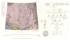
#1131
|
|
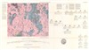
Preliminary Geologic Map of Lunar Orbiter Site II P-2 |
|
Carr, Michael H. |
|
Moon |
|
100k |
1967 |
U. S. Geological Survey |
|
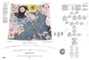
#1155
|
|
Preliminary Photogeologic Map of the Sabine Region of the Moon |
|
Wilshire, H. G. |
|
Moon |
|
250k |
1967 |
U. S. Geological Survey |
|
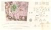
#1154
|
|
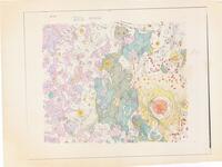
Preliminary Photogeologic Map of the Sabine Region of the Moon |
|
Wilshire, H. G. |
|
Moon |
|
250k |
1967 |
U. S. Geological Survey |
|
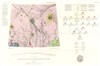
#807
|
 |
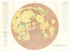
Geologic Map of the Mare Serenitatis Region of the Moon |
I-489 |
Carr, Michael H. |
|
Moon |
LAC 42 |
1M |
1966 |
U. S. Geological Survey |
|
#808
|
|
Geologic Map of the Montes Apenninus Region of the Moon |
I-463 |
Hackman, Robert J. |
|
Moon |
LAC 41 |
1M |
1966 |
U. S. Geological Survey |
|
#809
|
|
Geologic Map of the Pitatus Region of the Moon |
I-485 |
Trask, Newell J. |
|
Moon |
LAC 94 |
1M |
1966 |
U. S. Geological Survey |
|
#737
|
|
Geologic Map and Section of the Timocharis Region of the Moon |
I-462 |
Carr, Michael H. |
|
Moon |
LAC 40 |
1M |
1965 |
U. S. Geological Survey |
|
#739
|
|
Geologic Map of the Riphaeus Mountains Region of the Moon |
I-458 |
Eggleton, Richard E. |
|
Moon |
LAC 76 |
1M |
1965 |
U. S. Geological Survey |
|
#752
|
|
Lunar Orbiter Site I maps: Relief map showing outlines of high and low resolution photo coverage, Geologic and relief map, Slope-statistics subareas |
|
Offield, Terry W. |
|
Moon |
Lunar Orbiter pre-fligh |
500k |
1965 |
U. S. Geological Survey |
|
#673
|
|
Map of the Flamsteed area |
|
McCauley, John F. |
|
Moon |
|
1M |
1964 |
U. S. Geological Survey |
|
#687
|
|
Preliminary Geologic Map of the Pitatus Quadrangle of the Moon |
|
Titley, Spencer Rowe |
|
Moon |
LAC 94 |
|
1964 |
U. S. Geological Survey |
|
#689
|
|
Preliminary geologic map of the Theophilus Quadrangle of the Moon |
|
Milton, Daniel J. |
|
Moon |
LAC 78 |
1M |
1964 |
U. S. Geological Survey |
|
#718
|
|
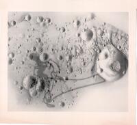
Topographic map of part of area covered in last photograph transmitted by Ranger VII |
|
|
|
Moon |
|
|
1964 |
U. S. Geological Survey |
|
#578
|
|
Geologic Map and Sections of the Letronne Region of the Moon |
I-385 |
Marshall, Charles H. |
|
Moon |
LAC 75 |
1M |
1963 |
U. S. Geological Survey |
|
#527
|
|
Geologic Map and Sections of the Kepler Region of the Moon |
I-355 |
Hackman, Robert J. |
|
Moon |
LAC 57 |
1M |
1962 |
U. S. Geological Survey |
|
#477
|
|
Description and evaluation of the physiographic regions - Engineer Special Study of the Surface of the Moon |
I-351 |
Hackman, Robert J. |
|
Moon |
Moon near side |
|
1961 |
U. S. Geological Survey |
|
#480
|
|
Generalized Photogeologic Map of the Moon - Engineer special study of the surface of the Moon |
I-351 |
Hackman, Robert J. |
|
Moon |
|
3.8M |
1961 |
U. S. Geological Survey |
|
#486
|
|
Lunar Rays - Engineer Special Study of the Surface of the Moon |
I-351 |
Hackman, Robert J. |
|
Moon |
|
3.8M |
1961 |
U. S. Geological Survey |
|
#493
|
|
Physiographic Divisions of the Moon - Engineer Special Study of the Surface of the Moon "first printing July 1960" |
I-351 |
Hackman, Robert J. |
|
Moon |
|
3.8M |
1961 |
U. S. Geological Survey |
|
#5830
|
|
Apollo 11 landing site outlines, unlabeled, untitled |
|
|
|
Moon |
LAC 60 |
|
|
U. S. Geological Survey |
|
#5831
|
|
Apollo 11 landing site shaded relief base |
|
|
Bridges, Patricia M. |
Moon |
LAC 60 |
|
|
U. S. Geological Survey |
|
#5833
|
|
Apollo 11 left window panorama pre-EVA |
|
|
|
Moon |
LAC 60 |
|
|
U. S. Geological Survey |
|
#5835
|
|
Apollo 11, 12, 14 traverses |
|
|
|
Moon |
|
250k |
|
U. S. Geological Survey |
|
#6248
|
|
Lunar surface albedo |
|
Pohn, Howard A. |
|
Moon |
|
5M |
|
U. S. Geological Survey |
|
#6772
|
|
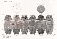
Map Showing Relief and Surface Markings of the Lunar Polar Regions nomenclature overlay |
|
|
|
Moon |
|
|
(1981) |
U. S. Geological Survey |
|
#6295
|
|
Margaritifer Sinus MC-19 Controlled Photomosaic |
|
|
|
Mars |
MC-19 |
|
|
U. S. Geological Survey |
|
#6303
|
|
Mars Chart |
|
|
|
Mars |
|
|
|
U. S. Geological Survey |
|
#6348
|
|
MC-16 Mosaic Map Folder (Controlled) |
|
|
|
Mars |
MC-16 |
|
|
U. S. Geological Survey |
|
#6350
|
|
MC-16 Shaded Relief Materials |
|
|
|
Mars |
MC-16 |
|
|
U. S. Geological Survey |
|
#6356
|
|
MC-18 Mosaic Map Folder (Controlled) |
|
|
|
Mars |
MC-18 |
|
|
U. S. Geological Survey |
|
#6462
|
|
Preliminary Geologic Map of the Timocharis Quadrangle of the Moon Map Set |
|
Carr, Michael H. |
|
Moon |
|
1M |
|
U. S. Geological Survey |
|
#6485
|
|
Preliminary topographic map of area visible from LM windows at Apollo XI landing site |
|
Nakata, Garry M. |
|
Moon |
LAC 60 |
|
|
U. S. Geological Survey |
|
#6487
|
|
Preliminary Topographic Map of the Greenaway Region of Venus |
|
|
|
Venus |
|
1.5M |
|
U. S. Geological Survey |
|
#6488
|
|
Preliminary Topographic Map of the Joliot Cure Region of Venus |
|
|
|
Venus |
|
1.5M |
|
U. S. Geological Survey |
|
#6489
|
|
Preliminary Topographic Map of the Joliot Cure Region of Venus, stereo Dem merged with Magellan altimetry |
|
|
|
Venus |
|
1.5M |
|
U. S. Geological Survey |
|
#6620
|
|
The Apollo 11 Landing Site |
|
Larson, K. B. |
Bridges, Patricia M. |
Moon |
LAC 60 |
200 |
|
U. S. Geological Survey |
|
#6621
|
|
The Apollo 11 Landing Site Selected lineament patterns, crater ages, and inferred ejecta blankets |
T-65253G |
Larson, K. B. |
Bridges, Patricia M. |
Moon |
LAC 60 |
200 |
|
U. S. Geological Survey |
|
#6653
|
|
Topographic map of Venus (with ground track dates) |
|
|
|
Venus |
|
50M |
|
U. S. Geological Survey |
|
#6670
|
|
USGS Mars Chart |
|
|
|
Mars |
|
|
|
U. S. Geological Survey |