Production_technique: lithography
6 maps
#361
Map 361
#119
 Karte der sichtbaren Seite der Mond-Oberfläche
1: 18 000 000
#101
Karte des Mondes in einem mittleren Librationzustand
#102
Karte des Mondes. Mittlere Libration. Map of the Moon in a mean state of libration. Carte de la Lune, dans l'etat de moyenne libration
1: 8 980 000
#93
Nach der Natur und mit Benützung der Schrötter'schen Special-Karten auf der K. K. Sternwarte in Wien, unter der Leitung des Herrn Direktors und Professors der Astronomie J. J. Littrow, gezeichnet von Albert Richard von 1819 bis 1830, und in Stein gestochen von demselben
#87
Mondkarte
Karte der sichtbaren Seite der Mond-Oberfläche
1: 18 000 000
#101
Karte des Mondes in einem mittleren Librationzustand
#102
Karte des Mondes. Mittlere Libration. Map of the Moon in a mean state of libration. Carte de la Lune, dans l'etat de moyenne libration
1: 8 980 000
#93
Nach der Natur und mit Benützung der Schrötter'schen Special-Karten auf der K. K. Sternwarte in Wien, unter der Leitung des Herrn Direktors und Professors der Astronomie J. J. Littrow, gezeichnet von Albert Richard von 1819 bis 1830, und in Stein gestochen von demselben
#87
Mondkarte
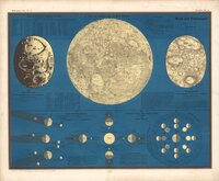 Karte der sichtbaren Seite der Mond-Oberfläche
1: 18 000 000
#101
Karte der sichtbaren Seite der Mond-Oberfläche
1: 18 000 000
#101
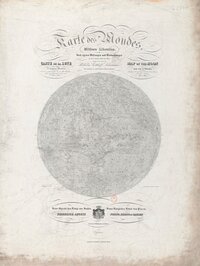 Karte des Mondes in einem mittleren Librationzustand
#102
Karte des Mondes in einem mittleren Librationzustand
#102
 Karte des Mondes. Mittlere Libration. Map of the Moon in a mean state of libration. Carte de la Lune, dans l'etat de moyenne libration
1: 8 980 000
#93
Karte des Mondes. Mittlere Libration. Map of the Moon in a mean state of libration. Carte de la Lune, dans l'etat de moyenne libration
1: 8 980 000
#93
 Nach der Natur und mit Benützung der Schrötter'schen Special-Karten auf der K. K. Sternwarte in Wien, unter der Leitung des Herrn Direktors und Professors der Astronomie J. J. Littrow, gezeichnet von Albert Richard von 1819 bis 1830, und in Stein gestochen von demselben
#87
Nach der Natur und mit Benützung der Schrötter'schen Special-Karten auf der K. K. Sternwarte in Wien, unter der Leitung des Herrn Direktors und Professors der Astronomie J. J. Littrow, gezeichnet von Albert Richard von 1819 bis 1830, und in Stein gestochen von demselben
#87
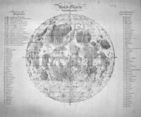 Mondkarte