Place_publication: Gotha
12 maps
#4241
 Mars.Marsmonde.
1: 23 500 000
#3869
Erdmond
1: 12 000 000
#162
Die sichtbare Seite der Mond-Oberfläche bei voller Beleuchtung : nach Beer u. Mädler's Karte
#150
Mondoberfläche
#145
Die sichtbare Seite der Mond-Oberfläche bei voller Beleuchtung : nach Beer u. Mädler's Karte
#146
Mondoberfläche
#137
Die sichtbare Seite der Mond-Oberfläche bei voller Beleuchtung : nach Beer u. Mädler's Karte
1: 13 000 000
#138
Mondoberfläche
#135
Die sichtbare Seite der Mond-Oberfläche bei voller Beleuchtung : nach Beer u. Mädler's Karte
#136
Mondoberfläche
#116
Die sichtbare Seite der Mond-Oberfläche bei voller Beleuchtung : nach Beer u. Mädler's Karte. Ausgabe in 63 B1 No1
1: 46 000 000
#105
Die sichtbare Seite der Mond-Oberfläche bei voller Beleuchtung : nach Beer u. Mädler's Karte. Ausgabe in 63 B1 No1
1: 46 000 000
Mars.Marsmonde.
1: 23 500 000
#3869
Erdmond
1: 12 000 000
#162
Die sichtbare Seite der Mond-Oberfläche bei voller Beleuchtung : nach Beer u. Mädler's Karte
#150
Mondoberfläche
#145
Die sichtbare Seite der Mond-Oberfläche bei voller Beleuchtung : nach Beer u. Mädler's Karte
#146
Mondoberfläche
#137
Die sichtbare Seite der Mond-Oberfläche bei voller Beleuchtung : nach Beer u. Mädler's Karte
1: 13 000 000
#138
Mondoberfläche
#135
Die sichtbare Seite der Mond-Oberfläche bei voller Beleuchtung : nach Beer u. Mädler's Karte
#136
Mondoberfläche
#116
Die sichtbare Seite der Mond-Oberfläche bei voller Beleuchtung : nach Beer u. Mädler's Karte. Ausgabe in 63 B1 No1
1: 46 000 000
#105
Die sichtbare Seite der Mond-Oberfläche bei voller Beleuchtung : nach Beer u. Mädler's Karte. Ausgabe in 63 B1 No1
1: 46 000 000
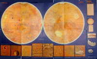 Mars.Marsmonde.
1: 23 500 000
#3869
Mars.Marsmonde.
1: 23 500 000
#3869
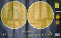 Erdmond
1: 12 000 000
#162
Die sichtbare Seite der Mond-Oberfläche bei voller Beleuchtung : nach Beer u. Mädler's Karte
#150
Erdmond
1: 12 000 000
#162
Die sichtbare Seite der Mond-Oberfläche bei voller Beleuchtung : nach Beer u. Mädler's Karte
#150
 Mondoberfläche
#145
Die sichtbare Seite der Mond-Oberfläche bei voller Beleuchtung : nach Beer u. Mädler's Karte
#146
Mondoberfläche
#145
Die sichtbare Seite der Mond-Oberfläche bei voller Beleuchtung : nach Beer u. Mädler's Karte
#146
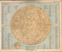 Mondoberfläche
#137
Die sichtbare Seite der Mond-Oberfläche bei voller Beleuchtung : nach Beer u. Mädler's Karte
1: 13 000 000
#138
Mondoberfläche
#135
Die sichtbare Seite der Mond-Oberfläche bei voller Beleuchtung : nach Beer u. Mädler's Karte
#136
Mondoberfläche
#116
Die sichtbare Seite der Mond-Oberfläche bei voller Beleuchtung : nach Beer u. Mädler's Karte. Ausgabe in 63 B1 No1
1: 46 000 000
#105
Mondoberfläche
#137
Die sichtbare Seite der Mond-Oberfläche bei voller Beleuchtung : nach Beer u. Mädler's Karte
1: 13 000 000
#138
Mondoberfläche
#135
Die sichtbare Seite der Mond-Oberfläche bei voller Beleuchtung : nach Beer u. Mädler's Karte
#136
Mondoberfläche
#116
Die sichtbare Seite der Mond-Oberfläche bei voller Beleuchtung : nach Beer u. Mädler's Karte. Ausgabe in 63 B1 No1
1: 46 000 000
#105
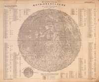 Die sichtbare Seite der Mond-Oberfläche bei voller Beleuchtung : nach Beer u. Mädler's Karte. Ausgabe in 63 B1 No1
1: 46 000 000
Die sichtbare Seite der Mond-Oberfläche bei voller Beleuchtung : nach Beer u. Mädler's Karte. Ausgabe in 63 B1 No1
1: 46 000 000