

The Catalog of Planetary Maps.
Sources: The research that led to this catalog was supported by Fulbright Hungary Grant No. 1222202, awarded to H. Hargitai for research at USGS Astrogeology, Flagstaff, Arizona (advisor: Trent Hare), and by the ICA Commission on Planetary Cartography (advisor: Kira Shingareva). Most of the data is based on the inventory of the map library of USGS Astrogeology.
Copyright and Use Notice: Published U.S. Geological Survey and U.S. Air Force maps are generally in the public domain. Some maps reproduced or displayed on this site may be protected by copyright.
This website includes thumbnail images or excerpts of maps for identification, documentation, research, and educational purposes only. These uses are believed to qualify as fair use under U.S. copyright law. Full-resolution copyrighted maps are not hosted unless explicit permission has been obtained or the material is confirmed to be in the public domain.
The inclusion of any map or photograph in this catalog does not imply that it is free of copyright restrictions. Responsibility for determining copyright status and obtaining necessary permissions rests entirely with the user.
If you are a copyright holder and believe material on this site is used inappropriately, please contact the curator (hargitai.henrik@btk.elte.hu) with details so we can review and address your concerns promptly.
Photos: Unless otherwise indicated, all photographs are by H. Hargitai. Several photographs are from the USGS Astrogeology Map Library and Lowell Observatory, both in Flagstaff, Arizona. Several photographs of Soviet maps were taken at MIIGAiK, Moscow.
Contact: The catalog is curated by H. Hargitai, ELTE, Budapest, hargitai.henrik@btk.elte.hu.
Country_publisher: Germany
153 maps
| # | Title | Map No. | Lead Author | Artist | Target | Quad. | Scale | Year | Publisher | |
|---|---|---|---|---|---|---|---|---|---|---|
| #162 | Die sichtbare Seite der Mond-Oberfläche bei voller Beleuchtung : nach Beer u. Mädler's Karte The visible side of the lunar surface at full illumination: after Beer and Madler's map | Ausfeld, Johann Carl | Moon | 1880 | Justus Perthes | |||||
| #163 |
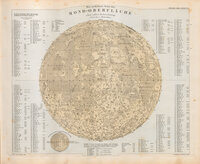 |
Mondoberfläche Lunar surface Stieler's Hand-Atlas. 1880. High resolution scan. | Beer, Wilhelm Wolff | Moon | 1880 | |||||
| #151 | Charte der Gebirge des Mondes Chart of the mountains of the Moon Title: Charte des Gebirge des Mondes (Chart of the Mountains of the Moon) Date 1878 Hachure-relief shading Cartograph… | Schmidt, Johann F. Julius | Moon | 1878 | Dietrich Reimer | |||||
| #156 |
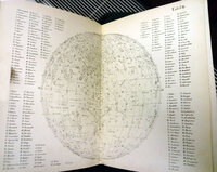 |
Map 156 Littrow JJ, 1878 Die Wunder des Himmels. Berlin, Verlan von Gustav Hempel. Sechste auflage | Tafel III | Littrow, Joseph Johann | Moon | 1878 | Verlag von Gustav Hempel | |||
| #155 | Mondcharte 25 sectionen un 2 erlautersungstafeln Moon map in 25 sections and 2 explanatory plates Cartographer: Wilhelm G Lohrman Sheets: 25 The map series was produced and started by Lohrman but publication was fini… | Lohrmann, Wilhelm Gothelf | Moon | 1.8M | 1878 | Verlag von Joahnn Ambrosius Barth | ||||
| #150 |
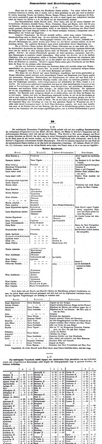 |
Mondoberfläche Lunar surface Plate no. 5 from: Stieler's Hand-Atlas. Gotha : J. Perthes, [1877?] | Beer, Wilhelm Wolff | Moon | 1877 | J. Perthes | ||||
| #145 | Die sichtbare Seite der Mond-Oberfläche bei voller Beleuchtung : nach Beer u. Mädler's Karte The visible side of the lunar surface at full illumination: after Beer and Madler's map | Ausfeld, Johann Carl | Moon | 1876 | Justus Perthes | |||||
| #146 |
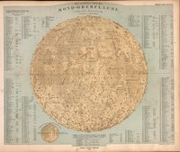 |
Mondoberfläche Lunar surface In lower left margin: Gotha : Justus Perthes 1876., 27.5 cm. diam., on sheet 38.3 x 46.0 cm. | Beer, Wilhelm Wolff | Moon | 1876 | Justus Perthes | ||||
| #137 | Die sichtbare Seite der Mond-Oberfläche bei voller Beleuchtung : nach Beer u. Mädler's Karte The visible side of the lunar surface at full illumination: after Beer and Madler's map | Ausfeld, Johann Carl | Moon | 13M | 1872 | Justus Perthes | ||||
| #138 | Mondoberfläche Lunar surface Adolf Stieler, Gotha, 1872 (also in 1882). NOT in 1891. | Beer, Wilhelm Wolff | Moon | 1872 | Adolf Stieler | |||||
| #135 | Die sichtbare Seite der Mond-Oberfläche bei voller Beleuchtung : nach Beer u. Mädler's Karte The visible side of the lunar surface at full illumination: after Beer and Madler's map | Ausfeld, Johann Carl | Moon | 1870 | Justus Perthes | |||||
| #136 | Mondoberfläche Lunar surface Stieler's Hand-Atlas. Justus Perthes.. Gotha. 1870. Color lithograph. 16 x 13.8". | Beer, Wilhelm Wolff | Moon | 1870 | Justus Perthes | |||||
| #124 |
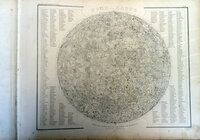 |
Mond—Karte Nach dem besten Quellen entworfen und gezeichnet Map of the Moon Meyer's Kriegs- u. Friedens- oder grosser Zeitungs-Atlas in 148 karten... J. Meyer. Hildburohausen et New-York . Schleif… | Radefeld, C. C. | Moon | 1860 | J. Meyer | ||||
| #119 |
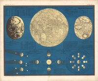 |
Karte der sichtbaren Seite der Mond-Oberfläche Map of the visible side of the lunar surface Moon and Eclipses Karte der sichtbaren Seite der Mond-Oberfläche Editor: L. Ewald 1857 Publisher Verlag von Jonghaus … | Wirtz, F. | Wirtz, F. | Moon | 18M | 1857 | Verlag von Jonghaus und Venator, Kartographisch-artistische Anstalt | ||
| #117 |
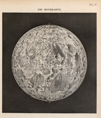 |
Der Mondkarte The Moon map Müller, J. 1856; Lehrbuch der kosmischen Physik - Atlas; Braunschweig Image courtesy of Ton Lindemann. | Müller, J. | Moon | 1856 | |||||
| #118 |
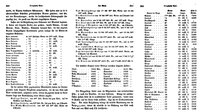 |
Map 118 Published in Franz Arago's Sammtliche Werke. Leipzig 1856. This is not a map, but a biscriptural list of the Moon's plac… | Arago, F. | Moon | 1856 | |||||
| #116 | Die sichtbare Seite der Mond-Oberfläche bei voller Beleuchtung : nach Beer u. Mädler's Karte. Ausgabe in 63 B1 No1 The visible side of the lunar surface at full illumination: after Beer and Madler's map. Edition in 63 sheets, no. 1 | Ausfeld, Johann Carl | Moon | 46M | 1853 | Justus Perthes | ||||
| #112 |
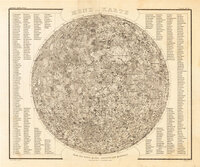 |
Mond-Karte Map of the Moon Size: 29.5 x 36 cm Title: Mond Karte Drawn by: Radefeld, C. in 1847 Uncolored steel engraving North-up First ed… | Radefeld, C. C. | Moon | 1850 | Joseph Meyer | ||||
| #114 |
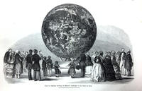 |
Relief der sichtbaren Halbkugel des Mondes, angefertigt von Th. Dickert in Bonn. Relief of the visible hemisphere of the Moon, made by Th. Dickert in Bonn. Location: Bonn, Germany, 1850, transported to the Field Museum of Natural History, Chicago (189x-190x) Constructed b… | Dickert, Th | Moon | 600k | 1850 | ||||
| #110 | Mond—Karte Nach dem besten Quellen entworfen und gezeichnet Moon map designed and drawn from the best sources | Radefeld, C. C. | Moon | 1847 | J. Meyer | |||||
| #108 |
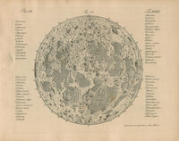 |
Map 108 Gehler, J.S.T. et al 1825-1845; Physikalisches Wörterbuch - Kupfer Atlas; Leipzig Image courtesy of Ton Lindemann. | Gehler, J. S. T. | Moon | 1842 | |||||
| #105 |
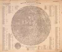 |
Die sichtbare Seite der Mond-Oberfläche bei voller Beleuchtung : nach Beer u. Mädler's Karte. Ausgabe in 63 B1 No1 The visible side of the lunar surface at full illumination: after Beer and Madler's map. Edition in 63 sheets, no. 1 Stieler's Hand Atlas 1841. (monochormatic) Steel engraved Johann Carl Ausfeld, engr. | Ausfeld, Johann Carl | Moon | 46M | 1841 | Justus Perthes | |||
| #106 |
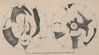 |
Map 106 Publication Date: 1841 Cartographers: W. Beer and J. H. Mädler Type: albedo map Publication: Beer W and Mädler JH (1841)… | Beer, Wilhelm Wolff | Mars | 1841 | |||||
| #101 |
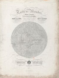 |
Karte des Mondes in einem mittleren Librationzustand Map of the Moon in a mean state of libration. According to the measurements and observations taken by the author in the years 1822 to 1836 Map of the Moon in a mean state of libration. According to the measurings and observations taken by th… | Lohrmann, Wilhelm Gothelf | Moon | 1838 | Verlag von Johann Ambrosius Barth | ||||
| #102 |
 |
Karte des Mondes. Mittlere Libration. Map of the Moon in a mean state of libration. Carte de la Lune, dans l'etat de moyenne libration Map of the Moon in a mean state of libration | Lohrmann, Wilhelm Gothelf | Moon | 9M | 1838 | Leipzig, Johann Ambrosius Barth |