|
#4561
|
|
Combined PVO and Venera altimetry |
|
|
|
Venus |
|
|
1990 |
|
|
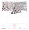
#4410
|
|
Phobos 1:100,000 sinusoidal 0, -90 |
|
|
Bridges, Patricia M. |
Phobos |
|
100k |
1989 |
|
|
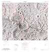
#4408
|
|
Phobos 1:100,000 sinusoidal 0, 180 |
|
|
Bridges, Patricia M. |
Phobos |
|
100k |
1989 |
|
|
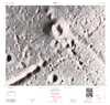
#4409
|
|
Phobos 1:100,000 sinusoidal 0, 90 |
|
|
Bridges, Patricia M. |
Phobos |
|
100k |
1989 |
|
|
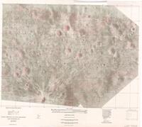
#4421
|
|
Tethis 1:5m shaded relief |
|
|
Inge, Jay L. |
Tethys |
|
5M |
1989 |
|
|
#4136
|
|
Ganymede JG-15 shaded relief |
|
|
Inge, Jay L. |
Ganymede |
Jg-15 |
|
1986 |
|
|
#3870
|
|
Europa Index Map - Albedo |
|
|
Inge, Jay L. |
Europa |
|
|
1984 |
|
|
#3796
|
|
Io Ji-4 |
|
|
Hagerty, Patricia G. A. |
Io |
Ji-4 |
5M |
1983 |
|
|
#3816
|
|
MC-7 Cebrenia relief |
|
|
Bridges, Patricia M. |
Mars |
MC-7 |
|
1983 |
|
|
#3657
|
|
Albedo Map of Europa Pole Je-4 |
|
|
Davis, Susan L. |
Europa |
Je-4 |
|
1982 |
|
|
#3613
|
|
Pioneer-Venus Hagfors Map of Venus |
|
|
|
Venus |
|
|
1981 |
|
|
#3339
|
|
Preliminary Pictorial Map of Callisto |
Jc 25M 1RM |
|
|
Callisto |
|
25M |
1979 |
|
|
#3172
|
|
LM 62 relief |
|
|
Davis, Susan L. |
Moon |
LM 62 |
|
1978 |
|
|
#3206
|
|
MC-7 Cebrenia albedo |
|
|
Bridges, Patricia M. |
Mars |
MC-7 |
5M |
1978 |
|
|
#3047
|
|
LM 103 coloration plate |
|
|
Inge, Jay L. |
Moon |
LM 103 |
1M |
1977 |
|
|
#3049
|
|
LM 103 relief plate |
|
|
Inge, Jay L. |
Moon |
LM 103 |
1M |
1977 |
|
|
#3053
|
|
LM 38 relief |
|
|
Hall, Barbara J. |
Moon |
LM 38 |
|
1977 |
|
|
#3078
|
 |
Lunar Topographic Orthophotomap - Heaviside |
LTO85C2 |
|
|
Moon |
|
250k |
1977 |
Defense Mapping Agency Topographic Center |
|
#2777
|
|
Lunar Photomap - Apollo 16 Traverses |
78D2S2 (25) |
|
|
Moon |
LAC 78 |
25k |
1975 |
Defense Mapping Agency Topographic Center |
|
#2312
|
|
Candidate Viking Rover Landing Site, Cebrenia Area -A rover mission in a volcanic terrain |
|
Boyce, J. M. |
|
Mars |
|
|
1974 |
|
|
#2314
|
|
Candidate Viking Rover Landing Site, Mangala Vallis Area - A rover mission in channeled terrain |
|
Dial, Arthur L. Jr |
|
Mars |
|
|
1974 |
|
|
#2316
|
|
Candidate Viking Rover Landing Site, South Polar Area - A rover mission in a the Polar Layered Terrain |
|
Dial, Arthur L. Jr |
|
Mars |
|
|
1974 |
|
|
#2318
|
|
Candidate Viking Rover Landing Site, Syrtis Major Area - A rover mission in a region of wind streaks |
|
Boyce, J. M. |
|
Mars |
|
|
1974 |
|
|
#2544
|
|
Lunar Topographic Orthophotomap - Federov |
LTO39B1 |
|
|
Moon |
|
250k |
1974 |
Defense Mapping Agency Topographic Center |
|
#2563
|
|
Lunar Topographic Orthophotomap - Humason |
LTO38B1 |
|
|
Moon |
|
250k |
1974 |
Defense Mapping Agency Topographic Center |
|
#2627
|
|
Lunar Topographic Orthophotomap - Vaisala (Väisälä) |
LTO39A4 |
|
|
Moon |
|
250k |
1974 |
Defense Mapping Agency Topographic Center |
|
#2630
|
|
Lunar Topographic Orthophotomap - Volkov |
LTO84D4 |
|
|
Moon |
|
250k |
1974 |
Defense Mapping Agency Topographic Center |
|
#2653
|
|
Lunar Topophotomap - Osiris |
42C3S2 (10) |
|
|
Moon |
|
10k |
1974 |
Defense Mapping Agency Topographic Center |
|
#2264
|
|
Proposed lunar nomenclature scheme (quadrangle names), sheets I, II, III |
|
|
|
Moon |
|
|
1973 |
|
|
#1891
|
|
Apollo Mission 15 Lunar Photography Index Maps Book |
|
|
|
Moon |
LAC 41 |
|
1972 |
US Air Force, Aeronautical Chart and Information Center |
|
#1971
|
|
Lunar Topographic Map - Descartes 1:25,000 |
|
|
|
Moon |
LAC 78 |
25k |
1972 |
|
|
#2001
|
|
Mars Chart MC-27 Uncontrolled Photomosaic |
|
|
|
Mars |
MC-27 |
5M |
1972 |
|
|
#2053
|
|
Preliminary Topographic Map Littrow Region of the Moon |
|
|
|
Moon |
|
250k |
1972 |
|
|
#1730
|
|
Apollo 14 traverse map |
|
|
|
Moon |
LAC 76 |
2.5k |
1971 |
U. S. Geological Survey Lunar Experiment Team |
|
#1801
|
|
Lunar Topographic Map - Hipparchus |
ORB V-24 |
|
|
Moon |
|
250k |
1971 |
|
|
#1568
|
|
Apollo Mission 12 Lunar Photography Indexes (4 sheets) |
|
MSC, Mapping Sciences Laboratory |
|
Moon |
LAC 76 |
|
1970 |
|
|
#1571
|
|
Base for Traverse Map Apollo 13 Fra Mauro Site |
|
Karlstrom, Thor N. V. |
|
Moon |
LAC 76 |
5k |
1970 |
|
|
#1600
|
|
Lunar chart (LPC-1) SPECIAL NASA EDITION |
LPC-1 |
|
|
Moon |
|
10M |
1970 |
|
|
#1601
|
|
Lunar Chart (one sided) |
LPC-1 (multipart edition) |
|
|
Moon |
Entire moon |
10M |
1970 |
|
|
#1669
|
|
Lunar Uncontrolled Mosaic - Tycho - Sheet A |
ORB V-30 |
|
|
Moon |
|
25k |
1970 |
U.S. Army Topographic Command |
|
#1670
|
|
Lunar Uncontrolled Mosaic - Tycho - Sheet B |
ORB V-30 |
|
|
Moon |
|
25k |
1970 |
U.S. Army Topographic Command |
|
#1671
|
|
Lunar Uncontrolled Mosaic - Tycho - Sheet C |
ORB V-30 |
|
|
Moon |
|
25k |
1970 |
U.S. Army Topographic Command |
|
#1672
|
|
Lunar Uncontrolled Mosaic - Tycho - Sheet D |
ORB V-30 |
|
|
Moon |
|
25k |
1970 |
U.S. Army Topographic Command |
|
#1673
|
|
Lunar Uncontrolled Mosaic - Tycho - Sheet E |
ORB V-30 |
|
|
Moon |
|
25k |
1970 |
U.S. Army Topographic Command |
|
#1674
|
|
Lunar Uncontrolled Mosaic - Tycho - Sheet F |
ORB V-30 |
|
|
Moon |
|
25k |
1970 |
U.S. Army Topographic Command |
|
#1675
|
|
Lunar Uncontrolled Mosaic - Tycho - Sheet G |
ORB V-30 |
|
|
Moon |
|
25k |
1970 |
U.S. Army Topographic Command |
|
#1676
|
|
Lunar Uncontrolled Mosaic - Tycho - Sheet H |
ORB V-30 |
|
|
Moon |
|
25k |
1970 |
U.S. Army Topographic Command |
|
#1677
|
|
Lunar Uncontrolled Mosaic - Tycho - Sheet I |
ORB V-30 |
|
|
Moon |
|
25k |
1970 |
U.S. Army Topographic Command |
|
#1678
|
|
Lunar Uncontrolled Mosaic - Tycho - Sheet J |
ORB V-30 |
|
|
Moon |
|
25k |
1970 |
U.S. Army Topographic Command |
|
#1679
|
|
Lunar Uncontrolled Mosaic - Tycho - Sheet K |
ORB V-30 |
|
|
Moon |
|
25k |
1970 |
U.S. Army Topographic Command |