|
#4596
|
|
Magellan Mapping Mission Planning Chart - Revision B |
|
McConnell, Shannon |
|
Venus |
|
|
1990 |
|
|
#4414
|
|
Preliminary Pictorial Map of Triton (Neptune-facing hemisphere) |
NTR 5M -08/008 AN |
|
Bridges, Patricia M. |
Triton |
|
5M |
1989 |
|
|
#4437
|
|
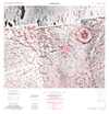
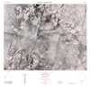
Untitled, South Elysium geologic map |
|
|
|
Mars |
|
5M |
1989 |
|
|
#4290
|
|
Geologic Map of the Elysium Region of Mars |
|
|
|
Mars |
|
|
1988 |
|
|
#4340
|
|
Venus Task Group, Working Group for Planetary System Nomenclature letter from Harold Maursky |
|
|
|
Venus |
|
|
1988 |
|
|
#4145
|
|
Mars crater ejecta outlines (central peak with pits, outer ejecta, outer ejecta) (several sheets, drawing and symbols) |
|
|
|
Mars |
|
|
1986 |
|
|
#3873
|
 |
Ganyemede Jg-12 review copy |
|
|
Davis, Susan L. |
Ganymede |
Jg-12 |
5M |
1984 |
|
|
#3828
|
|
Preliminary Ganymede Jg-4 review copy |
|
Head, James W. III |
Hagerty, Patricia G. A. |
Ganymede |
Jg-4 |
|
1983 |
|
|
#3582
|
|
Mars East Section |
|
|
Hall, Barbara J. |
Mars |
|
15M |
1981 |
|
|
#3587
|
|
Mars West Section Shaded Relief |
|
|
Hall, Barbara J. |
Mars |
|
15M |
1981 |
|
|
#3299
|
|
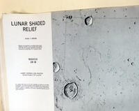
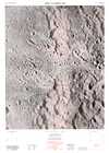
Lunar Shaded Relief - Seleucus |
LSR 38 |
|
|
Moon |
|
1M |
1979 |
Defense Mapping Agency, Aerospace Center |
|
#3147
|
|
Digital shaded relief map of Tithonium Chasma |
|
Edwards, Kathleen |
|
Mars |
|
|
1978 |
|
|
#3167
|
|
Heavily cratered ancient terrain, Moprhological units, Ancient terrain southeast of Schiaparelli Basin |
|
Mouginis-Mark, Peter J. |
|
Mars |
|
|
1978 |
|
|
#3209
|
|
Sampling area maps - Sand dunes: low return missions |
|
Mouginis-Mark, Peter J. |
|
Mars |
|
|
1978 |
|
|
#3237
|
|
Young lava flows N.W. of Apollinaris Patera, Morphological units |
|
Mouginis-Mark, Peter J. |
|
Mars |
|
|
1978 |
|
|
#2810
|
|
MC-17 Albedo Rendition |
|
|
Bridges, Patricia M. |
Mars |
MC-17 |
5M |
1975 |
|
|
#2496
|
|
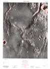
Lunar Topographic Orthophotomap - Acosta |
LTO80B4 |
|
|
Moon |
|
250k |
1974 |
Defense Mapping Agency Topographic Center |
|
#2498
|
|
Lunar Topographic Orthophotomap - Alfraganus |
LTO78A3 |
|
|
Moon |
|
250k |
1974 |
Defense Mapping Agency Topographic Center |
|
#2639
|
|
Lunar Topophotomap - Apollo 16 Landing Area |
78D2S1 (50) |
|
|
Moon |
LAC 78 |
50k |
1974 |
Defense Mapping Agency Topographic Center |
|
#2640
|
|
Lunar Topophotomap - Apollo 17 Landing Area |
43D1S1 (50) |
|
|
Moon |
LAC 43 |
50k |
1974 |
Defense Mapping Agency Topographic Center |
|
#2645
|
|
Lunar Topophotomap - Fossae Littrow |
42C2S1 (50) |
|
|
Moon |
|
50k |
1974 |
Defense Mapping Agency Topographic Center |
|
#2648
|
|
Lunar Topophotomap - Kira |
102A1S1 (50) |
|
|
Moon |
|
50k |
1974 |
Defense Mapping Agency Topographic Center |
|
#2091
|
|
Apollo Mission 17 Lunar Photography Index Maps Book |
|
|
|
Moon |
LAC 43 |
|
1973 |
Defense Mapping Agency, Aerospace Center |
|
#2267
|
|
Syrtis Major - MC-13 |
|
|
|
Mars |
|
5M |
1973 |
|
|
#1898
|
|
Candidate Viking landing site 12, Hesperia |
|
Hodges, Carroll Ann |
|
Mars |
|
1M |
1972 |
|