|
#3150
|
|
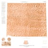
Generalized maps of the Viking Lander 2 Sample Field A) End of the primary mission, B) End of the extended mission (2 maps in one sheet) |
Professional Paper 1389 |
Moore, Henry J. |
|
Mars |
|
|
1978 |
|
|
#3164
|
|
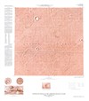
Geologic sketch map showing relation between Lander 2 site and crater Mie. |
|
|
|
Mars |
|
|
1978 |
|
|
#3167
|
|
Heavily cratered ancient terrain, Moprhological units, Ancient terrain southeast of Schiaparelli Basin |
|
Mouginis-Mark, Peter J. |
|
Mars |
|
|
1978 |
|
|
#3229
|
|
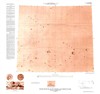
Viking I and II Generalized Working Maps of Sample Fields Set |
|
Moore, Henry J. |
|
Mars |
|
|
1978 |
|
|
#3231
|
|
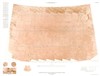
Viking Lander 2 Generalized Working Map of Sample Field Showing Locations of Rocks 5cm and Larger - Plate 1A |
|
Moore, Henry J. |
|
Mars |
|
|
1978 |
|
|
#3232
|
|
Viking Lander 2 Generalized Working Map of Sample Field Showing Locations of Rocks 5cm and Larger - Plate 1B |
|
Moore, Henry J. |
|
Mars |
|
|
1978 |
|
|
#3233
|
|
Viking Lander 2 Generalized Working Map of Sample Field Showing Locations of Rocks 5cm and Larger - Plate 1C |
|
Moore, Henry J. |
|
Mars |
|
|
1978 |
|
|
#3234
|
|
Viking Lander 2 Generalized Working Map of Sample Field Showing Locations of Rocks 5cm and Larger - Plate 2A |
|
Moore, Henry J. |
|
Mars |
|
|
1978 |
|
|
#3235
|
|
Viking Lander 2 Generalized Working Map of Sample Field Showing Locations of Rocks 5cm and Larger - Plate 2B |
|
Moore, Henry J. |
|
Mars |
|
|
1978 |
|
|
#3236
|
|
Viking Lander 2 Generalized Working Map of Sample Field Showing Locations of Rocks 5cm and Larger - Plate 2C |
|
Moore, Henry J. |
|
Mars |
|
|
1978 |
|
|
#3237
|
|
Young lava flows N.W. of Apollinaris Patera, Morphological units |
|
Mouginis-Mark, Peter J. |
|
Mars |
|
|
1978 |
|
|
#3026
|
 |
Controlled Mosaic of the Canberra Region of Mars (Viking 2 Landing Site) |
I-1060 |
|
|
Mars |
|
250k |
1977 |
U. S. Geological Survey |
|
#3029
|
|
Controlled Mosaic of the Utopia Panitia Region of Mars (Viking 2 Landing Site) |
I-1061 |
|
|
Mars |
|
1M |
1977 |
U. S. Geological Survey |
|
#3032
|
|
Controlled Mosaic of the Yorktown Region of Mars (Viking 1 landing site) |
I-1059 |
|
|
Mars |
|
250k |
1977 |
U. S. Geological Survey |
|
#3042
|
|
Geologic map of the Viking 2 landing site |
Fig 1b |
|
|
Mars |
|
|
1977 |
|
|
#3119
|
|
Shaded Relief Map of the Tritonis Lacus Region of Mars (Viking A2 Landing Site) |
I-1055 |
Inge, Jay L. |
Inge, Jay L. |
Mars |
|
1M |
1977 |
U. S. Geological Survey |
|
#2896
|
|
Controlled Mosaic of the Viking 1 Landing Site |
L-55232 |
|
|
Mars |
Lunae Palus Quadrangle |
250k |
1976 |
U. S. Geological Survey |
|
#3016
|
|
Viking site C-1 Capri Region relief |
|
|
Inge, Jay L. |
Mars |
|
1M |
1976 |
|
|
#2308
|
|
Apollo 16 Landing Area Negatives Map Set |
78D2S1(50) |
|
|
Moon |
LAC 78 |
50k |
1974 |
Defense Mapping Agency Aerospace Center, St Louis Air Force Station |
|
#2660
|
|
Maps of the USSR landing sites (Mars 6; planned 1974 spacecraft)-Inge: southernsite Nereidum Montes. Bridges: Erythraeum Region (northern site) |
|
|
Inge, Jay L. |
Moon |
|
1M |
1974 |
|
|
#2091
|
|
Apollo Mission 17 Lunar Photography Index Maps Book |
|
|
|
Moon |
LAC 43 |
|
1973 |
Defense Mapping Agency, Aerospace Center |
|
#1872
|
|
Apollo 15 - Preliminary Maps of Part of the Apennine-Hadley Region of the Moon Map Set |
|
|
|
Moon |
LAC 41 |
|
1972 |
|
|
#1890
|
|
Apollo Lunar Geology Investigation Team |
|
|
|
Moon |
|
|
1972 |
|
|
#1892
|
|
Apollo Mission 16 Lunar Photography Index Maps Book |
|
|
|
Moon |
LAC 78 |
|
1972 |
Defense Mapping Agency, Aerospace Center |
|
#1860
|
|
Topographic chart of the route of "lunokhod 1" 17 November 1970 to 20 January 1971 |
|
|
|
Moon |
Lunokhod 1 |
|
1971 |
|