

The Catalog of Planetary Maps.
Sources: The research that led to this catalog was supported by Fulbright Hungary Grant No. 1222202, awarded to H. Hargitai for research at USGS Astrogeology, Flagstaff, Arizona (advisor: Trent Hare), and by the ICA Commission on Planetary Cartography (advisor: Kira Shingareva). Most of the data is based on the inventory of the map library of USGS Astrogeology.
Copyright and Use Notice: Published U.S. Geological Survey and U.S. Air Force maps are generally in the public domain. Some maps reproduced or displayed on this site may be protected by copyright.
This website includes thumbnail images or excerpts of maps for identification, documentation, research, and educational purposes only. These uses are believed to qualify as fair use under U.S. copyright law. Full-resolution copyrighted maps are not hosted unless explicit permission has been obtained or the material is confirmed to be in the public domain.
The inclusion of any map or photograph in this catalog does not imply that it is free of copyright restrictions. Responsibility for determining copyright status and obtaining necessary permissions rests entirely with the user.
If you are a copyright holder and believe material on this site is used inappropriately, please contact the curator (hargitai.henrik@btk.elte.hu) with details so we can review and address your concerns promptly.
Photos: Unless otherwise indicated, all photographs are by H. Hargitai. Several photographs are from the USGS Astrogeology Map Library and Lowell Observatory, both in Flagstaff, Arizona. Several photographs of Soviet maps were taken at MIIGAiK, Moscow.
Contact: The catalog is curated by H. Hargitai, ELTE, Budapest, hargitai.henrik@btk.elte.hu.
Year of manuscript/observation: 1877
5 maps
| # | Title | Map No. | Lead Author | Artist | Target | Quad. | Scale | Year | Publisher | |
|---|---|---|---|---|---|---|---|---|---|---|
| #200 |
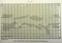 |
Carte de Mars faite en 1877 a l'Observatoire de Washington Map of Mars made in 1877 at the Washington Observatory [gallery ids="|" type="rectangular"] 1877 Published in: Flammarion, C (1892) La planete Mars et ses condtions d'habilit… | Fig 173 | Flammarion, Camille | Mars | 1892 | Gauthier-Villars et fils | |||
| #212 | Le Lac du Soleil maps Lake of the Sun maps | Fig 285, 286, 287 | Flammarion, Camille | Mars | 1892 | Gauthier-Villars et fils | ||||
| #190 |
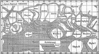 |
Map 190 A rare map where north is up. Based on Schiaparelli. | Mars | 186M | 1888 | |||||
| #159 | Map of Mars | Niesten, Louis | Mars | 1879 | Observatoire Royal de Bruxelles | |||||
| #154 |
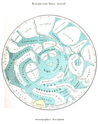 |
Mappa Areographica Exhibens Planeae Martis Chorographicam inter POlum Australem et Parallelum 40um Latitudinis Borealis, 1877-1878 Areographic map showing the chorography of the planet Mars between the south pole and the 40th parallel of northern latitude, 1877-1878 1877 (publ. 1878) Alternative reproduction Alternative reproduction G.V. Schiaparelli: Osservazioni astronomiche e… | Schiaparelli, Giovanni V. | Mars | 1878 | Tipografia della R. Accademia dei Lincei |