|
#5069
|
 |
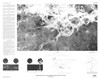
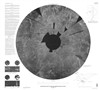
Altimetric radar image map of the Aphrodite Planitia Region of Venus (on envelope); Altimetric radar image map of the Aphrodite Terra Region of Venus (on sheet) |
I-2476 |
|
|
Venus |
|
10M |
1998 |
U. S. Geological Survey |
|
#5070
|
|
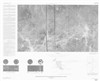
Altimetric radar image map of the Guinevere Planitia Region of Venus |
I-2457 |
|
|
Venus |
|
10M |
1998 |
U. S. Geological Survey |
|
#5071
|
|
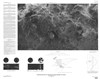
Altimetric radar image map of the Helen Planitia Region of Venus |
I-2477 |
|
|
Venus |
|
10M |
1998 |
U. S. Geological Survey |
|
#5072
|
|
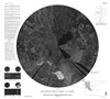
Altimetric radar image map of the Ishtar Terra region of Venus |
I-2490 |
|
|
Venus |
|
10M |
1998 |
U. S. Geological Survey |
|
#5073
|
|
Altimetric radar image map of the Lada Terra region of Venus |
I-2523 |
|
|
Venus |
|
10M |
1998 |
U. S. Geological Survey |
|
#5074
|
|
Altimetric radar image map of the Lavinia Planitia Region of Venus |
I-2475 |
|
|
Venus |
|
10M |
1998 |
U. S. Geological Survey |
|
#5075
|
|
Altimetric radar image map of the Niobe Planitia Region of Venus |
I-2467 |
|
|
Venus |
|
10M |
1998 |
U. S. Geological Survey |
|
#5076
|
|
Altimetric radar image map of the Sedna Planitia Region of Venus |
I-2466 |
|
|
Venus |
|
10M |
1998 |
U. S. Geological Survey |
|
#5077
|
|
Controlled Color Photomosaic of the Amenthes Quadrangle (MC-14) of Mars |
I-2485 |
|
|
Mars |
MC-14 |
5M |
1998 |
U. S. Geological Survey |
|
#5078
|
|
Controlled Color Photomosaic of the Coprates Quadrangle (MC-18) of Mars |
I-2527 |
|
|
Mars |
MC-18 |
5M |
1998 |
U. S. Geological Survey |
|
#5079
|
|
Controlled Color Photomosaic of the Elysium Quadrangle (MC-15) of Mars |
I-2486 |
|
|
Mars |
MC-15 |
5M |
1998 |
U. S. Geological Survey |
|
#5080
|
|
Controlled Color Photomosaic of the Margaritifer Sinus Quadrangle (MC-19) of Mars |
I-2531 |
|
|
Mars |
MC-19 |
5M |
1998 |
U. S. Geological Survey |
|
#5081
|
|
Controlled Color Photomosaic of the Memnonia Quadrangle (MC-16) of Mars |
I-2487 |
|
|
Mars |
MC-16 |
5M |
1998 |
U. S. Geological Survey |
|
#5082
|
|
Controlled Color Photomosaic of the Phoenicis Lacus Quadrangle (MC-17) of Mars |
I-2488 |
|
|
Mars |
MC-17 |
5M |
1998 |
U. S. Geological Survey |
|
#5083
|
|
Controlled Color Photomosaic of the Sinus Sabaeus Quadrangle (MC-20) of Mars |
I-2532 |
|
|
Mars |
MC-20 |
5M |
1998 |
U. S. Geological Survey |
|
#5084
|
|
Controlled Color Photomosaic of the Syrtis Major Quadrangle (MC-13) of Mars |
I-2484 |
|
|
Mars |
MC-13 |
5M |
1998 |
U. S. Geological Survey |
|
#5085
|
|
Geologic Map of Part of the Tyrrhena Patera Region of Mars (MTM Quadrangle -20252) |
I-2556 |
Gregg, Tracy K. P. |
|
Mars |
MTM-20252 |
500k |
1998 |
U. S. Geological Survey |
|
#5086
|
|
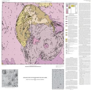
Geologic Map of Pavonis Mons Volcano, Mars |
I–2561 |
Scott, David H. S. |
|
Mars |
|
1M |
1998 |
U. S. Geological Survey |
|
#5087
|
|
Geologic Map of the Dao, Harmakhis, and Reull Valles Region of Mars |
I-2557 |
Price, Katherine H. |
|
Mars |
|
1M |
1998 |
U. S. Geological Survey |
|
#5088
|
|
Geologic Map of the MTM -85280 Quadrangle, Planum Australe Region of Mars |
I-2595 |
Herkenhoff, Ken |
|
Mars |
MTM-85280 |
500k |
1998 |
U. S. Geological Survey |
|
#5089
|
|
Geologic Map of the Western Ophir Planum Region (MTM -10067) of Mars |
I-2588 |
Schultz, Richard A. |
|
Mars |
MTM -10067 |
500k |
1998 |
U. S. Geological Survey |
|
#5128
|
|
Map 5128 |
Fig4 |
|
|
Ganymede |
|
|
1998 |
|
|
#6294
|
|
Margaritifer |
|
Williams, Kevin K. |
|
Mars |
|
500k |
(1998) |
|
|
#5090
|
|
Panorama and Orthoimage Map of the Pathfinder Landing Site - Ares Vallis, Mars |
|
Jaumann, Ralf |
|
Mars |
|
50 |
1998 |
German Aerospace Center |
|
#6434
|
|
Phoebe Regio |
|
Senske, David A. |
|
Venus |
|
5M |
(1998) |
|
|
#5091
|
|
Radar image and shaded relief map of the Aphrodite Planitia Region of Venus (on envelope); Radar image and shaded relief map of the Aphrodite Terra Region of Venus (on sheet) |
I-2476 |
|
Aeschliman, Ralph O. Jr |
Venus |
|
10M |
1998 |
U. S. Geological Survey |
|
#5092
|
|
Radar image and shaded relief map of the Guinevere Planitia Region of Venus |
I-2457 |
|
Aeschliman, Ralph O. Jr |
Venus |
|
10M |
1998 |
U. S. Geological Survey |
|
#5093
|
|
Radar image and shaded relief map of the Helen Planitia Region of Venus |
I-2477 |
|
Aeschliman, Ralph O. Jr |
Venus |
|
10M |
1998 |
U. S. Geological Survey |
|
#5094
|
|
Radar image and shaded relief map of the Ishtar Terra region of Venus |
I-2490 |
|
Aeschliman, Ralph O. Jr |
Venus |
|
10M |
1998 |
U. S. Geological Survey |
|
#5095
|
|
Radar image and shaded relief map of the Lada Terra region of Venus |
I-2523 |
|
Aeschliman, Ralph O. Jr |
Venus |
|
10M |
1998 |
U. S. Geological Survey |
|
#5096
|
|
Radar image and shaded relief map of the Lavinia Planitia Region of Venus |
I-2475 |
|
Aeschliman, Ralph O. Jr |
Venus |
|
10M |
1998 |
U. S. Geological Survey |
|
#5097
|
|
Radar image and shaded relief map of the Niobe Planitia Region of Venus |
I-2467 |
|
Aeschliman, Ralph O. Jr |
Venus |
|
10M |
1998 |
U. S. Geological Survey |
|
#5098
|
|
Radar image and shaded relief map of the Sedna Planitia Region of Venus |
I-2466 |
|
Aeschliman, Ralph O. Jr |
Venus |
|
10M |
1998 |
U. S. Geological Survey |
|
#5099
|
|
Radar image map of the Aphrodite Planitia Region of Venus (on envelope); Radar image map of the Aphrodite Terra Region of Venus (on sheet) |
I-2476 |
|
|
Venus |
|
10M |
1998 |
U. S. Geological Survey |
|
#5100
|
|
Radar image map of the Guinevere Planitia Region of Venus |
I-2457 |
|
|
Venus |
|
10M |
1998 |
U. S. Geological Survey |
|
#5101
|
|
Radar image map of the Helen Planitia Region of Venus |
I-2477 |
|
|
Venus |
|
10M |
1998 |
U. S. Geological Survey |
|
#5102
|
|
Radar image map of the Ishtar Terra region of Venus |
I-2490 |
|
|
Venus |
|
10M |
1998 |
U. S. Geological Survey |
|
#5103
|
|
Radar image map of the Lada Terra region of Venus |
I-2523 |
|
|
Venus |
|
10M |
1998 |
U. S. Geological Survey |
|
#5104
|
|
Radar image map of the Lavinia Planitia Region of Venus |
I-2475 |
|
|
Venus |
|
10M |
1998 |
U. S. Geological Survey |
|
#5105
|
|
Radar image map of the Niobe Planitia Region of Venus |
I-2467 |
|
|
Venus |
|
10M |
1998 |
U. S. Geological Survey |
|
#5106
|
|
Radar image map of the Sedna Planitia Region of Venus |
I-2466 |
|
|
Venus |
|
10M |
1998 |
U. S. Geological Survey |
|
#5108
|
|
Revised Shaded Relief Map of the Amenthes Quadrangle (MC-14) of Mars |
I-2485 |
|
Sanchez, Anthony G. |
Mars |
MC-14 |
5M |
1998 |
U. S. Geological Survey |
|
#5107
|
|
Revised Shaded Relief Map of the Coprates Quadrangle (MC-18) of Mars |
I-2527 |
|
Davis, Susan L. |
Mars |
MC-18 |
5M |
1998 |
U. S. Geological Survey |
|
#5109
|
|
Revised Shaded Relief Map of the Elysium Quadrangle (MC-15) of Mars |
I-2486 |
|
Bridges, Patricia M. |
Mars |
MC-15 |
5M |
1998 |
U. S. Geological Survey |
|
#5110
|
|
Revised Shaded Relief Map of the Margaritifer Sinus Quadrangle (MC-19) of Mars |
I-2531 |
|
Bridges, Patricia M. |
Mars |
MC-19 |
5M |
1998 |
U. S. Geological Survey |
|
#5111
|
|
Revised Shaded Relief Map of the Memnonia Quadrangle (MC-16) of Mars |
I-2487 |
|
Sanchez, Anthony G. |
Mars |
MC-16 |
5M |
1998 |
U. S. Geological Survey |
|
#5112
|
|
Revised Shaded Relief Map of the Phoenicis Lacus Quadrangle (MC-17) of Mars |
I-2488 |
|
Bridges, Patricia M. |
Mars |
MC-17 |
5M |
1998 |
U. S. Geological Survey |
|
#5113
|
|
Revised Shaded Relief Map of the Sinus Sabaeus Quadrangle (MC-20) of Mars |
I-2532 |
|
Bridges, Patricia M. |
Mars |
MC-20 |
5M |
1998 |
U. S. Geological Survey |
|
#5114
|
|
Revised shaded relief map of the Syrtis Major Quadrangle (MC-13) of Mars |
I-2484 |
|
Bridges, Patricia M. |
Mars |
MC-13 |
5M |
1998 |
U. S. Geological Survey |
|
#5115
|
|
Special map of the Eastern Equatorial region of Mars (The 2.5 km elevation contour, elevations above 2.5 km are shown as gray) |
|
Aeschliman, Ralph O. Jr |
|
Mars |
|
15M |
1998 |
U. S. Geological Survey |
|
#5116
|
|
Special map of the Western Equatorial region of Mars (The 2.5 km elevation contour, elevations above 2.5 km are shown as gray) |
|
Aeschliman, Ralph O. Jr |
|
Mars |
|
15M |
1998 |
U. S. Geological Survey |
|
#5117
|
|
Topographic map of the Aphrodite Planitia Region of Venus (on envelope); Topographic map of the Aphrodite Terra Region of Venus (on sheet) |
I-2476 |
|
Aeschliman, Ralph O. Jr |
Venus |
|
10M |
1998 |
U. S. Geological Survey |
|
#5118
|
|
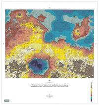
Topographic map of the Eastern Equatorial region of Mars (with special emphasis on the elevations from 0 to 5 km above-datum) |
|
Aeschliman, Ralph O. Jr |
|
Mars |
|
15M |
1998 |
|
|
#5119
|
|
Topographic map of the Guinevere Planitia Region of Venus |
I-2457 |
|
Aeschliman, Ralph O. Jr |
Venus |
|
10M |
1998 |
U. S. Geological Survey |
|
#5120
|
|
Topographic map of the Helen Planitia Region of Venus |
I-2477 |
|
Aeschliman, Ralph O. Jr |
Venus |
|
10M |
1998 |
U. S. Geological Survey |
|
#5121
|
|
Topographic map of the Ishtar terra region of Venus |
I-2490 |
|
Aeschliman, Ralph O. Jr |
Venus |
|
10M |
1998 |
U. S. Geological Survey |
|
#5122
|
|
Topographic map of the Lada Terra region of Venus |
I-2523 |
|
Aeschliman, Ralph O. Jr |
Venus |
|
10M |
1998 |
U. S. Geological Survey |
|
#5123
|
|
Topographic map of the Lavinia Planitia Region of Venus |
I-2475 |
|
Aeschliman, Ralph O. Jr |
Venus |
|
10M |
1998 |
U. S. Geological Survey |
|
#5124
|
|
Topographic map of the Niobe Planitia Region of Venus |
I-2467 |
|
Aeschliman, Ralph O. Jr |
Venus |
|
10M |
1998 |
U. S. Geological Survey |
|
#5125
|
|
Topographic map of the Sedna Planitia Region of Venus |
I-2466 |
|
Aeschliman, Ralph O. Jr |
Venus |
|
10M |
1998 |
U. S. Geological Survey |
|
#5126
|
|
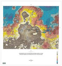
Topographic Map of the Western Equatorial Region of Mars |
|
Aeschliman, Ralph O. Jr |
|
Mars |
|
|
1998 |
|
|
#5127
|
|
Topographic map of the Western Equatorial region of Mars (with special emphasis on the elevations from 0 to 5 km above-datum) |
|
Aeschliman, Ralph O. Jr |
|
Mars |
|
15M |
1998 |
|