Clark R. Chapman’s maps of Mars
Published:
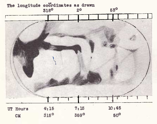
The Strolling Astronomer, 1961 (1-2)
Drawing, made with a 10-inch reflector, 1960.

Chapman’s 1960-61 map of Mars. Photo source
“The map of Mars was constructed by Clark R. Chapman and based on 60 of his drawings during the 1960-61 apparition of Mars. The drawings were made primarily with his 10-inch reflector between 11-May 19, 1960, and May .., 1961. The positions on the map are based on positions measured from JJ of Mr. Chapman’s drawings. It is placed on a Mercator projection”.
Literature: The Strolling Astronomer, 1962(7-8), p. 168.

http://adsabs.harvard.edu/abs/1962StAst..16..168C